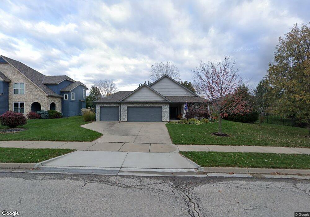
1650 George Williams Way Lawrence, KS 66047
West Lawrence NeighborhoodEstimated Value: $444,114 - $509,000
3
Beds
2
Baths
1,902
Sq Ft
$251/Sq Ft
Est. Value
About This Home
This home is located at 1650 George Williams Way, Lawrence, KS 66047 and is currently estimated at $478,279, approximately $251 per square foot. 1650 George Williams Way is a home located in Douglas County with nearby schools including Langston Hughes Elementary School, Southwest Middle School, and Lawrence High School.
Ownership History
Date
Name
Owned For
Owner Type
Purchase Details
Closed on
Jul 15, 2021
Sold by
Ward Debra L and Ward Kim A
Bought by
The Ward Family Trust
Current Estimated Value
Purchase Details
Closed on
Jul 1, 2021
Sold by
Woodward Gary L and Woodward Marilyn L
Bought by
Ward Debra L and Ward Kim A
Purchase Details
Closed on
Jun 7, 2004
Sold by
Adams Tyler Micah and Adams Tari Anne
Bought by
Woodward Gary L and Woodward Marilyn L
Home Financials for this Owner
Home Financials are based on the most recent Mortgage that was taken out on this home.
Original Mortgage
$115,000
Interest Rate
6.32%
Mortgage Type
Purchase Money Mortgage
Create a Home Valuation Report for This Property
The Home Valuation Report is an in-depth analysis detailing your home's value as well as a comparison with similar homes in the area
Home Values in the Area
Average Home Value in this Area
Purchase History
| Date | Buyer | Sale Price | Title Company |
|---|---|---|---|
| The Ward Family Trust | -- | Continental Title Co | |
| Ward Debra L | -- | Kansas Secured Title | |
| Woodward Gary L | -- | Commerce Title |
Source: Public Records
Mortgage History
| Date | Status | Borrower | Loan Amount |
|---|---|---|---|
| Previous Owner | Woodward Gary L | $115,000 |
Source: Public Records
Tax History Compared to Growth
Tax History
| Year | Tax Paid | Tax Assessment Tax Assessment Total Assessment is a certain percentage of the fair market value that is determined by local assessors to be the total taxable value of land and additions on the property. | Land | Improvement |
|---|---|---|---|---|
| 2025 | $6,344 | $50,819 | $9,200 | $41,619 |
| 2024 | $6,169 | $49,427 | $8,625 | $40,802 |
| 2023 | $6,068 | $47,012 | $8,625 | $38,387 |
| 2022 | $5,737 | $44,160 | $8,632 | $35,528 |
| 2021 | $4,424 | $33,097 | $8,632 | $24,465 |
| 2020 | $4,168 | $31,359 | $8,632 | $22,727 |
| 2019 | $3,963 | $29,866 | $8,632 | $21,234 |
| 2018 | $3,772 | $28,233 | $8,632 | $19,601 |
| 2017 | $3,640 | $26,956 | $8,632 | $18,324 |
| 2016 | $3,319 | $25,691 | $6,901 | $18,790 |
| 2015 | $3,262 | $25,254 | $6,901 | $18,353 |
| 2014 | $3,306 | $25,840 | $6,901 | $18,939 |
Source: Public Records
Map
Nearby Homes
- 1604 Bob White Dr
- 1709 Lake Alvamar Dr
- 1526 Legend Trail Dr Unit B
- 1528 Legend Trail Dr Unit A
- 5710 Goff Ct
- 1549 Legend Trail Dr Unit A
- 1564 Fountain Dr
- 1347 Kanza Dr
- 1120 Klein Ct
- 1115 Renaissance Dr
- 1601 Research Park Dr
- 6204 Berando Ct
- 1033 Stonecreek Dr
- 1315 Research Park Dr
- 1040 Stonecreek Dr
- 1017 Stoneridge Dr
- 1202 Little Knife
- 1300 Research Park Dr
- 5117 Harvard Rd
- 843 N 1500 Rd
- 1646 George Williams Way
- 1643 Bob White Dr
- 1647 Bob White Dr
- 1617 Cog Hill Ct
- 1621 Cog Hill Ct
- 5909 Whitetail Ct
- 5905 Whitetail Ct
- 1651 George Williams Way
- 1643 George Williams Way
- 1655 George Williams Way
- 1613 Cog Hill Ct
- 1659 George Williams Way
- 1639 George Williams Way
- 1646 Bob White Dr
- 1633 Bob White Dr
- 1642 Bob White Dr
- 5900 Whitetail Ct
- 1650 Bob White Dr
- 1638 Bob White Dr
- 1635 George Williams Way