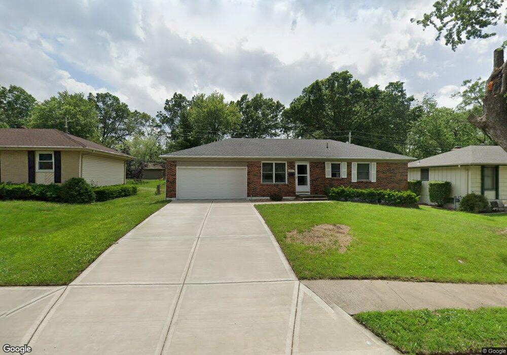
16511 E Cogan Rd Independence, MO 64055
Glendale NeighborhoodEstimated Value: $226,000 - $245,000
3
Beds
2
Baths
1,148
Sq Ft
$204/Sq Ft
Est. Value
About This Home
This home is located at 16511 E Cogan Rd, Independence, MO 64055 and is currently estimated at $234,470, approximately $204 per square foot. 16511 E Cogan Rd is a home located in Jackson County with nearby schools including Glendale Elementary School, Bridger Middle School, and Pioneer Ridge Middle School.
Ownership History
Date
Name
Owned For
Owner Type
Purchase Details
Closed on
Nov 17, 2005
Sold by
Masters Randy S and Masters Brooke A
Bought by
Chapman Joe F
Current Estimated Value
Home Financials for this Owner
Home Financials are based on the most recent Mortgage that was taken out on this home.
Original Mortgage
$45,000
Interest Rate
5.5%
Mortgage Type
Fannie Mae Freddie Mac
Purchase Details
Closed on
May 9, 1997
Sold by
Gunter Sheila and Shirk Margaret E
Bought by
Masters Randy S and Masters Brooke A
Home Financials for this Owner
Home Financials are based on the most recent Mortgage that was taken out on this home.
Original Mortgage
$58,320
Interest Rate
7.97%
Mortgage Type
Purchase Money Mortgage
Create a Home Valuation Report for This Property
The Home Valuation Report is an in-depth analysis detailing your home's value as well as a comparison with similar homes in the area
Home Values in the Area
Average Home Value in this Area
Purchase History
| Date | Buyer | Sale Price | Title Company |
|---|---|---|---|
| Chapman Joe F | -- | Kansas City Title | |
| Masters Randy S | -- | -- |
Source: Public Records
Mortgage History
| Date | Status | Borrower | Loan Amount |
|---|---|---|---|
| Closed | Chapman Joe F | $45,000 | |
| Previous Owner | Masters Randy S | $58,320 |
Source: Public Records
Tax History
| Year | Tax Paid | Tax Assessment Tax Assessment Total Assessment is a certain percentage of the fair market value that is determined by local assessors to be the total taxable value of land and additions on the property. | Land | Improvement |
|---|---|---|---|---|
| 2025 | $2,016 | $32,163 | $5,244 | $26,919 |
| 2024 | $1,970 | $29,095 | $3,762 | $25,333 |
| 2023 | $1,970 | $29,094 | $3,469 | $25,625 |
| 2022 | $1,796 | $24,320 | $3,780 | $20,540 |
| 2021 | $1,796 | $24,320 | $3,780 | $20,540 |
| 2020 | $1,733 | $22,804 | $3,780 | $19,024 |
| 2019 | $1,705 | $22,804 | $3,780 | $19,024 |
| 2018 | $1,554 | $19,846 | $3,289 | $16,557 |
| 2017 | $1,554 | $19,846 | $3,289 | $16,557 |
| 2016 | $1,531 | $19,349 | $3,131 | $16,218 |
Source: Public Records
Map
Nearby Homes
- 16409 E 31st St S
- 16501 E 28th Place
- 0 Multi Address N A Unit HMS2588688
- 3219 Vest St
- 16400 E Crackerneck Rd
- 2724 Queen Ridge Dr
- 2900 S M 291 Hwy
- 17201 E 32nd St S Unit 3
- 17201 E 32nd St S Unit 6
- 2705 S Breckenridge Dr
- 2805 Berry Ave
- 2527 Queen Ridge Dr
- 3416 S Marshall Ct
- 15804 E 27th St S
- 2800 S Woodbury Dr
- 3011 Cedar Crest Dr Unit B
- 2705 S Haden Ct
- 2608 Baker Rd
- 3415 S Davidson Ct
- 2417 S Ellison Way
- 16505 E Cogan Rd
- 16519 E Cogan Rd
- 16516 E Ellison Way
- 16525 E Cogan Rd
- 16501 E Cogan Rd
- 16508 E Ellison Way
- 16520 E Ellison Way
- 16508 E Cogan Rd
- 16516 E Cogan Rd
- 16500 E Cogan Rd
- 16531 E Cogan Rd
- 16524 E Cogan Rd
- 16600 E Ellison Way
- 16425 E Cogan Rd
- 3008 Porter Rd
- 16530 E Cogan Rd
- 16500 E Ellison Way
- 16607 E Cogan Rd
- 16420 E Cogan Dr
- 16420 E Cogan Rd
Your Personal Tour Guide
Ask me questions while you tour the home.