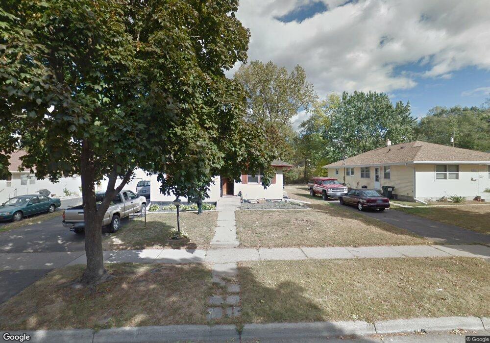
1656 Dieter St Saint Paul, MN 55106
Prosperity Heights NeighborhoodEstimated Value: $324,314 - $406,000
6
Beds
2
Baths
1,328
Sq Ft
$279/Sq Ft
Est. Value
About This Home
This home is located at 1656 Dieter St, Saint Paul, MN 55106 and is currently estimated at $370,329, approximately $278 per square foot. 1656 Dieter St is a home located in Ramsey County with nearby schools including Frost Lake Elementary School, Txuj Ci HMong Language and Culture Upper Campus, and Johnson Senior High School.
Ownership History
Date
Name
Owned For
Owner Type
Purchase Details
Closed on
Apr 26, 2015
Sold by
Moua Dang and Moua Mai
Bought by
Moua Dang and Moua Mai
Current Estimated Value
Home Financials for this Owner
Home Financials are based on the most recent Mortgage that was taken out on this home.
Original Mortgage
$218,400
Outstanding Balance
$166,786
Interest Rate
4.08%
Mortgage Type
New Conventional
Estimated Equity
$203,543
Purchase Details
Closed on
Nov 21, 1996
Sold by
Uren Blake H and Uren Joan
Bought by
Moua Seng Sue and Moua Nou
Create a Home Valuation Report for This Property
The Home Valuation Report is an in-depth analysis detailing your home's value as well as a comparison with similar homes in the area
Home Values in the Area
Average Home Value in this Area
Purchase History
| Date | Buyer | Sale Price | Title Company |
|---|---|---|---|
| Moua Dang | $515 | Attorney | |
| Moua Seng Sue | $106,000 | -- |
Source: Public Records
Mortgage History
| Date | Status | Borrower | Loan Amount |
|---|---|---|---|
| Open | Moua Dang | $218,400 |
Source: Public Records
Tax History Compared to Growth
Tax History
| Year | Tax Paid | Tax Assessment Tax Assessment Total Assessment is a certain percentage of the fair market value that is determined by local assessors to be the total taxable value of land and additions on the property. | Land | Improvement |
|---|---|---|---|---|
| 2025 | $6,416 | $347,600 | $30,000 | $317,600 |
| 2023 | $6,416 | $330,200 | $25,000 | $305,200 |
| 2022 | $5,152 | $296,800 | $25,000 | $271,800 |
| 2021 | $5,540 | $255,000 | $25,000 | $230,000 |
| 2020 | $5,624 | $258,400 | $18,700 | $239,700 |
| 2019 | $4,332 | $220,300 | $18,700 | $201,600 |
| 2018 | $3,662 | $191,700 | $18,700 | $173,000 |
| 2017 | $3,706 | $166,700 | $18,700 | $148,000 |
| 2016 | $3,522 | $0 | $0 | $0 |
| 2015 | $3,038 | $154,300 | $18,700 | $135,600 |
| 2014 | $2,694 | $0 | $0 | $0 |
Source: Public Records
Map
Nearby Homes
- 1672 Manton St
- 1627 Christie Place
- 1435 Price Ave
- 1607 Hoyt Ave E
- 1637 Iowa Ave E
- 1639 Clarence St
- 1583 Nevada Ave E
- 1854 Barclay St
- 1751 Clarence St
- 1676 Montana Ave E
- 1849 Kennard St
- 1740 English St
- 1869 Birmingham St
- 1450 Arlington Ave E
- 1743 White Bear Ave N
- 1696 Nevada Ave E
- 1870 Clarence St
- 1685 Arlington Ave E
- 1856 Flandrau St
- 1562 Chamber St
- 1652 Dieter St
- 1646 Dieter St
- 0 Hazelwood St Unit 4389446
- 1661 Hazelwood St
- xxx Hazelwood St
- 1520 Larpenteur Ave E
- 1526 Larpenteur Ave E
- 1651 Hazelwood St
- 1526 1526 Larpenteur Ave E
- 1526 1526 Larpenteur-Avenue-e
- 1659 Dieter St
- 1655 Dieter St
- 1663 Dieter St
- 1653 Dieter St
- 1653 1653 Dieter-Street-
- 1651 1651 Hazelwood-Street-
- 1642 Dieter St
- 1667 Dieter St N
- 1667 Dieter St
- 1647 Dieter St