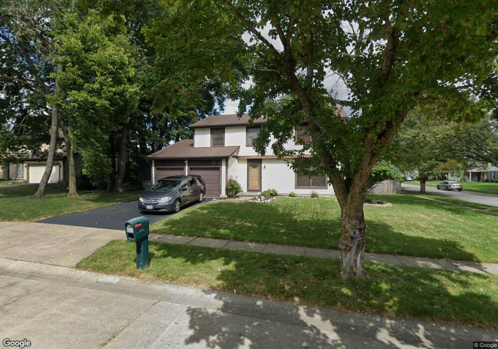
1664 Flat Rock Ct Columbus, OH 43235
Brookside Village NeighborhoodEstimated Value: $392,907 - $427,000
4
Beds
3
Baths
1,872
Sq Ft
$219/Sq Ft
Est. Value
About This Home
This home is located at 1664 Flat Rock Ct, Columbus, OH 43235 and is currently estimated at $409,227, approximately $218 per square foot. 1664 Flat Rock Ct is a home located in Franklin County with nearby schools including Brookside Elementary School, McCord Middle School, and Worthington Kilbourne High School.
Ownership History
Date
Name
Owned For
Owner Type
Purchase Details
Closed on
Nov 18, 1996
Sold by
Mezzanotte Douglas V
Bought by
Foley Arthur S and Foley Terri L
Current Estimated Value
Home Financials for this Owner
Home Financials are based on the most recent Mortgage that was taken out on this home.
Original Mortgage
$118,750
Outstanding Balance
$11,796
Interest Rate
8.18%
Mortgage Type
New Conventional
Estimated Equity
$397,431
Purchase Details
Closed on
Jan 28, 1994
Purchase Details
Closed on
Oct 16, 1987
Create a Home Valuation Report for This Property
The Home Valuation Report is an in-depth analysis detailing your home's value as well as a comparison with similar homes in the area
Home Values in the Area
Average Home Value in this Area
Purchase History
| Date | Buyer | Sale Price | Title Company |
|---|---|---|---|
| Foley Arthur S | $125,000 | -- | |
| -- | $109,000 | -- | |
| -- | -- | -- |
Source: Public Records
Mortgage History
| Date | Status | Borrower | Loan Amount |
|---|---|---|---|
| Open | Foley Arthur S | $118,750 |
Source: Public Records
Tax History Compared to Growth
Tax History
| Year | Tax Paid | Tax Assessment Tax Assessment Total Assessment is a certain percentage of the fair market value that is determined by local assessors to be the total taxable value of land and additions on the property. | Land | Improvement |
|---|---|---|---|---|
| 2024 | $6,171 | $100,520 | $35,210 | $65,310 |
| 2023 | $5,901 | $100,520 | $35,210 | $65,310 |
| 2022 | $6,501 | $87,860 | $31,190 | $56,670 |
| 2021 | $5,997 | $87,860 | $31,190 | $56,670 |
| 2020 | $5,777 | $87,860 | $31,190 | $56,670 |
| 2019 | $5,287 | $72,560 | $26,010 | $46,550 |
| 2018 | $2,561 | $72,560 | $26,010 | $46,550 |
| 2017 | $4,418 | $72,560 | $26,010 | $46,550 |
| 2016 | $4,098 | $57,720 | $17,330 | $40,390 |
| 2015 | $2,049 | $57,720 | $17,330 | $40,390 |
| 2014 | $4,097 | $57,720 | $17,330 | $40,390 |
| 2013 | $2,038 | $57,715 | $17,325 | $40,390 |
Source: Public Records
Map
Nearby Homes
- 2687 Snouffer Rd
- 7164 Durness Place
- 1620 Park Row Dr Unit A
- 1637 Park Row Dr Unit F
- 1721 Worthington Run Dr Unit 1721-1731
- 1380 Tiehack Ct
- 6921 Spruce Pine Dr
- 6550 Winston Ct E
- 1930 Shallowford Ave
- 2056 Fincastle Ct
- 1889 Slaton Ct Unit 1889
- 2161 Heatherfield Ave
- 1307 Lakeside Ct
- 1041 Rosebank Dr
- 1828 Gardenstone Dr
- 2001 Sawbury Blvd Unit 2001
- 1118 Ravine Ridge Dr
- 7373 Palmleaf Ln
- 1101 Bluffway Dr
- 2074 Hard Rd
- 1661 Rushing Way
- 1667 Rushing Way
- 1640 Flat Rock Ct
- 1665 Flat Rock Ct
- 1657 Flat Rock Ct
- 1679 Rushing Way
- 7200 Swift Way
- 1673 Flat Rock Ct
- 1643 Flat Rock Ct
- 1632 Flat Rock Ct
- 1687 Rushing Way
- 1635 Flat Rock Ct
- 1688 Flat Rock Ct
- 1635 Rushing Way
- 1681 Flat Rock Ct
- 1695 Rushing Way
- 1627 Flat Rock Ct
- 1624 Flat Rock Ct
- 1664 Rushing Way
- 1656 Rushing Way