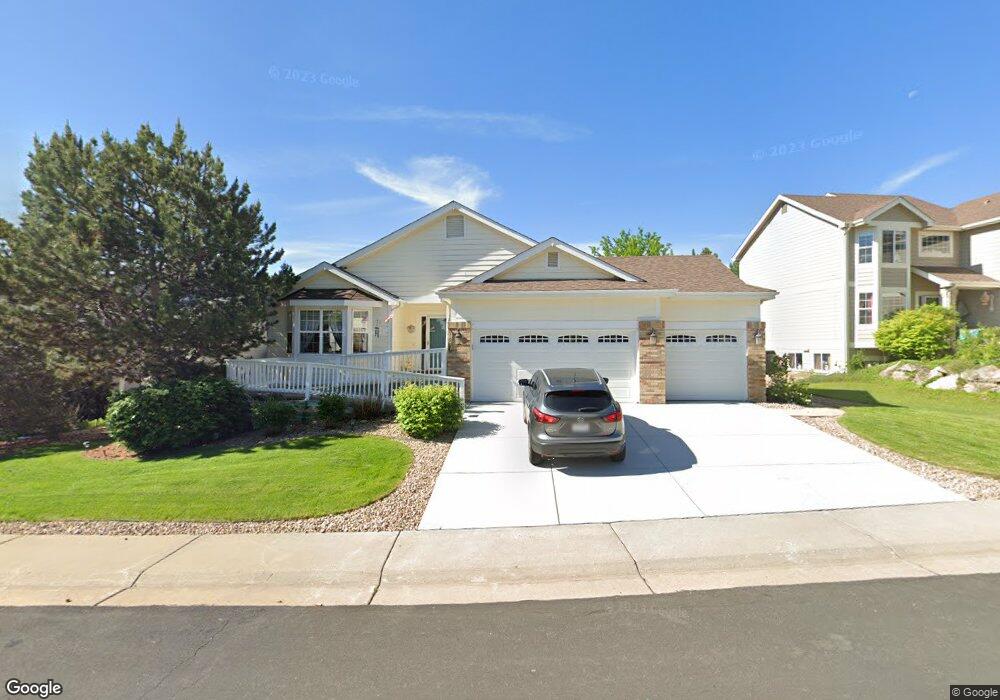
1667 Marsh Hawk Cir Castle Rock, CO 80109
Red Hawk NeighborhoodEstimated Value: $647,638 - $715,000
3
Beds
2
Baths
2,050
Sq Ft
$334/Sq Ft
Est. Value
About This Home
This home is located at 1667 Marsh Hawk Cir, Castle Rock, CO 80109 and is currently estimated at $684,410, approximately $333 per square foot. 1667 Marsh Hawk Cir is a home located in Douglas County with nearby schools including Clear Sky Elementary School, Castle Rock Middle School, and Castle View High School.
Ownership History
Date
Name
Owned For
Owner Type
Purchase Details
Closed on
Mar 28, 2005
Sold by
Long Joseph F and Long Kathy S
Bought by
Carter David P and Carter Bonny J
Current Estimated Value
Home Financials for this Owner
Home Financials are based on the most recent Mortgage that was taken out on this home.
Original Mortgage
$225,200
Interest Rate
5.71%
Mortgage Type
Stand Alone First
Purchase Details
Closed on
Dec 30, 2003
Sold by
Audirsch Dean A and Audirsch Dayna B
Bought by
Long Joseph F and Long Kathy S
Home Financials for this Owner
Home Financials are based on the most recent Mortgage that was taken out on this home.
Original Mortgage
$206,800
Interest Rate
5%
Mortgage Type
Unknown
Purchase Details
Closed on
Apr 28, 2000
Sold by
U S Home Corp
Bought by
Audirsch Dean A and Audirsch Dayna B
Home Financials for this Owner
Home Financials are based on the most recent Mortgage that was taken out on this home.
Original Mortgage
$214,200
Interest Rate
8.19%
Create a Home Valuation Report for This Property
The Home Valuation Report is an in-depth analysis detailing your home's value as well as a comparison with similar homes in the area
Home Values in the Area
Average Home Value in this Area
Purchase History
| Date | Buyer | Sale Price | Title Company |
|---|---|---|---|
| Carter David P | $281,500 | Land Title | |
| Long Joseph F | $258,500 | North American Title | |
| Audirsch Dean A | $225,545 | -- |
Source: Public Records
Mortgage History
| Date | Status | Borrower | Loan Amount |
|---|---|---|---|
| Previous Owner | Carter David P | $225,200 | |
| Previous Owner | Long Joseph F | $206,800 | |
| Previous Owner | Audirsch Dean A | $214,200 | |
| Closed | Long Joseph F | $38,775 |
Source: Public Records
Tax History Compared to Growth
Tax History
| Year | Tax Paid | Tax Assessment Tax Assessment Total Assessment is a certain percentage of the fair market value that is determined by local assessors to be the total taxable value of land and additions on the property. | Land | Improvement |
|---|---|---|---|---|
| 2024 | $2,572 | $47,520 | $10,460 | $37,060 |
| 2023 | $2,608 | $47,520 | $10,460 | $37,060 |
| 2022 | $1,707 | $32,570 | $7,500 | $25,070 |
| 2021 | $1,782 | $32,570 | $7,500 | $25,070 |
| 2020 | $1,617 | $30,890 | $6,230 | $24,660 |
| 2019 | $1,625 | $30,890 | $6,230 | $24,660 |
| 2018 | $1,565 | $29,480 | $4,770 | $24,710 |
| 2017 | $1,433 | $29,480 | $4,770 | $24,710 |
| 2016 | $1,182 | $25,870 | $4,420 | $21,450 |
| 2015 | $1,756 | $26,960 | $4,420 | $22,540 |
| 2014 | $1,698 | $22,950 | $3,980 | $18,970 |
Source: Public Records
Map
Nearby Homes
- 1825 Cooper Ct
- 1076 Switch Grass Dr
- 1684 Marsh Hawk Cir
- 1272 Ballata Ct
- 1492 Bergen Rock St
- 2204 Jute Ln
- 1480 Thunder Butte Rd
- 1057 Bulrush Dr
- 1497 Bent Grass Cir
- 1478 Bergen Rock St
- 1465 Red Cliff Way
- 2347 Switch Grass Way
- 1820 Sapling Ct
- 1556 Bent Wedge Point
- 1195 Melting Snow Way
- 1108 Melting Snow Way
- 1105 Melting Snow Way
- 2775 Morningbird Ln
- 1057 Melting Snow Way
- 2751 Keepsake Way
- 1669 Marsh Hawk Cir
- 1665 Marsh Hawk Cir
- 1081 Surlyn Ct
- 1671 Marsh Hawk Cir
- 1663 Marsh Hawk Cir
- 1666 Marsh Hawk Cir
- 1668 Marsh Hawk Cir
- 1065 Surlyn Ct
- 1664 Marsh Hawk Cir
- 1093 Surlyn Ct
- 991 Harpy Ct
- 1670 Marsh Hawk Cir
- 1661 Marsh Hawk Cir
- 1047 Surlyn Ct
- 1672 Marsh Hawk Cir
- 1673 Marsh Hawk Cir
- 977 Harpy Ct
- 980 Harpy Ct
- 1840 Cooper Ct
- 1031 Surlyn Ct