Estimated Value: $249,471 - $328,000
3
Beds
2
Baths
2,208
Sq Ft
$133/Sq Ft
Est. Value
About This Home
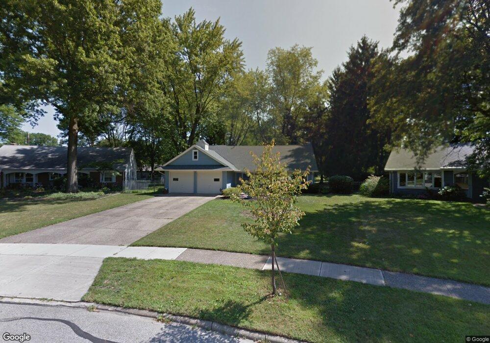
This home is located at 167 Tamarack Dr, Berea, OH 44017 and is currently estimated at $292,868, approximately $132 per square foot. 167 Tamarack Dr is a home located in Cuyahoga County with nearby schools including Grindstone Elementary School, Berea-Midpark Middle School, and Berea-Midpark High School.
Ownership History
Date
Name
Owned For
Owner Type
Purchase Details
Closed on
May 21, 2010
Sold by
Porter Kathleen K
Bought by
Buehrer Anthony E and Buehrer Michelle
Current Estimated Value
Home Financials for this Owner
Home Financials are based on the most recent Mortgage that was taken out on this home.
Original Mortgage
$111,800
Outstanding Balance
$73,741
Interest Rate
5.12%
Mortgage Type
Purchase Money Mortgage
Estimated Equity
$219,127
Purchase Details
Closed on
Dec 11, 1992
Sold by
Wargo John J
Bought by
Porter D Richard
Purchase Details
Closed on
Jun 1, 1979
Bought by
Wargo John J
Purchase Details
Closed on
Aug 10, 1977
Sold by
Burnham Ronald G
Bought by
Union Commerce Bank Trustee
Purchase Details
Closed on
Jan 1, 1975
Bought by
Burnham Ronald G
Create a Home Valuation Report for This Property
The Home Valuation Report is an in-depth analysis detailing your home's value as well as a comparison with similar homes in the area
Home Values in the Area
Average Home Value in this Area
Purchase History
| Date | Buyer | Sale Price | Title Company |
|---|---|---|---|
| Buehrer Anthony E | $140,000 | Maximum Title | |
| Porter D Richard | $132,000 | -- | |
| Wargo John J | $83,000 | -- | |
| Union Commerce Bank Trustee | -- | -- | |
| Burnham Ronald G | -- | -- |
Source: Public Records
Mortgage History
| Date | Status | Borrower | Loan Amount |
|---|---|---|---|
| Open | Buehrer Anthony E | $111,800 |
Source: Public Records
Tax History
| Year | Tax Paid | Tax Assessment Tax Assessment Total Assessment is a certain percentage of the fair market value that is determined by local assessors to be the total taxable value of land and additions on the property. | Land | Improvement |
|---|---|---|---|---|
| 2025 | $4,882 | $67,410 | $13,860 | $53,550 |
| 2024 | $3,926 | $67,410 | $13,860 | $53,550 |
| 2023 | $4,709 | $68,190 | $12,570 | $55,620 |
| 2022 | $4,680 | $68,180 | $12,570 | $55,620 |
| 2021 | $4,640 | $68,180 | $12,570 | $55,620 |
| 2020 | $4,433 | $57,790 | $10,640 | $47,150 |
| 2019 | $4,315 | $165,100 | $30,400 | $134,700 |
| 2018 | $4,285 | $57,790 | $10,640 | $47,150 |
| 2017 | $3,921 | $49,010 | $9,420 | $39,590 |
| 2016 | $3,892 | $49,010 | $9,420 | $39,590 |
| 2015 | $3,678 | $49,010 | $9,420 | $39,590 |
| 2014 | $3,678 | $49,010 | $9,420 | $39,590 |
Source: Public Records
Map
Nearby Homes
- 160 Marian Ln Unit 6A
- 146 Marian Ln
- 143 Baker St
- 333 Parkway Dr
- 211 W Bridge St
- 169 Kempton Dr
- 380 Adrian Dr
- 347 Beeler Dr
- 516 Fair St
- 132 Stonefield Dr
- 57 Riverside Dr
- 487 Karen Dr
- 147 Stone Ridge Way
- 428 Park Place
- 49 Monroe St
- 379 Laurel Dr
- 8783 Roberts Ct Unit 22A
- 100 River Rock Way
- 56 3rd Ave
- 659 Wesley Dr
- 165 Tamarack Dr
- 169 Tamarack Dr
- 163 Tamarack Dr
- 138 Tamarack Dr
- 175 Tamarack Dr
- 170 Tamarack Dr
- 297 Pineview Dr
- 289 Pineview Dr
- 305 Pineview Dr
- 161 Tamarack Dr
- 176 Tamarack Dr
- 183 Tamarack Dr
- 279 Pineview Dr
- 311 Pineview Dr
- 271 Pineview Dr
- 184 Tamarack Dr
- 169 Sunset Dr
- 159 Tamarack Dr
- 191 Tamarack Dr
- 141 Sunset Dr
Your Personal Tour Guide
Ask me questions while you tour the home.