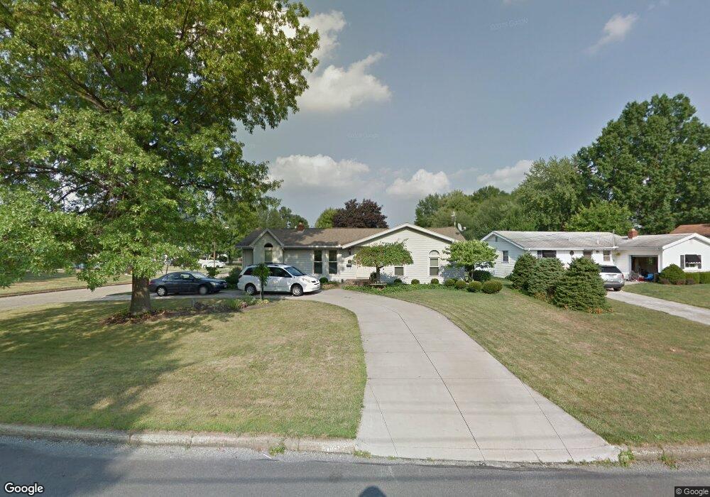
1673 Laurie Dr Youngstown, OH 44511
Austintown NeighborhoodEstimated Value: $193,660 - $214,000
3
Beds
1
Bath
1,362
Sq Ft
$149/Sq Ft
Est. Value
About This Home
This home is located at 1673 Laurie Dr, Youngstown, OH 44511 and is currently estimated at $203,415, approximately $149 per square foot. 1673 Laurie Dr is a home located in Mahoning County with nearby schools including Austintown Elementary School, Austintown Intermediate School, and Austintown Middle School.
Ownership History
Date
Name
Owned For
Owner Type
Purchase Details
Closed on
Jun 24, 2003
Sold by
Thomas Martha A
Bought by
Won Inae
Current Estimated Value
Home Financials for this Owner
Home Financials are based on the most recent Mortgage that was taken out on this home.
Original Mortgage
$88,000
Outstanding Balance
$37,484
Interest Rate
5.4%
Mortgage Type
Purchase Money Mortgage
Estimated Equity
$165,931
Purchase Details
Closed on
Jul 14, 1997
Sold by
Caruso Joseph A and Caruso Barbara J
Bought by
Thomas Martha A
Home Financials for this Owner
Home Financials are based on the most recent Mortgage that was taken out on this home.
Original Mortgage
$73,600
Interest Rate
8%
Purchase Details
Closed on
Jun 13, 1961
Bought by
Caruso Joseph A and B J
Create a Home Valuation Report for This Property
The Home Valuation Report is an in-depth analysis detailing your home's value as well as a comparison with similar homes in the area
Home Values in the Area
Average Home Value in this Area
Purchase History
| Date | Buyer | Sale Price | Title Company |
|---|---|---|---|
| Won Inae | $110,000 | -- | |
| Thomas Martha A | $92,000 | -- | |
| Caruso Joseph A | -- | -- |
Source: Public Records
Mortgage History
| Date | Status | Borrower | Loan Amount |
|---|---|---|---|
| Open | Won Inae | $88,000 | |
| Previous Owner | Thomas Martha A | $73,600 |
Source: Public Records
Tax History Compared to Growth
Tax History
| Year | Tax Paid | Tax Assessment Tax Assessment Total Assessment is a certain percentage of the fair market value that is determined by local assessors to be the total taxable value of land and additions on the property. | Land | Improvement |
|---|---|---|---|---|
| 2024 | $2,588 | $55,540 | $8,010 | $47,530 |
| 2023 | $2,540 | $55,540 | $8,010 | $47,530 |
| 2022 | $2,134 | $37,390 | $6,850 | $30,540 |
| 2021 | $2,137 | $37,390 | $6,850 | $30,540 |
| 2020 | $2,145 | $37,390 | $6,850 | $30,540 |
| 2019 | $2,133 | $33,390 | $6,120 | $27,270 |
| 2018 | $2,055 | $33,390 | $6,120 | $27,270 |
| 2017 | $2,022 | $33,390 | $6,120 | $27,270 |
| 2016 | $1,999 | $32,660 | $6,410 | $26,250 |
| 2015 | $1,939 | $32,660 | $6,410 | $26,250 |
| 2014 | $1,946 | $32,660 | $6,410 | $26,250 |
| 2013 | $1,985 | $33,680 | $6,410 | $27,270 |
Source: Public Records
Map
Nearby Homes
- 4235 Patricia Ave
- 4241 Wedgewood Dr
- 4289 Wedgewood Dr
- 4262 Pembrook Rd
- 40 Woodleigh Ct
- 3913 Claridge Dr
- 4234 Burkey Rd
- 3890 Ayrshire Dr
- 4102 Burkey Rd
- 3852 Edinburgh Dr
- 2414 Ardenwood Place
- 2699 Hamman Dr
- 2430 Redgate Ln
- 2493 Frostwood Dr
- 532 Westgate Blvd
- 3972 Artmar Dr
- 4674 Barrington Dr
- 2388 Innwood Dr
- 1439 Bexley Dr
- 1560 S Meridian Rd
- 1679 Laurie Dr
- 4289 Patricia Ave
- 1685 Laurie Dr
- 4294 Patricia Ave
- 4298 Patricia Ave
- 4288 Patricia Ave
- 1707 Laurie Dr
- 4283 Patricia Ave
- 1668 Laurie Dr
- 1674 Laurie Dr
- 1662 Laurie Dr
- 1680 Laurie Dr
- 4284 Patricia Ave
- 1713 Laurie Dr
- 1686 Laurie Dr
- 4277 Patricia Ave
- 1692 Laurie Dr
- 4278 Patricia Ave
- 1719 Laurie Dr
- 1702 Laurie Dr