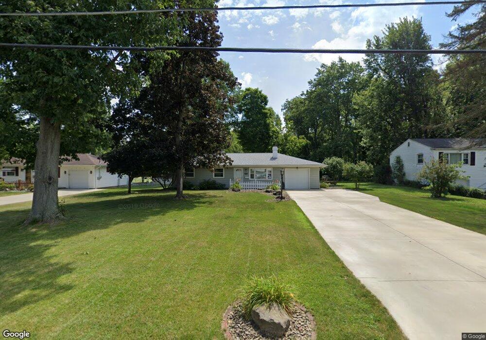
1679 Lancaster Dr Youngstown, OH 44511
Austintown NeighborhoodEstimated Value: $149,000 - $190,000
3
Beds
1
Bath
988
Sq Ft
$163/Sq Ft
Est. Value
About This Home
This home is located at 1679 Lancaster Dr, Youngstown, OH 44511 and is currently estimated at $161,263, approximately $163 per square foot. 1679 Lancaster Dr is a home located in Mahoning County with nearby schools including Austintown Elementary School, Austintown Intermediate School, and Austintown Middle School.
Ownership History
Date
Name
Owned For
Owner Type
Purchase Details
Closed on
Feb 22, 2010
Sold by
Myers Nancy A Bidelman and Myers Charles F
Bought by
Mctigue P Breen
Current Estimated Value
Home Financials for this Owner
Home Financials are based on the most recent Mortgage that was taken out on this home.
Original Mortgage
$56,949
Outstanding Balance
$38,566
Interest Rate
5.5%
Mortgage Type
FHA
Estimated Equity
$122,697
Purchase Details
Closed on
Oct 6, 2004
Sold by
Smith Eleanor and Smith William J
Bought by
Bidelman Nancy A
Purchase Details
Closed on
Dec 17, 2001
Sold by
Smith Eleanor
Bought by
Smith Eleanor and Smith William J
Purchase Details
Closed on
Jul 19, 2001
Sold by
Estate Of George A Smith
Bought by
Smith Eleanor A
Purchase Details
Closed on
Aug 19, 1976
Bought by
Smith George A
Create a Home Valuation Report for This Property
The Home Valuation Report is an in-depth analysis detailing your home's value as well as a comparison with similar homes in the area
Home Values in the Area
Average Home Value in this Area
Purchase History
| Date | Buyer | Sale Price | Title Company |
|---|---|---|---|
| Mctigue P Breen | $58,000 | None Available | |
| Bidelman Nancy A | -- | -- | |
| Smith Eleanor | -- | -- | |
| Smith Eleanor A | -- | -- | |
| Smith George A | -- | -- |
Source: Public Records
Mortgage History
| Date | Status | Borrower | Loan Amount |
|---|---|---|---|
| Open | Mctigue P Breen | $56,949 |
Source: Public Records
Tax History
| Year | Tax Paid | Tax Assessment Tax Assessment Total Assessment is a certain percentage of the fair market value that is determined by local assessors to be the total taxable value of land and additions on the property. | Land | Improvement |
|---|---|---|---|---|
| 2024 | $1,732 | $37,460 | $8,330 | $29,130 |
| 2023 | $1,701 | $37,460 | $8,330 | $29,130 |
| 2022 | $1,339 | $23,610 | $7,130 | $16,480 |
| 2021 | $1,340 | $23,610 | $7,130 | $16,480 |
| 2020 | $1,345 | $23,610 | $7,130 | $16,480 |
| 2019 | $1,329 | $21,070 | $6,360 | $14,710 |
| 2018 | $1,279 | $21,070 | $6,360 | $14,710 |
| 2017 | $1,266 | $21,070 | $6,360 | $14,710 |
| 2016 | $1,303 | $21,470 | $6,670 | $14,800 |
| 2015 | $1,264 | $21,470 | $6,670 | $14,800 |
| 2014 | $1,269 | $21,470 | $6,670 | $14,800 |
| 2013 | $1,255 | $21,470 | $6,670 | $14,800 |
Source: Public Records
Map
Nearby Homes
- 1649 Lancaster Dr
- 1726 Lancaster Dr
- 4235 Patricia Ave
- 3990 Claridge Dr
- 4242 Kerrybrook Dr
- 3890 Ayrshire Dr
- 3968 Cannon Rd
- 4314 Kerrybrook Dr
- 3852 Edinburgh Dr
- 3970 Dunbar St
- 3786 Bryant Dr
- 3772 Bryant Dr
- 4345 Pembrook Rd
- 4102 Burkey Rd
- 4234 Lake Rd
- 3799 Cumberland Cir
- 4202 Burkey Rd
- 3673 Nottingham Ave
- 1275 S Meridian Rd
- 3011 Bainbridge Ave
- 1685 Lancaster Dr
- 1673 Lancaster Dr
- 1703 Lancaster Dr
- 1684 Lancaster Dr
- 1678 Lancaster Dr
- 1667 Lancaster Dr
- 1709 Lancaster Dr
- 1672 Lancaster Dr
- 1702 Lancaster Dr
- 1666 Lancaster Dr
- 1661 Lancaster Dr
- 1715 Lancaster Dr
- 1708 Lancaster Dr
- 4216 Carlisle Ave
- 1660 Lancaster Dr
- 1714 Lancaster Dr
- 4209 Patricia Ave
- 1721 Lancaster Dr
- 4215 Carlisle Ave
- 1655 Lancaster Dr