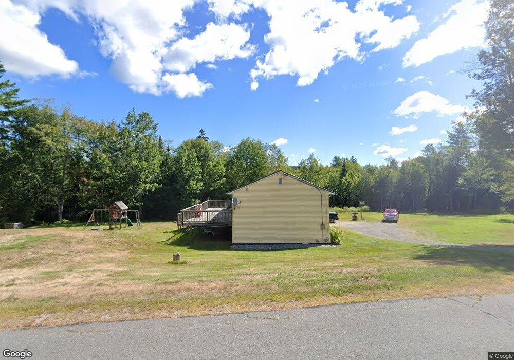
168 Number 9 Rd Rowe, MA 01367
Heath NeighborhoodEstimated Value: $353,000 - $441,000
3
Beds
1
Bath
2,080
Sq Ft
$185/Sq Ft
Est. Value
About This Home
This home is located at 168 Number 9 Rd, Rowe, MA 01367 and is currently estimated at $384,876, approximately $185 per square foot. 168 Number 9 Rd is a home located in Franklin County with nearby schools including Mohawk Trail Regional High School.
Ownership History
Date
Name
Owned For
Owner Type
Purchase Details
Closed on
Mar 16, 2009
Sold by
Deutsche Bank Natl T C
Bought by
Johnston Jeffrey M and Johnston Rebecca L
Current Estimated Value
Home Financials for this Owner
Home Financials are based on the most recent Mortgage that was taken out on this home.
Original Mortgage
$164,123
Outstanding Balance
$104,636
Interest Rate
5.18%
Mortgage Type
Purchase Money Mortgage
Estimated Equity
$280,240
Purchase Details
Closed on
Dec 3, 2008
Sold by
Beattie Jennifer L
Bought by
Deutsche Bank Natl T C
Purchase Details
Closed on
Oct 1, 1997
Sold by
Commercial Credit Corp
Bought by
Beattie Jennifer L
Home Financials for this Owner
Home Financials are based on the most recent Mortgage that was taken out on this home.
Original Mortgage
$81,840
Interest Rate
7.41%
Mortgage Type
Purchase Money Mortgage
Purchase Details
Closed on
Jan 6, 1997
Sold by
Bouchard Homer V and Bouchard Alice M
Bought by
Commercial Credit Corp
Create a Home Valuation Report for This Property
The Home Valuation Report is an in-depth analysis detailing your home's value as well as a comparison with similar homes in the area
Home Values in the Area
Average Home Value in this Area
Purchase History
| Date | Buyer | Sale Price | Title Company |
|---|---|---|---|
| Johnston Jeffrey M | $149,900 | -- | |
| Deutsche Bank Natl T C | $198,000 | -- | |
| Beattie Jennifer L | $73,000 | -- | |
| Commercial Credit Corp | $71,935 | -- |
Source: Public Records
Mortgage History
| Date | Status | Borrower | Loan Amount |
|---|---|---|---|
| Open | Johnston Jeffrey M | $164,123 | |
| Previous Owner | Commercial Credit Corp | $81,840 |
Source: Public Records
Tax History Compared to Growth
Tax History
| Year | Tax Paid | Tax Assessment Tax Assessment Total Assessment is a certain percentage of the fair market value that is determined by local assessors to be the total taxable value of land and additions on the property. | Land | Improvement |
|---|---|---|---|---|
| 2025 | $5,340 | $283,900 | $95,000 | $188,900 |
| 2024 | $5,551 | $271,700 | $91,000 | $180,700 |
| 2023 | $57 | $238,800 | $62,500 | $176,300 |
| 2022 | $5,128 | $238,400 | $62,500 | $175,900 |
| 2021 | $5,222 | $231,900 | $55,000 | $176,900 |
| 2020 | $5,037 | $226,400 | $46,500 | $179,900 |
| 2019 | $32 | $241,000 | $49,100 | $191,900 |
| 2018 | $33 | $241,000 | $49,100 | $191,900 |
| 2017 | $29 | $229,100 | $47,500 | $181,600 |
| 2016 | $4,715 | $229,900 | $47,500 | $182,400 |
| 2015 | $4,605 | $230,700 | $47,500 | $183,200 |
Source: Public Records
Map
Nearby Homes
- 60 Stone Hill Rd
- Lot 121 Davis Mine Rd
- 594 Massachusetts 8a
- 1192 Chapel Hill Rd
- 442 Mcmillan Rd
- 2173 Vermont 8a
- 1154 Vermont 8a
- 201 Ford Hill Rd
- 127 County Rd
- 843 Kentfield Rd
- 210 Burrington Hill Rd
- 14 South Rd
- 6 Chippewa Dr
- 166 Taylor Ln
- 380 Smith Rd
- 9 Depot St
- 233 Poverty Row
- 1587 Upper Holbrook Rd
- 139 Taylor Brook Rd
- 1153 Faulkner Rd
- 167 Number 9 Rd
- 92 Number 9 Rd
- 177 Number 9 Rd
- 177 Number 9 Rd
- 168 Number Nine Rd
- 151 Number Nine Rd
- 10 Groll Rd
- 159 Number 9 Rd
- 113 Number 9 Rd
- 151 Number 9 Rd
- 25 Groll Rd
- 191 Number 9 Rd
- 136 Number 9 Rd
- 143 Number 9 Rd
- 177 Number Nine Rd
- 151 Number 9 Rd
- 146 Cyrus Stage Rd
- 116 Number 9 Rd
- 221 Number 9 Rd
- 78 Number Nine Rd