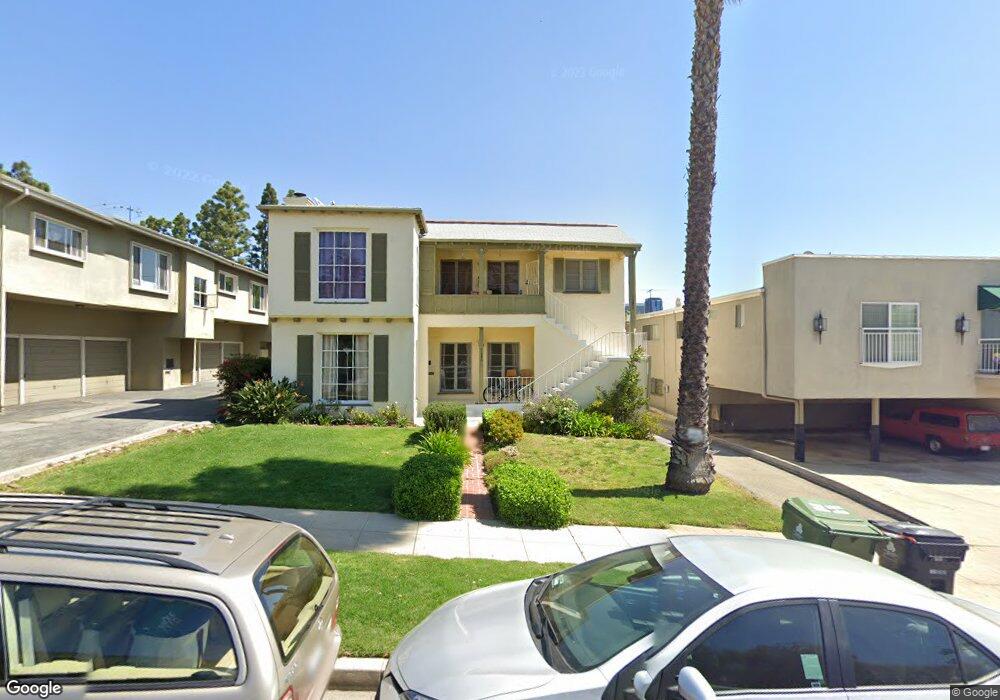
1680 Manning Ave Los Angeles, CA 90024
Westwood NeighborhoodEstimated Value: $2,094,944 - $2,519,000
4
Beds
4
Baths
2,552
Sq Ft
$915/Sq Ft
Est. Value
About This Home
This home is located at 1680 Manning Ave, Los Angeles, CA 90024 and is currently estimated at $2,335,986, approximately $915 per square foot. 1680 Manning Ave is a home located in Los Angeles County with nearby schools including Fairburn Avenue Elementary, Westwood Charter School, and Ralph Waldo Emerson Community Charter Middle School.
Ownership History
Date
Name
Owned For
Owner Type
Purchase Details
Closed on
Sep 13, 2006
Sold by
Winkler Irene and Irene Winkler Living Trust
Bought by
Winkler Properties Lp
Current Estimated Value
Purchase Details
Closed on
Feb 17, 2000
Sold by
Morgan Bruce F Tr Bruce F Morgan Trust
Bought by
Winkler Irene and Irene Winkler Living Trust
Purchase Details
Closed on
Jan 28, 1999
Sold by
Lindsey Susan M Emmet
Bought by
Lindsey Susan M Emmet and Susan M Emmet Lindsey Living T
Purchase Details
Closed on
May 20, 1998
Sold by
Morgan William W Living Trust
Bought by
Lindsay Susan M Emmet
Purchase Details
Closed on
Dec 4, 1996
Sold by
Morgan Bruce F
Bought by
Morgan Bruce F and The Bruce F Morgan Living Trus
Purchase Details
Closed on
Sep 5, 1996
Sold by
Morgan William W
Bought by
Morgan William W and The William W Morgan Jr Living
Create a Home Valuation Report for This Property
The Home Valuation Report is an in-depth analysis detailing your home's value as well as a comparison with similar homes in the area
Home Values in the Area
Average Home Value in this Area
Purchase History
| Date | Buyer | Sale Price | Title Company |
|---|---|---|---|
| Winkler Properties Lp | -- | None Available | |
| Winkler Marvin | -- | None Available | |
| Winkler Irene | $555,000 | First American Title Co | |
| Lindsey Susan M Emmet | -- | -- | |
| Lindsay Susan M Emmet | -- | -- | |
| Morgan Bruce F | -- | -- | |
| Morgan William W | -- | -- |
Source: Public Records
Tax History Compared to Growth
Tax History
| Year | Tax Paid | Tax Assessment Tax Assessment Total Assessment is a certain percentage of the fair market value that is determined by local assessors to be the total taxable value of land and additions on the property. | Land | Improvement |
|---|---|---|---|---|
| 2025 | $10,441 | $853,004 | $691,633 | $161,371 |
| 2024 | $10,441 | $836,279 | $678,072 | $158,207 |
| 2023 | $10,245 | $819,882 | $664,777 | $155,105 |
| 2022 | $9,778 | $803,807 | $651,743 | $152,064 |
| 2021 | $9,648 | $788,047 | $638,964 | $149,083 |
| 2019 | $9,364 | $764,675 | $620,013 | $144,662 |
| 2018 | $9,282 | $749,682 | $607,856 | $141,826 |
| 2016 | $8,866 | $720,573 | $584,253 | $136,320 |
| 2015 | $8,738 | $709,750 | $575,477 | $134,273 |
| 2014 | $8,776 | $695,848 | $564,205 | $131,643 |
Source: Public Records
Map
Nearby Homes
- 1621 Hilts Ave Unit 1
- 10620 Holman Ave
- 1621 Manning Ave
- 1677 Westholme Ave
- 10633 Kinnard Ave Unit 1
- 1567 Westholme Ave Unit 4A
- 10582 Holman Ave
- 10600 Wilkins Ave Unit 3D
- 1811 Manning Ave Unit 101
- 10671 Wilkins Ave Unit 5
- 1817 Prosser Ave Unit 503
- 1551 Manning Ave Unit 101
- 1651 Fairburn Ave
- 10687 Wilkins Ave Unit 1
- 1831 Prosser Ave Unit 210
- 1831 Prosser Ave Unit 205
- 1821 1/2 Westholme Ave
- 1823 Westholme Ave
- 1809 Overland Ave Unit 5
- 1745 Selby Ave Unit 5
- 1686 Manning Ave
- 1676 Manning Ave
- 1676 Manning Ave Unit 6
- 1676 Manning Ave Unit 2
- 10657 Eastborne Ave
- 1670 Manning Ave Unit 107
- 1670 Manning Ave Unit 201
- 1670 Manning Ave Unit 106
- 1675 Manning Ave
- 1659 Manning Ave
- 1665 Manning Ave
- 1665 Manning Ave Unit 1
- 1665 Manning Ave Unit 2
- 1658 Manning Ave
- 1660 Manning Ave
- 1655 Manning Ave
- 10650 Holman Ave Unit 301
- 10650 Holman Ave Unit 211
- 10650 Holman Ave Unit 210
- 10650 Holman Ave Unit 208