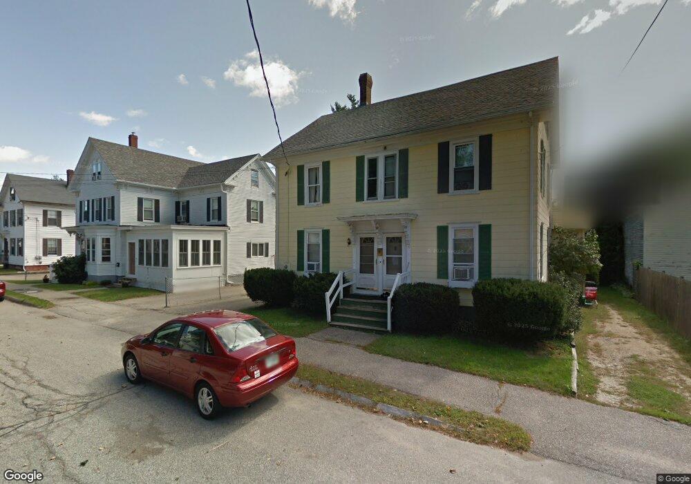
This updated 4-bedroom, 1-bathroom unit spanning approximately 1,500 square feet is on the second and third floors of a duplex, just a short 0.25-mile stroll to vibrant downtown Dover.
Previously cherished by a tenant for two decades, this unit has undergone extensive modernization, ensuring a comfortable and inviting living space for its new occupants. Recent upgrades include:
•Stylish Kitchen: Enjoy cooking in the newly renovated kitchen featuring all-new stainless steel appliances, including a refrigerator/freezer with icemaker and electric range with true convection/air-fry mode. Admire the elegance of quartz countertops and the convenience of real-wood kitchen cabinets with soft-close doors & drawers. Motion-activated under-cabinet lighting, and a new, large stainless steel sink with spring-neck pull-down faucet will make doing dishes a breeze!
•Fresh Interiors: Revel in the radiance of a freshly re-glazed tub/shower, new luxury vinyl plank floors in the kitchen, vinyl floors in the bathroom, and plush carpeting throughout the remaining living spaces.
•Modern Amenities: Experience the convenience of a brand-new high-efficiency GE Profile washer and dryer located right in the master bedroom.
Upon entering the unit, you're greeted by a welcoming foyer, perfect for shedding your shoes and hanging up your jacket on the installed coatrack. Climb the stairs to the main floor (2nd story) where you'll discover the living room, eat-in kitchen, full bathroom, master bedroom with washer/dryer, and a second bedroom. The second floor (3rd story) offers two versatile rooms suitable for a den, game room, home office, or additional bedrooms.
While there's no backyard access, you'll have exclusive use of a dedicated driveway that can accommodate 2-3 vehicles. Additionally, free unassigned on-street parking is available year-round, except during winter parking bans announced by the city.
Utility-wise, water/sewer expenses are included in rent, while tenants pay for heat/hot water (both via natural gas through Unitil), electricity (Eversource), and optionally internet/cable (historically Comcast/Xfinity). Snow removal is up to the tenant as well. No cats allowed, but small dogs may be considered for an additional fee (certain breeds are restricted by insurance). Interested tenants must apply via this property link on Apartments[dot]com ($29 fee, non-refundable) after showing.