Estimated Value: $382,028
3
Beds
3
Baths
4,276
Sq Ft
$89/Sq Ft
Est. Value
About This Home
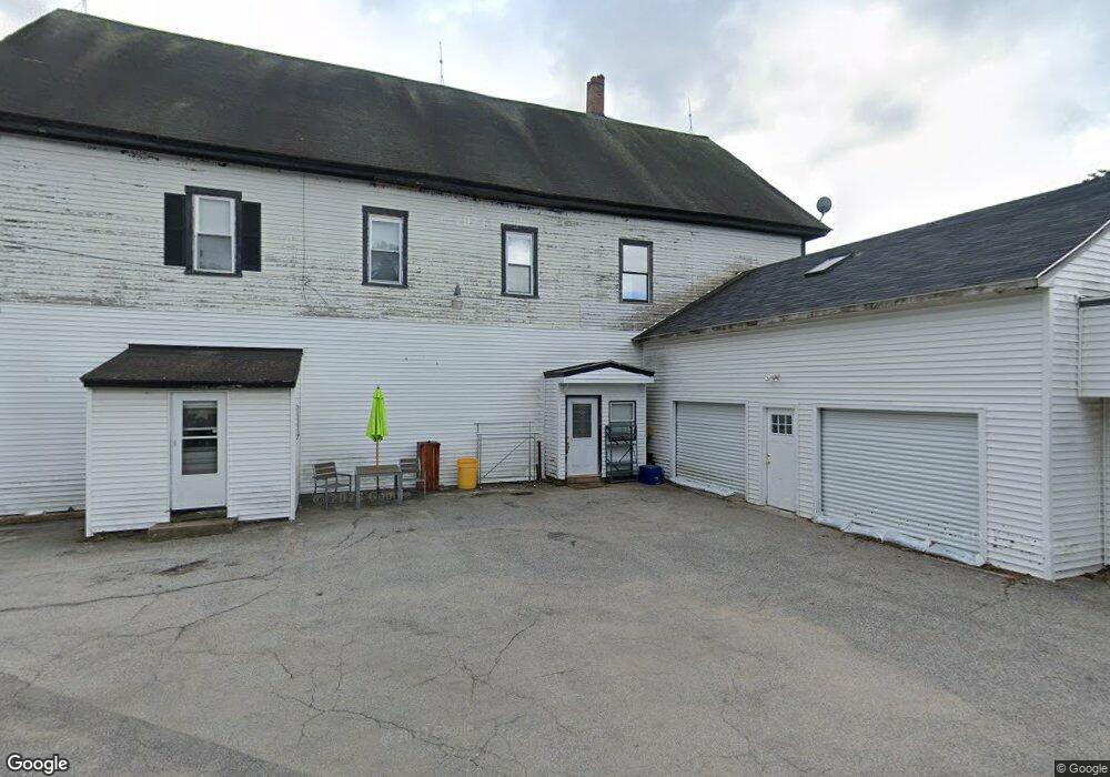
This home is located at 17 Gorboro Rd Unit C 066, Epsom, NH 03234 and is currently estimated at $382,028, approximately $89 per square foot. 17 Gorboro Rd Unit C 066 is a home located in Merrimack County with nearby schools including Epsom Central School, Cornerstone Christian Academy, and Epsom Better Buddies.
Ownership History
Date
Name
Owned For
Owner Type
Purchase Details
Closed on
May 12, 2022
Sold by
Tremblay Linda
Bought by
Larry A Morgan Ret and Morgan
Current Estimated Value
Purchase Details
Closed on
Feb 28, 2017
Sold by
Baghdad Renee
Bought by
Baghdad Amel
Purchase Details
Closed on
Mar 6, 2003
Sold by
Nickerson Larry R and Nickerson Ellen R
Bought by
Baghdad Amel M and Baghdad Renee K
Create a Home Valuation Report for This Property
The Home Valuation Report is an in-depth analysis detailing your home's value as well as a comparison with similar homes in the area
Home Values in the Area
Average Home Value in this Area
Purchase History
| Date | Buyer | Sale Price | Title Company |
|---|---|---|---|
| Larry A Morgan Ret | -- | None Available | |
| Larry A Morgan Ret | -- | None Available | |
| Baghdad Amel | -- | -- | |
| Baghdad Amel | -- | -- | |
| Baghdad Amel M | $153,000 | -- | |
| Baghdad Amel M | $153,000 | -- |
Source: Public Records
Tax History
| Year | Tax Paid | Tax Assessment Tax Assessment Total Assessment is a certain percentage of the fair market value that is determined by local assessors to be the total taxable value of land and additions on the property. | Land | Improvement |
|---|---|---|---|---|
| 2025 | $5,483 | $312,600 | $159,400 | $153,200 |
| 2024 | $7,283 | $273,400 | $106,900 | $166,500 |
| 2023 | $6,734 | $273,400 | $106,900 | $166,500 |
| 2022 | $7,045 | $295,500 | $129,000 | $166,500 |
| 2021 | $6,986 | $295,500 | $129,000 | $166,500 |
| 2020 | $6,451 | $295,500 | $129,000 | $166,500 |
| 2019 | $8,008 | $295,600 | $111,000 | $184,600 |
| 2018 | $7,677 | $295,600 | $111,000 | $184,600 |
| 2017 | $7,588 | $295,600 | $111,000 | $184,600 |
| 2016 | $7,935 | $317,000 | $111,000 | $206,000 |
| 2015 | $7,551 | $317,000 | $111,000 | $206,000 |
| 2014 | $8,677 | $389,800 | $105,000 | $284,800 |
| 2013 | $8,518 | $377,400 | $105,000 | $272,400 |
Source: Public Records
Map
Nearby Homes
- 0 Dover Unit 33 & 35
- 88 Old Town Road Extension
- 5 Old Turnpike Rd
- 157 Old Turnpike Rd
- 520 Goboro Rd
- 21 Depot Rd
- 2 Archer Cir
- 9 Princess Ln
- 6 Lincoln St
- 19 Meadow Lark Ln
- 11 Nash Ln
- 15 Nash Ln
- 1050 Dover Rd
- 27 Tyler Ave
- 0 Dowboro Rd Unit 11
- 0 Poor Town Rd Unit 4
- 3 Spruce Cove Rd
- 67 Swiggey Brook Rd
- 1563 1st New Hampshire Turnpike
- 0A Old Turnpike Rd
Your Personal Tour Guide
Ask me questions while you tour the home.