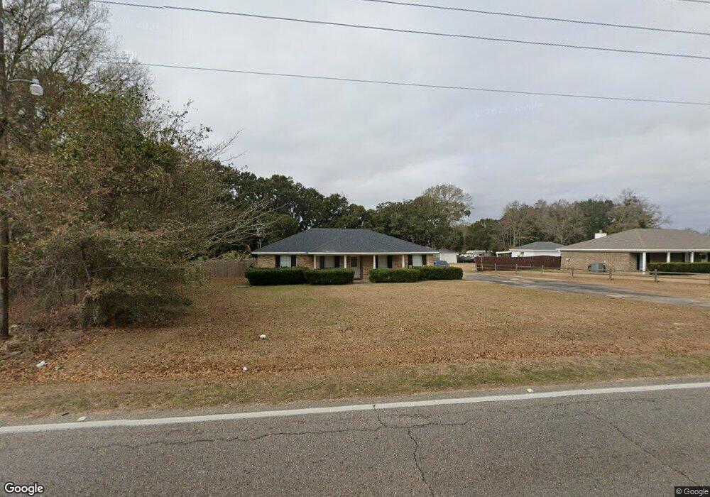
1700 Dawes Rd Mobile, AL 36695
Yorkwood NeighborhoodEstimated Value: $241,786 - $353,000
3
Beds
2
Baths
1,971
Sq Ft
$149/Sq Ft
Est. Value
About This Home
This home is located at 1700 Dawes Rd, Mobile, AL 36695 and is currently estimated at $293,697, approximately $149 per square foot. 1700 Dawes Rd is a home located in Mobile County with nearby schools including Elsie Collier Elementary School, Bernice J Causey Middle School, and Baker High School.
Ownership History
Date
Name
Owned For
Owner Type
Purchase Details
Closed on
Jun 29, 2022
Sold by
Earl Mckinnell Jr Albert
Bought by
Touchstone Sandra Lee
Current Estimated Value
Purchase Details
Closed on
Dec 10, 2002
Sold by
Smith Clifford L
Bought by
Loper Sandra M and Smith Sandra Mckinnell
Home Financials for this Owner
Home Financials are based on the most recent Mortgage that was taken out on this home.
Original Mortgage
$112,500
Interest Rate
7.8%
Mortgage Type
Unknown
Purchase Details
Closed on
Feb 16, 2000
Sold by
Carter Georgia Mae
Bought by
Mckinnell Albert Earl
Create a Home Valuation Report for This Property
The Home Valuation Report is an in-depth analysis detailing your home's value as well as a comparison with similar homes in the area
Home Values in the Area
Average Home Value in this Area
Purchase History
| Date | Buyer | Sale Price | Title Company |
|---|---|---|---|
| Touchstone Sandra Lee | -- | Laurendine Chase R | |
| Loper Sandra M | $3,750 | Heritage Title Llc | |
| Mckinnell Albert Earl | -- | -- |
Source: Public Records
Mortgage History
| Date | Status | Borrower | Loan Amount |
|---|---|---|---|
| Previous Owner | Loper Sandra M | $112,500 |
Source: Public Records
Tax History Compared to Growth
Tax History
| Year | Tax Paid | Tax Assessment Tax Assessment Total Assessment is a certain percentage of the fair market value that is determined by local assessors to be the total taxable value of land and additions on the property. | Land | Improvement |
|---|---|---|---|---|
| 2024 | $2,185 | $21,200 | $3,500 | $17,700 |
| 2023 | $2,056 | $14,130 | $2,200 | $11,930 |
| 2022 | $626 | $14,270 | $2,200 | $12,070 |
| 2021 | $647 | $14,720 | $2,200 | $12,520 |
| 2020 | $668 | $15,150 | $2,200 | $12,950 |
| 2019 | $734 | $16,520 | $0 | $0 |
| 2018 | $745 | $16,740 | $0 | $0 |
| 2017 | $772 | $17,300 | $0 | $0 |
| 2016 | $780 | $17,460 | $0 | $0 |
| 2013 | $432 | $10,160 | $0 | $0 |
Source: Public Records
Map
Nearby Homes
- 1645 Dawes Rd
- 1763 Harrington Way
- 1519 Vassar Ct
- 1675 Stonebridge Ct
- 1839 Kendall Ct
- 8391 Jeff Hamilton Road Extension
- 8391 Jeff Hamilton Road Extension
- 8545 Brandy Oak Ct
- 1720 Leroy Stevens Rd
- 1935 E Clarke Rd
- 0 Twelve Oaks Dr Unit 7603591
- 2006 E Clarke Rd
- 8391 Jeptha Ct
- 8569 E Anvil Ct
- 8700 Irongate Way
- 8525 Gayla Ct
- 2155 Brittany Dr
- 8880 Ohara Dr
- 8090 Suzanne Way
- 8712 Fangorn Rd
- 1710 Dawes Rd
- 1680 Dawes Rd
- 1725 Dawes Rd
- 1750 Dawes Rd
- 1750 Dawes Rd
- 1711 Dawes Rd
- 1701 Dawes Rd
- 1648 Dawes Rd
- 1745 Dawes Rd
- 1759 Dawes Rd
- 1675 Dawes Rd
- 8715 Augusta Dr N
- 1660 Woodberry Dr
- 1650 Woodberry Dr
- 1640 Woodberry Dr
- 8570 Jeff Hamilton Road Extension
- 8530 Jeff Hamilton Road Extension
- 1711 Augusta Dr W
- 1630 Woodberry Dr
- 1701 Augusta Dr W