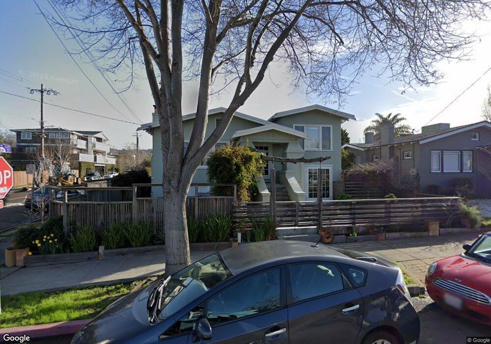
1701 10th St Berkeley, CA 94710
West Berkeley NeighborhoodEstimated Value: $1,063,358 - $1,466,000
2
Beds
2
Baths
1,095
Sq Ft
$1,098/Sq Ft
Est. Value
About This Home
This home is located at 1701 10th St, Berkeley, CA 94710 and is currently estimated at $1,202,840, approximately $1,098 per square foot. 1701 10th St is a home located in Alameda County with nearby schools including Rosa Parks Elementary School, Ruth Acty Elementary, and Berkeley Arts Magnet at Whittier School.
Ownership History
Date
Name
Owned For
Owner Type
Purchase Details
Closed on
Dec 11, 2013
Sold by
Marx Kenneth
Bought by
Harter Shane A and Harter Taylor A
Current Estimated Value
Home Financials for this Owner
Home Financials are based on the most recent Mortgage that was taken out on this home.
Original Mortgage
$702,049
Outstanding Balance
$530,676
Interest Rate
4.5%
Mortgage Type
FHA
Estimated Equity
$672,164
Purchase Details
Closed on
Nov 22, 2006
Sold by
Marx Kenneth and Robison Deborah
Bought by
Marx Kenneth
Home Financials for this Owner
Home Financials are based on the most recent Mortgage that was taken out on this home.
Original Mortgage
$250,000
Interest Rate
6.11%
Mortgage Type
New Conventional
Create a Home Valuation Report for This Property
The Home Valuation Report is an in-depth analysis detailing your home's value as well as a comparison with similar homes in the area
Home Values in the Area
Average Home Value in this Area
Purchase History
| Date | Buyer | Sale Price | Title Company |
|---|---|---|---|
| Harter Shane A | $715,000 | Old Republic Title Company | |
| Marx Kenneth | -- | Fidelity National Title |
Source: Public Records
Mortgage History
| Date | Status | Borrower | Loan Amount |
|---|---|---|---|
| Open | Harter Shane A | $702,049 | |
| Previous Owner | Marx Kenneth | $250,000 |
Source: Public Records
Tax History
| Year | Tax Paid | Tax Assessment Tax Assessment Total Assessment is a certain percentage of the fair market value that is determined by local assessors to be the total taxable value of land and additions on the property. | Land | Improvement |
|---|---|---|---|---|
| 2025 | $13,124 | $876,453 | $262,936 | $613,517 |
| 2024 | $13,124 | $859,271 | $257,781 | $601,490 |
| 2023 | $12,805 | $842,427 | $252,728 | $589,699 |
| 2022 | $12,540 | $825,910 | $247,773 | $578,137 |
| 2021 | $12,585 | $809,722 | $242,916 | $566,806 |
| 2020 | $12,008 | $801,421 | $240,426 | $560,995 |
| 2019 | $11,633 | $785,713 | $235,714 | $549,999 |
| 2018 | $11,450 | $770,311 | $231,093 | $539,218 |
| 2017 | $11,050 | $755,211 | $226,563 | $528,648 |
| 2016 | $10,746 | $740,403 | $222,121 | $518,282 |
| 2015 | $10,604 | $729,284 | $218,785 | $510,499 |
| 2014 | $10,540 | $715,000 | $214,500 | $500,500 |
Source: Public Records
Map
Nearby Homes
- 995 Virginia St
- 940 Delaware St
- 1128 Delaware St
- 1728 Curtis St
- 921 Jones St
- 1631 Belvedere Ave
- 817 Delaware St
- 2013 9th St
- 1919 Curtis St
- 1261 Hearst Ave
- 817 Jones St
- 1322 Virginia St
- 1339 Kains Ave
- 1400 Santa fe Ave
- 2144 Curtis St
- 1450 Fourth St Unit 5
- 1050 Allston Way
- 2241 Ninth St
- 1411 Hearst Ave Unit 2
- 1368 Rose St
- 1028 Virginia St
- 1705 10th St
- 1032 Virginia St
- 1709 10th St
- 1655 10th St
- 1700 10th St
- 1034 Virginia St
- 1711 10th St
- 1651 10th St
- 1014 Virginia St
- 1717 10th St
- 1708 10th St
- 1654 10th St
- 1700 San Pablo Ave
- 1647 10th St
- 1047 Virginia St
- 1039 Virginia St
- 1041 Virginia St
- 1037 Virginia St
- 1035 Virginia St
Your Personal Tour Guide
Ask me questions while you tour the home.