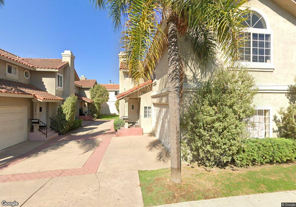
1705 Mackay Ln Unit A Redondo Beach, CA 90278
North Redondo Beach NeighborhoodEstimated Value: $1,044,059 - $1,188,000
4
Beds
3
Baths
1,620
Sq Ft
$697/Sq Ft
Est. Value
About This Home
This home is located at 1705 Mackay Ln Unit A, Redondo Beach, CA 90278 and is currently estimated at $1,128,765, approximately $696 per square foot. 1705 Mackay Ln Unit A is a home located in Los Angeles County with nearby schools including Birney Elementary School, Adams Middle School, and Redondo Union High School.
Ownership History
Date
Name
Owned For
Owner Type
Purchase Details
Closed on
Apr 29, 1996
Sold by
Mancini Stephen C
Bought by
Namoos Waleed M
Current Estimated Value
Home Financials for this Owner
Home Financials are based on the most recent Mortgage that was taken out on this home.
Original Mortgage
$165,000
Outstanding Balance
$8,102
Interest Rate
7.8%
Estimated Equity
$1,120,663
Create a Home Valuation Report for This Property
The Home Valuation Report is an in-depth analysis detailing your home's value as well as a comparison with similar homes in the area
Home Values in the Area
Average Home Value in this Area
Purchase History
| Date | Buyer | Sale Price | Title Company |
|---|---|---|---|
| Namoos Waleed M | $220,000 | Continental Lawyers Title Co |
Source: Public Records
Mortgage History
| Date | Status | Borrower | Loan Amount |
|---|---|---|---|
| Open | Namoos Waleed M | $165,000 |
Source: Public Records
Tax History
| Year | Tax Paid | Tax Assessment Tax Assessment Total Assessment is a certain percentage of the fair market value that is determined by local assessors to be the total taxable value of land and additions on the property. | Land | Improvement |
|---|---|---|---|---|
| 2025 | $4,445 | $365,448 | $158,470 | $206,978 |
| 2024 | $4,445 | $358,283 | $155,363 | $202,920 |
| 2023 | $4,370 | $351,259 | $152,317 | $198,942 |
| 2022 | $4,313 | $344,373 | $149,331 | $195,042 |
| 2021 | $4,208 | $337,621 | $146,403 | $191,218 |
| 2019 | $4,130 | $327,609 | $142,061 | $185,548 |
| 2018 | $4,006 | $321,186 | $139,276 | $181,910 |
| 2016 | $3,871 | $308,717 | $133,869 | $174,848 |
| 2015 | $3,801 | $304,081 | $131,859 | $172,222 |
| 2014 | $3,758 | $298,126 | $129,277 | $168,849 |
Source: Public Records
Map
Nearby Homes
- 2317 Carnegie Ln Unit B
- 2410 Grant Ave Unit A
- 2220 Huntington Ln Unit 4
- 2114 Carnegie Ln Unit C
- 2118 Grant Ave Unit 1
- 2420 Mathews Ave Unit B
- 2227 Mathews Ave
- 2315 Nelson Ave Unit 1
- 2604 Grant Ave Unit A
- 2604 Grant Ave Unit B
- 2313 Nelson Ave Unit A
- 2301 Marshallfield Ln Unit A
- 2607 Huntington Ln
- 2609 Vanderbilt Ln Unit 4
- 2018 Grant Ave Unit A
- 2018 Grant Ave Unit C
- 2205 Marshallfield Ln Unit B
- 2205 Marshallfield Ln Unit A
- 2203 Marshallfield Ln Unit B
- 2007 Blossom Ln
- 1705 Mackay Ln
- 1705 Mackay Ln Unit B
- 1703 Mackay Ln Unit A
- 1703 Mackay Ln Unit A4157
- 1703 Mackay Ln Unit B
- 2323 Rockefeller Ln
- 2321 Rockefeller Ln Unit 1
- 2319 Rockefeller Ln Unit B
- 2319 Rockefeller Ln
- 2319 Rockefeller Ln Unit A
- 2319 Rockefeller Ln Unit C
- 2319 Rockefeller Ln Unit B
- 1707 Mackay Ln
- 2401 Rockefeller Ln
- 2317 Rockefeller Ln Unit A
- 2317 Rockefeller Ln Unit C
- 2317 Rockefeller Ln Unit B
- 1702 Mackay Ln
- 2320 Carnegie Ln Unit B
- 2320 Carnegie Ln Unit A
Your Personal Tour Guide
Ask me questions while you tour the home.