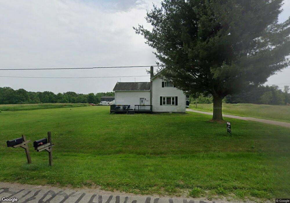
1708 Carson Rd Ashtabula, OH 44004
Estimated Value: $285,000 - $540,000
3
Beds
2
Baths
1,888
Sq Ft
$219/Sq Ft
Est. Value
About This Home
This home is located at 1708 Carson Rd, Ashtabula, OH 44004 and is currently estimated at $413,454, approximately $218 per square foot. 1708 Carson Rd is a home located in Ashtabula County with nearby schools including Lakeside High School.
Ownership History
Date
Name
Owned For
Owner Type
Purchase Details
Closed on
Mar 8, 2012
Sold by
Sophia Investments Ltd
Bought by
Equity Trust Co
Current Estimated Value
Purchase Details
Closed on
Dec 19, 2006
Sold by
Estate Of Catherine Kulik
Bought by
Kulik Anthony Clayton and Goldfarb Catherine Joann
Purchase Details
Closed on
Mar 26, 2003
Sold by
Geauga Savings Bank
Bought by
Sophia Investments Ltd
Purchase Details
Closed on
Feb 27, 2003
Sold by
Perkins Ronald E
Bought by
Geauga Savings Bank
Create a Home Valuation Report for This Property
The Home Valuation Report is an in-depth analysis detailing your home's value as well as a comparison with similar homes in the area
Purchase History
| Date | Buyer | Sale Price | Title Company |
|---|---|---|---|
| Equity Trust Co | $200,000 | None Available | |
| Kulik Anthony Clayton | -- | None Available | |
| Sophia Investments Ltd | $163,000 | -- | |
| Geauga Savings Bank | $150,000 | -- |
Source: Public Records
Tax History
| Year | Tax Paid | Tax Assessment Tax Assessment Total Assessment is a certain percentage of the fair market value that is determined by local assessors to be the total taxable value of land and additions on the property. | Land | Improvement |
|---|---|---|---|---|
| 2024 | $6,294 | $107,000 | $62,370 | $44,630 |
| 2023 | $3,663 | $107,000 | $62,370 | $44,630 |
| 2022 | $2,914 | $81,070 | $47,990 | $33,080 |
| 2021 | $2,943 | $81,070 | $47,990 | $33,080 |
| 2020 | $2,686 | $81,070 | $47,990 | $33,080 |
| 2019 | $2,776 | $76,690 | $48,230 | $28,460 |
| 2018 | $2,663 | $76,690 | $48,230 | $28,460 |
| 2017 | $2,585 | $76,690 | $48,230 | $28,460 |
| 2016 | $3,053 | $69,130 | $42,740 | $26,390 |
| 2015 | $7,008 | $69,130 | $42,740 | $26,390 |
| 2014 | $2,744 | $69,130 | $42,740 | $26,390 |
| 2013 | $2,013 | $59,290 | $29,820 | $29,470 |
Source: Public Records
Map
Nearby Homes
- 1788 Mills Rd
- 3448 Maple Rd
- 0 Maple Rd Unit LotWP001
- 0 Maple Rd
- 1267 Knickerbocker Cir
- 0 Plymouth Gageville Rd Unit 5174776
- 4132 Benetka Rd
- 0 Griggs Rd Unit 5176126
- 2631 State Route 46 N
- 2930 S Ridge Rd E
- 1930 E 52nd St
- 183 1626 E 51st St
- 1626 132 E 51st St
- 1626 #165 E 51st St
- 0 Buttonwood Ln
- 3401 Shomo Dr
- 2130 E 44th St
- 4422 Rodgers Rd
- 5031 Blakeslee Ave
- 211 W 58th St
- 1656 Carson Rd
- 1767 Carson Rd
- 1750 Carson Rd
- 1705 Carson Rd
- 1794 Carson Rd
- 3667 Plymouth Brown Rd
- 3747 Plymouth Brown Rd
- 3677 Plymouth Brown Rd
- 3755 Plymouth Brown Rd
- V/L #1 Plymouth Brown Rd
- 1836 Carson Rd
- 3759 Plymouth Brown Rd
- 3645 Plymouth Brown Rd
- 3700 Plymouth Brown Rd
- 3768 Plymouth Brown Rd
- 3781 Plymouth Brown Rd
- 3628 Plymouth Brown Rd
- 1568 Carson Rd
- 3803 Plymouth Brown Rd
- 3635 Plymouth Brown Rd
Your Personal Tour Guide
Ask me questions while you tour the home.