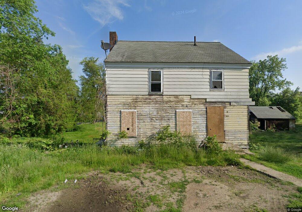
171 Vaughn Rd Coventry Township, OH 44319
Estimated Value: $200,696 - $460,000
3
Beds
1
Bath
2,482
Sq Ft
$114/Sq Ft
Est. Value
About This Home
This home is located at 171 Vaughn Rd, Coventry Township, OH 44319 and is currently estimated at $283,674, approximately $114 per square foot. 171 Vaughn Rd is a home located in Summit County with nearby schools including Eagle Elementary, St. Francis de Sales School, and Academy of the Immaculate Heart of Mary.
Ownership History
Date
Name
Owned For
Owner Type
Purchase Details
Closed on
Jul 7, 1999
Sold by
Crawford James and Crawford Angela Chere
Bought by
The City Of Akron
Current Estimated Value
Purchase Details
Closed on
Nov 2, 1998
Sold by
Bergdorf Ronald
Bought by
Crawford James and Crawford Angela Chere
Purchase Details
Closed on
Oct 21, 1998
Sold by
Crawford Katherine
Bought by
Crawford James and Crawford Angela Chere
Create a Home Valuation Report for This Property
The Home Valuation Report is an in-depth analysis detailing your home's value as well as a comparison with similar homes in the area
Home Values in the Area
Average Home Value in this Area
Purchase History
| Date | Buyer | Sale Price | Title Company |
|---|---|---|---|
| The City Of Akron | -- | Endress/Lawyers Title | |
| Crawford James | -- | -- | |
| Crawford James | -- | -- |
Source: Public Records
Tax History Compared to Growth
Tax History
| Year | Tax Paid | Tax Assessment Tax Assessment Total Assessment is a certain percentage of the fair market value that is determined by local assessors to be the total taxable value of land and additions on the property. | Land | Improvement |
|---|---|---|---|---|
| 2025 | $3,008 | $12,922 | $12,922 | -- |
| 2024 | $3,008 | $49,683 | $12,922 | $36,761 |
| 2023 | $4,231 | $49,683 | $12,922 | $36,761 |
| 2022 | $4,231 | $35,648 | $9,100 | $26,548 |
| 2021 | $4,083 | $35,648 | $9,100 | $26,548 |
| 2020 | $4,498 | $35,650 | $9,100 | $26,550 |
| 2019 | $4,549 | $39,290 | $7,320 | $31,970 |
| 2018 | $4,472 | $39,290 | $7,320 | $31,970 |
| 2017 | $4,599 | $39,290 | $7,320 | $31,970 |
| 2016 | $4,599 | $38,100 | $7,320 | $30,780 |
| 2015 | $4,599 | $38,100 | $7,320 | $30,780 |
| 2014 | $4,525 | $38,100 | $7,320 | $30,780 |
| 2013 | $4,598 | $39,660 | $7,320 | $32,340 |
Source: Public Records
Map
Nearby Homes
- 262 Teal Cir
- 0 W Warner Rd
- 336 Teal Cir
- 202 W Warner Rd
- 2925 Greenwing Ct
- 2972 N Turkeyfoot Rd
- 71 Delora Dr
- 449 W Long Lake Blvd
- 3101 Wagoner St
- 206 Lakota Ave
- 61 Leicester Dr
- 3025 Lamb Dr
- 72 Weil Ave
- 584 Apple Dr
- 428 Canova Dr
- 2069 Penguin Ave
- 802 Portage Lakes Dr
- 796 Portage Lakes Dr
- 2679 Edwin Ave
- 0 S Main St
- 234 Mallard Point Dr
- 2696 Canvasback Cir
- 2688 Canvasback Cir
- 2700 Canvasback Cir
- 2704 Canvasback Cir
- 2684 Canvasback Cir
- 2802 Canvasback Cir
- 2680 Canvasback Cir
- 2806 Canvasback Cir
- 2810 Canvasback Cir
- 2701 Canvasback Cir
- 101 N House Dr
- 109 N House Dr
- 2705 Canvasback Cir
- 3537 Vaughn
- 2709 Canvasback Cir
- 93 N House Dr
- 2672 Canvasback Cir
- 126 Mallard Point Dr
- 2671 Canvasback Cir