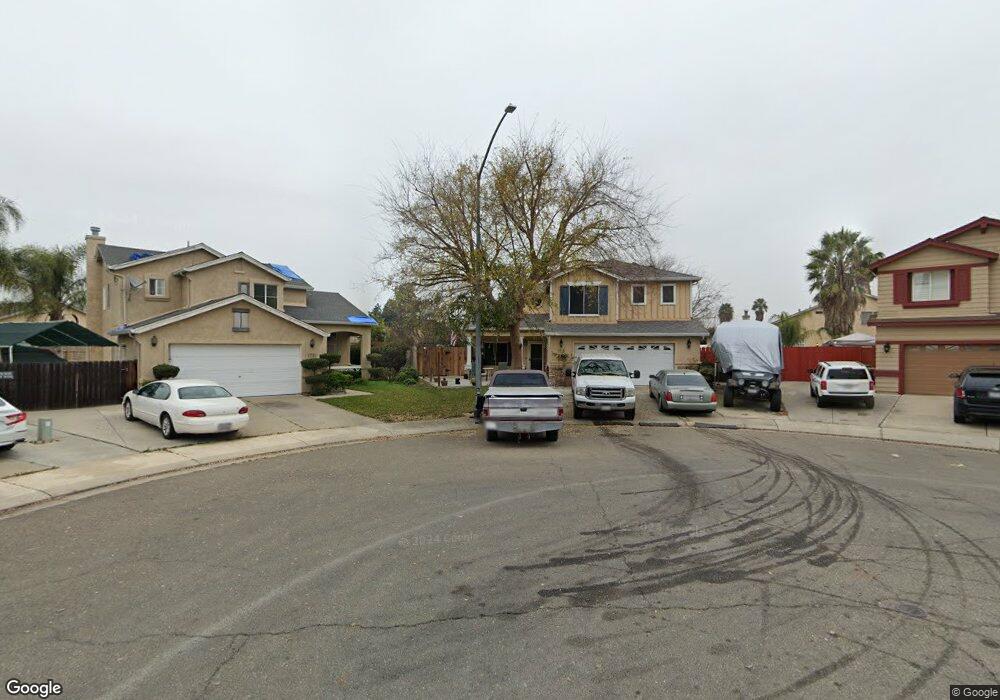
1715 Galaxy Ct Stockton, CA 95206
Seaport NeighborhoodEstimated Value: $294,000 - $508,000
4
Beds
3
Baths
2,100
Sq Ft
$205/Sq Ft
Est. Value
About This Home
This home is located at 1715 Galaxy Ct, Stockton, CA 95206 and is currently estimated at $430,064, approximately $204 per square foot. 1715 Galaxy Ct is a home located in San Joaquin County with nearby schools including Taylor Leadership Academy, San Joaquin Elementary School, and John Marshall Elementary School.
Ownership History
Date
Name
Owned For
Owner Type
Purchase Details
Closed on
Apr 21, 2025
Sold by
Biscaia Mario A and Biscaia Diane L
Bought by
Mario And Diane Biscaia Revocable Trust and Biscaia
Current Estimated Value
Purchase Details
Closed on
Apr 3, 1997
Sold by
Florsheim Bros
Bought by
Biscaia Mario A and Biscaia Diane L
Home Financials for this Owner
Home Financials are based on the most recent Mortgage that was taken out on this home.
Original Mortgage
$140,626
Interest Rate
7.86%
Mortgage Type
FHA
Create a Home Valuation Report for This Property
The Home Valuation Report is an in-depth analysis detailing your home's value as well as a comparison with similar homes in the area
Home Values in the Area
Average Home Value in this Area
Purchase History
| Date | Buyer | Sale Price | Title Company |
|---|---|---|---|
| Mario And Diane Biscaia Revocable Trust | -- | None Listed On Document | |
| Biscaia Mario A | $143,000 | Chicago Title Co |
Source: Public Records
Mortgage History
| Date | Status | Borrower | Loan Amount |
|---|---|---|---|
| Previous Owner | Biscaia Mario A | $140,626 |
Source: Public Records
Tax History Compared to Growth
Tax History
| Year | Tax Paid | Tax Assessment Tax Assessment Total Assessment is a certain percentage of the fair market value that is determined by local assessors to be the total taxable value of land and additions on the property. | Land | Improvement |
|---|---|---|---|---|
| 2025 | $5,039 | $240,700 | $40,711 | $199,989 |
| 2024 | $4,988 | $235,981 | $39,913 | $196,068 |
| 2023 | $4,919 | $231,355 | $39,131 | $192,224 |
| 2022 | $4,759 | $226,819 | $38,364 | $188,455 |
| 2021 | $4,655 | $222,372 | $37,612 | $184,760 |
| 2020 | $4,685 | $220,093 | $37,227 | $182,866 |
| 2019 | $4,673 | $215,779 | $36,498 | $179,281 |
| 2018 | $5,048 | $211,549 | $35,783 | $175,766 |
| 2017 | $2,866 | $207,402 | $35,082 | $172,320 |
| 2016 | $2,892 | $203,336 | $34,394 | $168,942 |
| 2014 | $2,483 | $175,000 | $53,000 | $122,000 |
Source: Public Records
Map
Nearby Homes
- 2650 S Fresno Ave
- 1232 Denver Ave
- 1409 Laguna Cir
- 1413 Laguna Cir
- 2128 Green River Ln
- 1823 Fort Hall Place
- 1156 Derrick Dr
- 2242 Port Trinity Cir
- 2050 Grey Stone Dr
- 2079 Gordon Verner Cir
- 3330 Konig Ct
- 1890 Gordon Verner Cir
- 2215 Dune Place
- 864 W 5th St
- 1526 Kimiyo St
- 3412 Shogoro Ln
- 3745 Wild Rose Ln
- 2402 Sailboat Ct
- 3779 Zeally Ln
- 2428 Shell Ct
- 1721 Galaxy Ct
- 2613 Reef Ct
- 1710 Galaxy Ct
- 2621 Reef Ct
- 1727 Galaxy Ct
- 2605 Reef Ct
- 2629 Reef Ct
- 1674 Lever Blvd
- 1718 Galaxy Ct
- 1688 Lever Blvd
- 1662 Lever Blvd
- 1696 Lever Blvd
- 1650 Lever Blvd
- 1733 Galaxy Ct
- 1734 Galaxy Ct
- 2711 Reef Ct
- 1714 Lever Blvd
- 1634 Lever Blvd
- 2602 Reef Ct
- 2640 Calero Hills Ln