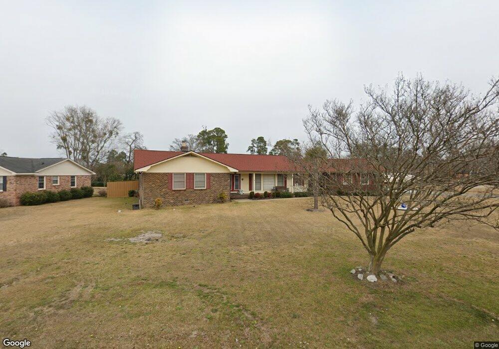
1717 3rd Loop Rd Florence, SC 29505
Estimated Value: $223,649 - $283,000
3
Beds
2
Baths
2,214
Sq Ft
$113/Sq Ft
Est. Value
About This Home
This home is located at 1717 3rd Loop Rd, Florence, SC 29505 and is currently estimated at $251,162, approximately $113 per square foot. 1717 3rd Loop Rd is a home located in Florence County with nearby schools including Briggs Elementary School, Henry L. Sneed Middle School, and John W. Moore Middle School.
Ownership History
Date
Name
Owned For
Owner Type
Purchase Details
Closed on
Dec 12, 2024
Sold by
Williams Mark H and Williams Debra M
Bought by
Williams Mark H and Williams Debra M
Current Estimated Value
Purchase Details
Closed on
Apr 30, 2015
Sold by
Clark John P
Bought by
Williams Mark H and Williams Debra M
Home Financials for this Owner
Home Financials are based on the most recent Mortgage that was taken out on this home.
Original Mortgage
$178,138
Interest Rate
3.79%
Mortgage Type
New Conventional
Create a Home Valuation Report for This Property
The Home Valuation Report is an in-depth analysis detailing your home's value as well as a comparison with similar homes in the area
Purchase History
| Date | Buyer | Sale Price | Title Company |
|---|---|---|---|
| Williams Mark H | -- | None Listed On Document | |
| Williams Mark H | -- | None Listed On Document | |
| Williams Mark H | $167,000 | -- |
Source: Public Records
Mortgage History
| Date | Status | Borrower | Loan Amount |
|---|---|---|---|
| Previous Owner | Williams Mark H | $178,138 |
Source: Public Records
Tax History
| Year | Tax Paid | Tax Assessment Tax Assessment Total Assessment is a certain percentage of the fair market value that is determined by local assessors to be the total taxable value of land and additions on the property. | Land | Improvement |
|---|---|---|---|---|
| 2025 | $979 | $9,099 | $880 | $8,219 |
| 2024 | $592 | $9,099 | $880 | $8,219 |
| 2023 | $497 | $6,671 | $880 | $5,791 |
| 2022 | $803 | $6,671 | $880 | $5,791 |
| 2021 | $873 | $6,670 | $0 | $0 |
| 2020 | $785 | $6,670 | $0 | $0 |
| 2019 | $732 | $6,671 | $880 | $5,791 |
| 2018 | $691 | $6,670 | $0 | $0 |
| 2017 | $655 | $6,670 | $0 | $0 |
| 2016 | $608 | $6,670 | $0 | $0 |
| 2015 | $534 | $5,600 | $0 | $0 |
| 2014 | $461 | $5,595 | $880 | $4,715 |
Source: Public Records
Map
Nearby Homes
- 1716 Furman Dr
- 1814 Citadel St
- 2001 Elaine Cir
- 1808 Taylor Ct
- 1779 S Saint Anthony Ave
- 1804 Woods Dr
- 1811 Meadow Green Place
- 1816 Meadow Green Place
- 1700 Bellevue Dr
- 2101 W McCown Dr
- 1815 Hampton Dr
- 1905 Marsh Ave
- 1507 Rosedale St
- 1830 Marsh Ave
- 0 State Road S-21-869
- 2303 W McCown Dr
- 2109 Eaton Cir
- 1807 Nottingham Dr
- 1768 Marsh Ave
- 2141 Elderberry Dr
- 1721 3rd Loop Rd
- 2003 Bellevue Dr
- 1718 Mars Hill Cir
- 1725 3rd Loop Rd
- 1722 Mars Hill Cir
- 2006 Bellevue Dr
- 1702 3rd Loop Rd
- 1706 3rd Loop Rd
- 2000 Bellevue Dr
- 1607 3rd Loop Rd
- 1921 Bellevue Dr
- 1800 Mars Hill Cir
- 1731 3rd Loop Rd
- 1710 3rd Loop Rd
- 1713 Mars Hill Cir
- 1715 Mars Hill Cir
- 1721 Mars Hill Cir
- 1725 Mars Hill Cir
- 1620 3rd Loop Rd
- 1922 Bellevue Dr
Your Personal Tour Guide
Ask me questions while you tour the home.