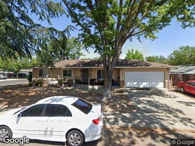
1717 Glouster Way Modesto, CA 95350
Estimated Value: $390,000 - $401,443
3
Beds
2
Baths
1,144
Sq Ft
$345/Sq Ft
Est. Value
About This Home
This home is located at 1717 Glouster Way, Modesto, CA 95350 and is currently estimated at $394,611, approximately $344 per square foot. 1717 Glouster Way is a home located in Stanislaus County with nearby schools including George Eisenhut Elementary School, Prescott Junior High School, and Grace M. Davis High School.
Ownership History
Date
Name
Owned For
Owner Type
Purchase Details
Closed on
May 22, 2002
Sold by
Dolieslager Harvey J and Dolieslager Mary D
Bought by
Anglin Lloyd and Tomerlin Shannon
Current Estimated Value
Home Financials for this Owner
Home Financials are based on the most recent Mortgage that was taken out on this home.
Original Mortgage
$142,759
Interest Rate
6.83%
Mortgage Type
FHA
Purchase Details
Closed on
Jun 3, 1998
Sold by
Dolieslager Harvey J and Dolieslager Mary D
Bought by
Dolieslager Harvey J and Dolieslager Mary D
Create a Home Valuation Report for This Property
The Home Valuation Report is an in-depth analysis detailing your home's value as well as a comparison with similar homes in the area
Home Values in the Area
Average Home Value in this Area
Purchase History
| Date | Buyer | Sale Price | Title Company |
|---|---|---|---|
| Anglin Lloyd | $145,000 | Stewart Title | |
| Dolieslager Harvey J | -- | -- |
Source: Public Records
Mortgage History
| Date | Status | Borrower | Loan Amount |
|---|---|---|---|
| Open | Anglin Lloyd | $164,000 | |
| Closed | Anglin Lloyd | $142,759 | |
| Closed | Anglin Lloyd | $8,700 |
Source: Public Records
Tax History Compared to Growth
Tax History
| Year | Tax Paid | Tax Assessment Tax Assessment Total Assessment is a certain percentage of the fair market value that is determined by local assessors to be the total taxable value of land and additions on the property. | Land | Improvement |
|---|---|---|---|---|
| 2024 | $2,302 | $209,986 | $72,407 | $137,579 |
| 2023 | $2,259 | $205,870 | $70,988 | $134,882 |
| 2022 | $2,196 | $201,835 | $69,597 | $132,238 |
| 2021 | $2,074 | $197,879 | $68,233 | $129,646 |
| 2020 | $2,046 | $195,851 | $67,534 | $128,317 |
| 2019 | $2,020 | $192,011 | $66,210 | $125,801 |
| 2018 | $1,994 | $188,247 | $64,912 | $123,335 |
| 2017 | $1,946 | $184,557 | $63,640 | $120,917 |
| 2016 | $1,893 | $180,940 | $62,393 | $118,547 |
| 2015 | $1,877 | $178,223 | $61,456 | $116,767 |
| 2014 | $1,742 | $164,500 | $30,000 | $134,500 |
Source: Public Records
Map
Nearby Homes
- 3001 Radnor Way
- 1829 Glouster Way
- 3101 Lisa Ct
- 3101 Wyatt Way
- 2036 Sheldon Dr
- 1801 Innsbrook Dr
- 2405 Sharondell Dr
- 2044 Juanita Ct
- 2113 Viking Ln
- 1425 Rosemead Ct
- 3037 Holiday Ln
- 2037 Wally Ct
- 1404 Glen Aulen Dr
- 3305 Brooktree Ln
- 2621 Prescott Rd Unit 218
- 2621 Prescott Rd Unit 68
- 2621 Prescott Rd Unit 115
- 2621 Prescott Rd Unit 224
- 2621 Prescott Rd Unit 245
- 2621 Prescott Rd Unit 163
- 1717 Glouster Way
- 3020 Beckett Ln
- 1713 Glouster Way
- 3021 Radnor Way
- 3024 Beckett Ln
- 1720 Glouster Way
- 3017 Beckett Ln
- 1716 Glouster Way
- 1724 Glouster Way
- 3025 Radnor Way
- 3021 Beckett Ln
- 3005 Radnor Way
- 3100 Beckett Ln
- 1800 Glouster Way
- 1805 Glouster Way
- 1717 W Rumble Rd
- 3029 Radnor Way
- 1723 W Rumble Rd
- 1804 Langton Ln
- 1727 W Rumble Rd