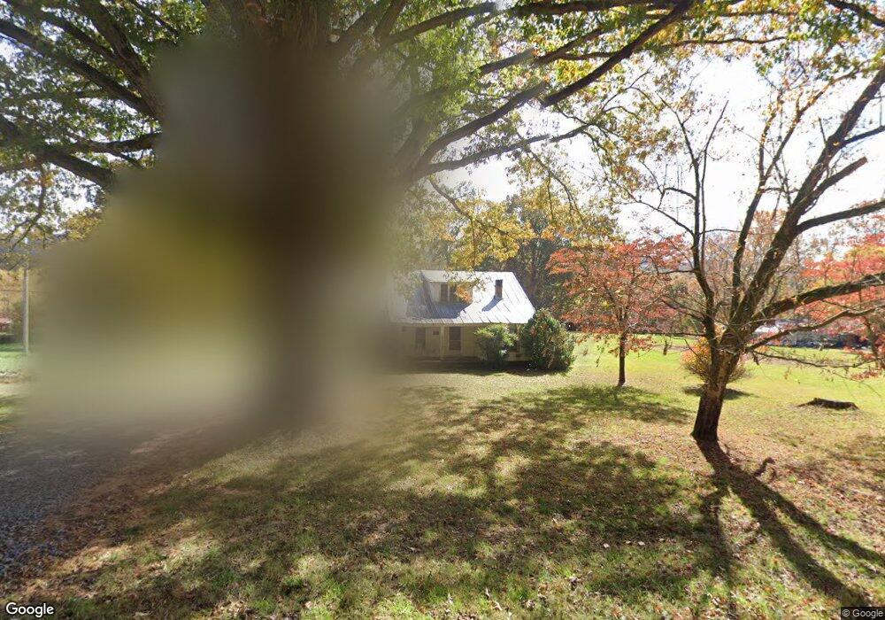
17293 Morganton Hwy Morganton, GA 30560
Estimated Value: $511,194 - $749,000
--
Bed
--
Bath
2,088
Sq Ft
$305/Sq Ft
Est. Value
About This Home
This home is located at 17293 Morganton Hwy, Morganton, GA 30560 and is currently estimated at $637,049, approximately $305 per square foot. 17293 Morganton Hwy is a home with nearby schools including Fannin County High School.
Ownership History
Date
Name
Owned For
Owner Type
Purchase Details
Closed on
Dec 8, 2020
Sold by
Maner Carolyn J
Bought by
Maner Jonathan S and Maner Robert Daniel
Current Estimated Value
Purchase Details
Closed on
May 28, 2004
Sold by
Falls Edgar F
Bought by
Falls Edgar F Trustee Of The Edgar Falls
Purchase Details
Closed on
Oct 14, 1988
Bought by
Falls Edgar F and Falls Lara
Create a Home Valuation Report for This Property
The Home Valuation Report is an in-depth analysis detailing your home's value as well as a comparison with similar homes in the area
Home Values in the Area
Average Home Value in this Area
Purchase History
| Date | Buyer | Sale Price | Title Company |
|---|---|---|---|
| Maner Jonathan S | -- | -- | |
| Maner Jonathan S | -- | -- | |
| Falls Edgar F Trustee Of The Edgar Falls | -- | -- | |
| Falls Edgar F Trustee Of The Edgar Falls | -- | -- | |
| Maner Carolyn J | -- | -- | |
| Maner Carolyn J | -- | -- | |
| Falls Edgar F | -- | -- |
Source: Public Records
Tax History Compared to Growth
Tax History
| Year | Tax Paid | Tax Assessment Tax Assessment Total Assessment is a certain percentage of the fair market value that is determined by local assessors to be the total taxable value of land and additions on the property. | Land | Improvement |
|---|---|---|---|---|
| 2024 | $1,089 | $203,954 | $47,354 | $156,600 |
| 2023 | $440 | $130,970 | $47,354 | $83,616 |
| 2022 | $623 | $130,970 | $47,354 | $83,616 |
| 2021 | $830 | $101,000 | $47,354 | $53,646 |
| 2020 | $842 | $101,000 | $47,354 | $53,646 |
| 2019 | $859 | $101,000 | $47,354 | $53,646 |
| 2018 | $911 | $75,840 | $22,194 | $53,646 |
| 2017 | $1,376 | $77,741 | $22,194 | $55,547 |
| 2016 | $798 | $69,963 | $22,194 | $47,769 |
| 2015 | $863 | $71,719 | $22,194 | $49,526 |
| 2014 | $1,338 | $79,574 | $23,681 | $55,894 |
| 2013 | -- | $62,722 | $23,680 | $39,041 |
Source: Public Records
Map
Nearby Homes
- 16810 Morganton Hwy
- 164 Hoot Owl Hill
- 145 Hoot Owl Ridge
- 195 Hoot Owl Ridge
- 77 Beaver's Cove
- 180 Shepherds Ridge
- 558 Tipton Springs Rd
- Lot 38 Shepherds Way
- 366 Shepherds Way
- 455 Shepherds Walk
- Vacant Tipton Springs Rd
- 74 Shepherds Trail
- 335 Mountain Rd
- 185 Mountain Rd
- 177 Mountain Rd
- 158 Mountain Meadows Dr
- 166 Mountain Rd
- 2722 Daves Rd
- 17545 Morganton Hwy
- 282 Morganton Hwy
- 17427 Morganton Hwy
- 17290 Morganton Hwy
- 17290 Morganton Hwy
- 24376 Morganton Hwy
- 26564 Morganton Hwy
- 17330 Morganton Hwy
- 17232 Morganton Hwy
- 17322 Morganton Hwy
- 17840 Morganton Hwy
- 17159 Morganton Hwy
- 357 Wilscot Farms Rd
- 16976 Morganton Hwy
- 76 C and C Dr
- 17817 Morganton Hwy
- 17055 Morganton Hwy
- 17055 Morganton Hwy
- 17625 Morganton Hwy
- 261 Daves Rd