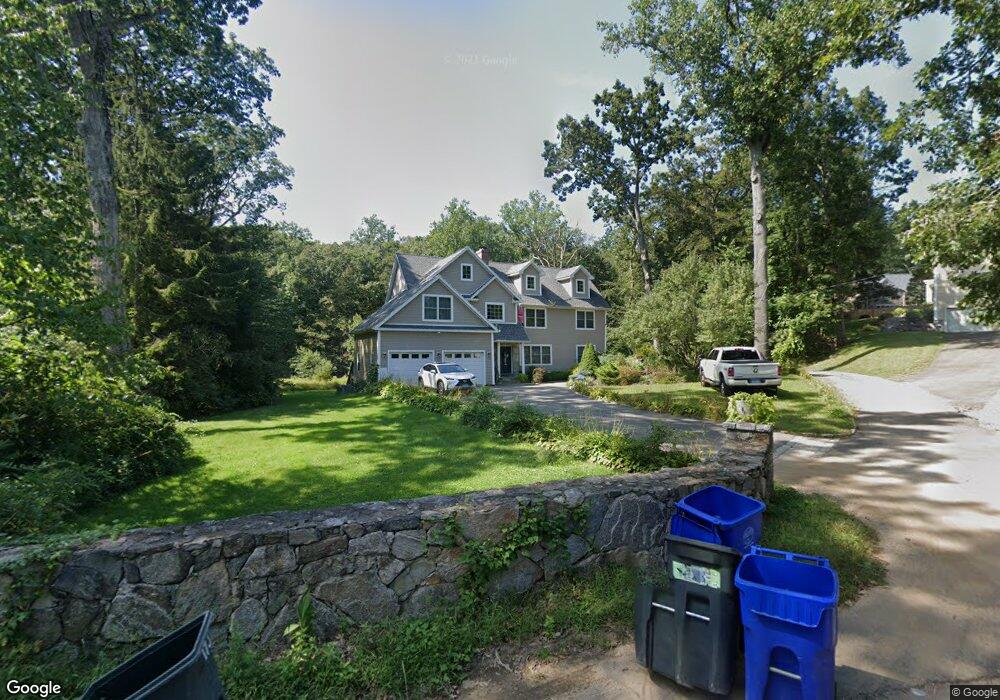
173 N Taylor Ave Norwalk, CT 06854
West Norwalk NeighborhoodEstimated Value: $745,000 - $942,166
3
Beds
2
Baths
1,468
Sq Ft
$604/Sq Ft
Est. Value
About This Home
This home is located at 173 N Taylor Ave, Norwalk, CT 06854 and is currently estimated at $886,542, approximately $603 per square foot. 173 N Taylor Ave is a home located in Fairfield County with nearby schools including Kendall Elementary School, Ponus Ridge Middle School, and Brien Mcmahon High School.
Ownership History
Date
Name
Owned For
Owner Type
Purchase Details
Closed on
Apr 6, 2010
Sold by
Central Mortgage Co
Bought by
Gorski Bozena
Current Estimated Value
Purchase Details
Closed on
Feb 3, 2010
Sold by
Albano Frank J
Bought by
Central Mortgage Co
Purchase Details
Closed on
Jun 27, 1997
Sold by
Household Realty Corp
Bought by
Albano Frank J and Albano Victoria A
Home Financials for this Owner
Home Financials are based on the most recent Mortgage that was taken out on this home.
Original Mortgage
$122,550
Interest Rate
7.81%
Mortgage Type
Unknown
Create a Home Valuation Report for This Property
The Home Valuation Report is an in-depth analysis detailing your home's value as well as a comparison with similar homes in the area
Home Values in the Area
Average Home Value in this Area
Purchase History
| Date | Buyer | Sale Price | Title Company |
|---|---|---|---|
| Gorski Bozena | $200,000 | -- | |
| Gorski Bozena | $200,000 | -- | |
| Central Mortgage Co | -- | -- | |
| Central Mortgage Co | -- | -- | |
| Albano Frank J | $129,000 | -- | |
| Albano Frank J | $129,000 | -- |
Source: Public Records
Mortgage History
| Date | Status | Borrower | Loan Amount |
|---|---|---|---|
| Open | Albano Frank J | $200,000 | |
| Previous Owner | Albano Frank J | $300,000 | |
| Previous Owner | Albano Frank J | $122,550 |
Source: Public Records
Tax History Compared to Growth
Tax History
| Year | Tax Paid | Tax Assessment Tax Assessment Total Assessment is a certain percentage of the fair market value that is determined by local assessors to be the total taxable value of land and additions on the property. | Land | Improvement |
|---|---|---|---|---|
| 2025 | $12,353 | $515,880 | $143,510 | $372,370 |
| 2024 | $12,170 | $515,880 | $143,510 | $372,370 |
| 2023 | $11,222 | $446,010 | $135,310 | $310,700 |
| 2022 | $11,013 | $446,000 | $135,300 | $310,700 |
| 2021 | $10,727 | $446,010 | $135,310 | $310,700 |
| 2020 | $10,721 | $446,010 | $135,310 | $310,700 |
| 2019 | $10,421 | $446,010 | $135,310 | $310,700 |
| 2018 | $10,205 | $382,750 | $148,290 | $234,460 |
| 2017 | $9,854 | $382,750 | $148,290 | $234,460 |
| 2016 | $9,787 | $383,820 | $148,290 | $235,530 |
| 2015 | $9,733 | $382,750 | $148,290 | $234,460 |
| 2014 | $9,607 | $382,750 | $148,290 | $234,460 |
Source: Public Records
Map
Nearby Homes
- 14 Windward Rd
- 218 N Taylor Ave
- 150 Fillow St
- 12 Camelot Dr Unit B1
- 29 Nash Place
- 3 Wynne Rd
- 146 Gillies Ln Unit 146
- 63 Ferris Ave
- 31 June Ave
- 17 Redcoat Rd
- 2 Fox Run Rd
- 3 Devon Ave
- 5 Tower Dr
- 10 Ledgebrook Dr Unit 1
- 2 Coldspring St
- 5 Maher Dr
- 2 Finley St
- 28 Fox Run Rd
- 7 Girard St
- 51 1/2 Magnolia Ave
- 171 N Taylor Ave
- 175 N Taylor Ave
- 172 N Taylor Ave
- 167 N Taylor Ave
- 174 N Taylor Ave
- 168 N Taylor Ave
- 178 N Taylor Ave
- 162 N Taylor Ave
- 5 Chipping Ln
- 164 N Taylor Ave
- 159 N Taylor Ave
- 194 N Taylor Ave
- 2 Twin Ledge Rd
- 192 N Taylor Ave
- 160 N Taylor Ave
- 196 N Taylor Ave
- 155 N Taylor Ave
- 3 Chipping Ln
- 75 Marlin Dr
- 77 Marlin Dr