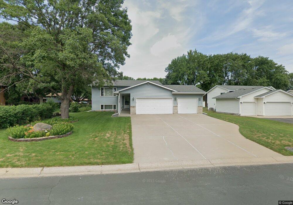
1747 13th Ave W Shakopee, MN 55379
Estimated Value: $391,000 - $413,809
4
Beds
2
Baths
1,120
Sq Ft
$362/Sq Ft
Est. Value
About This Home
This home is located at 1747 13th Ave W, Shakopee, MN 55379 and is currently estimated at $405,202, approximately $361 per square foot. 1747 13th Ave W is a home located in Scott County with nearby schools including Sweeney Elementary School, East Middle School, and Shakopee Senior High School.
Ownership History
Date
Name
Owned For
Owner Type
Purchase Details
Closed on
Dec 30, 2008
Sold by
Thomas Byron D and Thomas Janet L
Bought by
Uy Mon and Hong Hak Bunna
Current Estimated Value
Purchase Details
Closed on
Jul 31, 2002
Sold by
Lalim Darrol K and Lalim Elizabeth
Bought by
Thomas Byron D and Thomas Janet L
Create a Home Valuation Report for This Property
The Home Valuation Report is an in-depth analysis detailing your home's value as well as a comparison with similar homes in the area
Home Values in the Area
Average Home Value in this Area
Purchase History
| Date | Buyer | Sale Price | Title Company |
|---|---|---|---|
| Uy Mon | $225,000 | -- | |
| Thomas Byron D | $237,500 | -- |
Source: Public Records
Tax History Compared to Growth
Tax History
| Year | Tax Paid | Tax Assessment Tax Assessment Total Assessment is a certain percentage of the fair market value that is determined by local assessors to be the total taxable value of land and additions on the property. | Land | Improvement |
|---|---|---|---|---|
| 2025 | $3,734 | $375,600 | $177,700 | $197,900 |
| 2024 | $3,790 | $365,600 | $172,500 | $193,100 |
| 2023 | $3,986 | $358,300 | $169,100 | $189,200 |
| 2022 | $3,986 | $369,800 | $169,100 | $200,700 |
| 2021 | $3,410 | $320,600 | $136,000 | $184,600 |
| 2020 | $3,650 | $302,200 | $116,500 | $185,700 |
| 2019 | $3,558 | $286,100 | $102,000 | $184,100 |
| 2018 | $3,606 | $0 | $0 | $0 |
| 2016 | $3,298 | $0 | $0 | $0 |
| 2014 | -- | $0 | $0 | $0 |
Source: Public Records
Map
Nearby Homes
- 1853 Stone Meadow Blvd
- 1538 12th Ave W
- 1226 Polk St S
- 2075 13th Ave W
- 1187 Jackson St S
- 2123 Agate Curve
- 1259 Taylor St Unit 3
- 2224 Quarry Ln
- 1279 Taylor St Unit 5
- 2007 10th Ave W Unit 12
- 1813 6th Ave W
- 816 Regent Dr
- 1690 Windigo Ln
- 696 Jutland Ave
- 1861 Attenborough St
- 1179 Cubasue Ct
- 508 Hackney Ave
- The Ferguson Plan at Bluff View - Cottage Series
- The Edison Plan at Bluff View - Cottage Series
- The Tatum Plan at Bluff View - Cottage Series
- 1747 1747 13th-Avenue-w
- 1737 13th Ave W
- 1291 Harrison St S
- 1281 Harrison St S
- 1727 13th Ave W
- 1726 Presidential Cir
- 1730 Presidential Cir
- 1271 Harrison St S
- 1717 1717 13th-Avenue-w
- 1717 13th Ave W
- 1710 13th Ave W
- 1706 13th Ave W
- 1261 Harrison St S
- 1702 13th Ave W
- 1707 13th Ave W
- 1722 Presidential Cir
- 1734 Presidential Cir
- 1776 13th Ave W
- 1294 Harrison St S
- 1282 Harrison St S