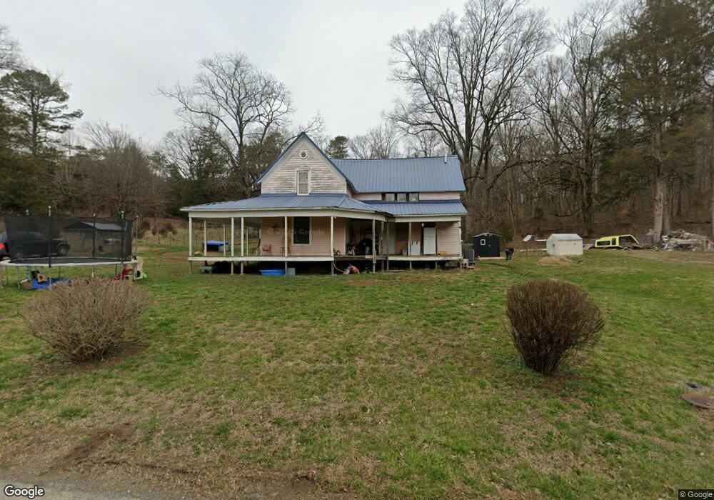
175 Peters Rd Luttrell, TN 37779
Plainview NeighborhoodEstimated Value: $262,000 - $487,424
Studio
1
Bath
1,264
Sq Ft
$276/Sq Ft
Est. Value
About This Home
This home is located at 175 Peters Rd, Luttrell, TN 37779 and is currently estimated at $349,141, approximately $276 per square foot. 175 Peters Rd is a home located in Union County with nearby schools including Luttrell Elementary School, H Maynard Middle School, and Union County High School.
Ownership History
Date
Name
Owned For
Owner Type
Purchase Details
Closed on
Feb 27, 2026
Sold by
Ford Gayle
Bought by
Ford Gayle
Current Estimated Value
Purchase Details
Closed on
Dec 22, 2020
Sold by
Ford Gayle
Bought by
Jones Clinton
Purchase Details
Closed on
Jun 12, 1997
Sold by
Ford Gene A
Bought by
Lanspen Darrell W
Purchase Details
Closed on
Aug 26, 1992
Bought by
Ford Gene A and Ford Gayle W
Purchase Details
Closed on
May 15, 1984
Bought by
Allen James D
Create a Home Valuation Report for This Property
The Home Valuation Report is an in-depth analysis detailing your home's value as well as a comparison with similar homes in the area
Home Values in the Area
Average Home Value in this Area
Purchase History
| Date | Buyer | Sale Price | Title Company |
|---|---|---|---|
| Ford Gayle | -- | None Listed On Document | |
| Jones Clinton Edward | -- | None Available | |
| Jones Clinton Edward | -- | None Available | |
| Lanspen Darrell W | -- | -- | |
| Lanspen Darrell W | -- | -- | |
| Ford Gene A | $77,000 | -- | |
| Ford Gene A | $77,000 | -- | |
| Allen James D | -- | -- | |
| Allen James D | -- | -- |
Source: Public Records
Tax History
| Year | Tax Paid | Tax Assessment Tax Assessment Total Assessment is a certain percentage of the fair market value that is determined by local assessors to be the total taxable value of land and additions on the property. | Land | Improvement |
|---|---|---|---|---|
| 2025 | $581 | $30,575 | $18,050 | $12,525 |
| 2024 | $581 | $30,575 | $18,050 | $12,525 |
| 2023 | $581 | $30,575 | $18,050 | $12,525 |
| 2022 | $501 | $31,525 | $18,050 | $13,475 |
| 2021 | $559 | $26,100 | $16,650 | $9,450 |
| 2020 | $587 | $27,450 | $17,600 | $9,850 |
| 2019 | $587 | $27,450 | $17,600 | $9,850 |
| 2018 | $587 | $27,450 | $17,600 | $9,850 |
| 2017 | $587 | $27,450 | $17,600 | $9,850 |
| 2016 | $489 | $22,550 | $17,025 | $5,525 |
| 2015 | $486 | $22,550 | $17,025 | $5,525 |
| 2014 | $401 | $22,389 | $0 | $0 |
Source: Public Records
Map
Nearby Homes
- 0 Tazewell Pike Unit 1312170
- 417 Wolfe Rd
- 395 Wolfe Rd
- 204 Archer Rd
- 295 Clear Branch Rd
- 0 Wolfenbarger Tract 1 Unit 1294792
- 738 & 742 Archer Rd
- 122 2nd St
- 540 Monday Rd
- 110 Wenger Park Ln
- 265 Pecan Cir
- 408 E Mountain View Rd
- 225 Acorn Dr
- 157 Acorn Dr
- 226 Acorn Dr
- 129 Clinch View Dr
- 411 Meadowbreeze Rd
- 515 Wallace Rd
- 130 Gentry Ln
- 560 Prospect Rd
- 147 Peters Rd
- 144 Peters Rd
- 225 Peters Rd Unit 231
- 571 Tazewell Pike
- 161 Michele Ln
- 0 Tazwell Pike Unit 564720
- 0 Tazwell Pike Unit 564763
- 0 Tazwell Pike Unit 564600
- 0 Tazwell Pike Unit 592201
- L 12-R Tazewell Pike
- L-12R Tazewell Pike
- 171 Michele Ln
- 0 Tazewell Pike Unit 321531
- 0 Tazewell Pike Unit 276576
- 0 Tazewell Pike Unit 479254
- 0 Tazewell Pike Unit 479252
- 0 Tazewell Pike Unit 479246
- 0 Tazewell Pike Unit 479239
- 0 Tazewell Pike Unit 479230
- 0 Tazewell Pike Unit 479168
Your Personal Tour Guide
Ask me questions while you tour the home.