
175 Upper Main St Edgartown, MA 02539
Edgartown NeighborhoodEstimated Value: $3,218,000 - $6,845,000
4
Beds
7
Baths
5,102
Sq Ft
$906/Sq Ft
Est. Value
About This Home
As of July 2019
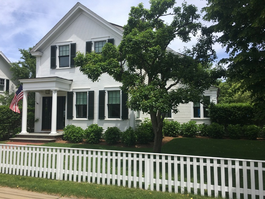
Sale price includes and deed reflects adjacent vacant lot at 4 Perkins Lane. Lot is .23 acres and is assessed (2019) at $429,200.
Last Listed By
Carol Shore
Donnelly + Co Listed on: 07/01/2019
Ownership History
Date
Name
Owned For
Owner Type
Purchase Details
Closed on
Aug 6, 2021
Sold by
175 Upper Main Street Nt
Bought by
Harleston Jeffrey S and Harleston Maria E
Total Days on Market
0
Current Estimated Value
Purchase Details
Listed on
Jul 1, 2019
Closed on
Jul 1, 2019
Sold by
Dualflight Llc
Bought by
175 Upper Main Street Nt
Seller's Agent
Carol Shore
Donnelly + Co
Buyer's Agent
Carol Shore
Donnelly + Co
Sold Price
$5,100,000
Home Financials for this Owner
Home Financials are based on the most recent Mortgage that was taken out on this home.
Avg. Annual Appreciation
-1.65%
Original Mortgage
$3,825,000
Interest Rate
4%
Mortgage Type
Purchase Money Mortgage
Purchase Details
Closed on
Feb 23, 2007
Sold by
Warren Colburn Nt and Campbell Kenneth J
Bought by
Dualflight Llc
Home Financials for this Owner
Home Financials are based on the most recent Mortgage that was taken out on this home.
Original Mortgage
$650,000
Interest Rate
6.23%
Mortgage Type
Purchase Money Mortgage
Purchase Details
Closed on
Feb 24, 2000
Sold by
Sanger Margaret
Bought by
Warren Colburn Nt and Campbell Kenneth J
Home Financials for this Owner
Home Financials are based on the most recent Mortgage that was taken out on this home.
Original Mortgage
$288,000
Interest Rate
8.15%
Mortgage Type
Purchase Money Mortgage
Purchase Details
Closed on
May 22, 1998
Sold by
Perkins John R and Norton Philip J
Bought by
Sanger Margaret
Create a Home Valuation Report for This Property
The Home Valuation Report is an in-depth analysis detailing your home's value as well as a comparison with similar homes in the area
Similar Homes in Edgartown, MA
Home Values in the Area
Average Home Value in this Area
Purchase History
Date | Buyer | Sale Price | Title Company |
---|---|---|---|
Harleston Jeffrey S | -- | None Available | |
175 Upper Main Street Nt | $5,100,000 | -- | |
Dualflight Llc | $1,100,000 | -- | |
Warren Colburn Nt | $320,000 | -- | |
Sanger Margaret | $230,000 | -- |
Source: Public Records
Mortgage History
Date | Status | Borrower | Loan Amount |
---|---|---|---|
Open | Harleston Jeffrey S | $3,677,600 | |
Previous Owner | 175 Upper Main Street Nt | $3,825,000 | |
Previous Owner | Dualflight Llc | $1,500,000 | |
Previous Owner | Sanger Margaret | $9,999,999 | |
Previous Owner | Dualflight Llc | $650,000 | |
Previous Owner | Sanger Margaret | $300,700 | |
Previous Owner | Sanger Margaret | $100,000 | |
Previous Owner | Sanger Margaret | $288,000 |
Source: Public Records
Property History
Date | Event | Price | Change | Sq Ft Price |
---|---|---|---|---|
07/01/2019 07/01/19 | Sold | $5,100,000 | -- | $1,000 / Sq Ft |
Source: LINK (Vineyard)
Tax History Compared to Growth
Tax History
Year | Tax Paid | Tax Assessment Tax Assessment Total Assessment is a certain percentage of the fair market value that is determined by local assessors to be the total taxable value of land and additions on the property. | Land | Improvement |
---|---|---|---|---|
2024 | $10,368 | $4,065,800 | $705,200 | $3,360,600 |
2023 | $9,989 | $3,963,800 | $715,400 | $3,248,400 |
2022 | $7,857 | $2,593,100 | $569,400 | $2,023,700 |
2021 | $8,969 | $2,734,600 | $491,100 | $2,243,500 |
2020 | $9,028 | $2,694,800 | $451,300 | $2,243,500 |
2019 | $9,527 | $2,461,700 | $438,000 | $2,023,700 |
2018 | $9,425 | $2,435,500 | $391,400 | $2,044,100 |
2017 | $8,198 | $2,309,300 | $417,500 | $1,891,800 |
2016 | $8,218 | $2,270,200 | $378,400 | $1,891,800 |
2015 | $5,438 | $1,567,100 | $360,200 | $1,206,900 |
Source: Public Records
Agents Affiliated with this Home
-
C
Seller's Agent in 2019
Carol Shore
Donnelly + Co
Map
Source: LINK (Vineyard)
MLS Number: 35503
APN: EDGA-000020C-000016-000001
Nearby Homes
- 26 Curtis Ln
- 32 Norton Orchard Rd
- 10 Tilton Way
- 56 Robinson Rd
- 10 Peases Point Way N
- 11 Norton St
- 2 Orchard Ln
- 11 Bernard Way
- 68 Winter St
- 68 Winter St Unit 2
- 62 N Summer St
- 25 Simpson's Ln
- 24 Dark Woods Rd
- 25 Dock St
- 68 N Water St
- 52 Fuller St
- 114 N Water St
- 54 Fuller St
- 25 Beetle Swamp Rd
- 117 N Water St
- 175 Upper Main St
- 175 Upper Main St Rear
- 179 Upper Main St
- 4 Perkins Ln
- 185 Upper Main St
- 7 Curtis Ln
- 165 Upper Main St
- 189 Upper Main St
- 134 Cooke St
- 6 Easy St
- 161 Upper Main St
- 5 Curtis Ln
- 130 Cooke St
- 140 Cooke St
- 11 Curtis Ln
- 130, 132, 134 Cooke St
- 124 Cooke St
- 136 Cooke St
- 136 Cooke St Unit 136A&B
- 132 Cooke St