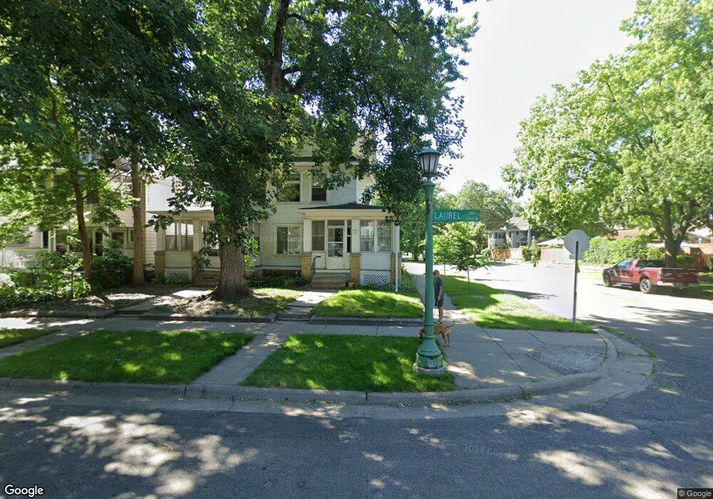
1754 Laurel Ave Saint Paul, MN 55104
Union Park NeighborhoodEstimated Value: $514,000 - $525,000
8
Beds
2
Baths
2,789
Sq Ft
$186/Sq Ft
Est. Value
About This Home
This home is located at 1754 Laurel Ave, Saint Paul, MN 55104 and is currently estimated at $518,213, approximately $185 per square foot. 1754 Laurel Ave is a home located in Ramsey County with nearby schools including Groveland Park Elementary School, Hidden River Middle School, and Central Senior High School.
Ownership History
Date
Name
Owned For
Owner Type
Purchase Details
Closed on
Sep 12, 2018
Sold by
Volk Joanna S
Bought by
Collins Keith
Current Estimated Value
Home Financials for this Owner
Home Financials are based on the most recent Mortgage that was taken out on this home.
Original Mortgage
$306,000
Interest Rate
4.5%
Mortgage Type
Commercial
Purchase Details
Closed on
May 3, 2018
Sold by
Volk Joanna S and Volk Michael S
Bought by
Volk Joanna S
Create a Home Valuation Report for This Property
The Home Valuation Report is an in-depth analysis detailing your home's value as well as a comparison with similar homes in the area
Home Values in the Area
Average Home Value in this Area
Purchase History
| Date | Buyer | Sale Price | Title Company |
|---|---|---|---|
| Collins Keith | $382,500 | Titlesmart Inc | |
| Volk Joanna S | -- | None Available |
Source: Public Records
Mortgage History
| Date | Status | Borrower | Loan Amount |
|---|---|---|---|
| Closed | Collins Keith | $306,000 |
Source: Public Records
Tax History Compared to Growth
Tax History
| Year | Tax Paid | Tax Assessment Tax Assessment Total Assessment is a certain percentage of the fair market value that is determined by local assessors to be the total taxable value of land and additions on the property. | Land | Improvement |
|---|---|---|---|---|
| 2025 | $8,792 | $472,800 | $109,400 | $363,400 |
| 2023 | $8,792 | $452,900 | $109,400 | $343,500 |
| 2022 | $8,510 | $431,700 | $109,400 | $322,300 |
| 2021 | $7,738 | $427,400 | $109,400 | $318,000 |
| 2020 | $7,880 | $402,300 | $109,400 | $292,900 |
| 2019 | $7,430 | $378,800 | $109,400 | $269,400 |
| 2018 | $7,640 | $354,500 | $109,400 | $245,100 |
| 2017 | $6,370 | $368,200 | $109,400 | $258,800 |
| 2016 | $6,362 | $0 | $0 | $0 |
| 2015 | $6,854 | $302,100 | $109,400 | $192,700 |
| 2014 | $6,662 | $0 | $0 | $0 |
Source: Public Records
Map
Nearby Homes
- 1670 Ashland Ave
- 1821 Selby Ave
- 1798 Marshall Ave
- 1671 Marshall Ave
- 1836 Marshall Ave
- 1796 Iglehart Ave
- 266 Fry St
- 1920 Laurel Ave
- 1787 Carroll Ave
- 1540 Ashland Ave Unit 12
- 1917 Summit Ave Unit 2
- 1611 Carroll Ave
- 1510 Laurel Ave
- 184 Saratoga St N
- 1935 Iglehart Ave
- 1826 Goodrich Ave
- 382 Fry St
- 1943 Carroll Ave
- 389 Fairview Ave N
- 406 Beacon Ave
- 1752-54 Laurel Ave
- 1746 Laurel Ave
- 1744 Laurel Ave
- 1758 Laurel Ave
- 1740 Laurel Ave
- 1764 Laurel Ave
- 1736 Laurel Ave
- 1755 Ashland Ave
- 1749 Ashland Ave
- 1745 Ashland Ave
- 1753 Laurel Ave
- 1749 1749 Laurel Ave
- 1766 Laurel Ave
- 1732 Laurel Ave
- 1759 Ashland Ave
- 1745 Laurel Ave
- 1741 Ashland Ave
- 1759 Laurel Ave
- 1741 Laurel Ave
- 1765 Ashland Ave