Estimated Value: $655,000 - $717,452
5
Beds
3
Baths
1,620
Sq Ft
$427/Sq Ft
Est. Value
About This Home
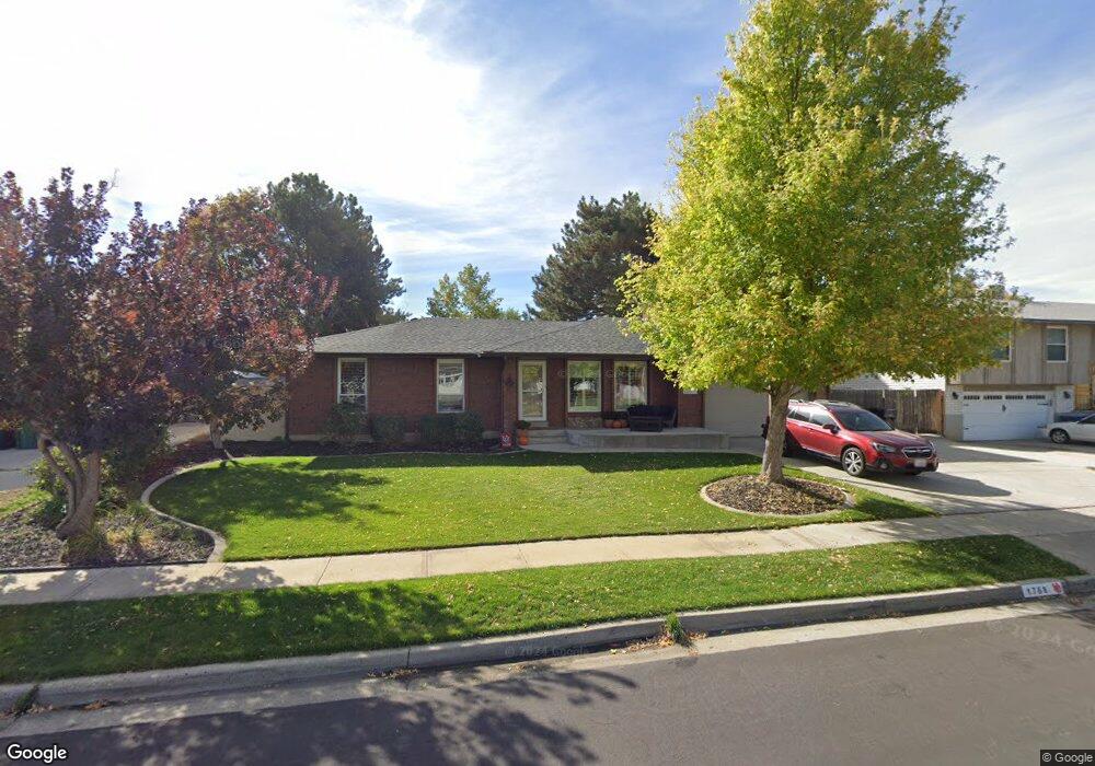
This home is located at 1768 Abbedale Ln, Sandy, UT 84092 and is currently estimated at $691,363, approximately $426 per square foot. 1768 Abbedale Ln is a home located in Salt Lake County with nearby schools including Willow Canyon Elementary School, Eastmont Middle School, and Jordan High.
Ownership History
Date
Name
Owned For
Owner Type
Purchase Details
Closed on
Nov 18, 2022
Sold by
Jackson Gavin M
Bought by
Doxey Grant Ford and Doxey Ally Katelynn
Current Estimated Value
Home Financials for this Owner
Home Financials are based on the most recent Mortgage that was taken out on this home.
Original Mortgage
$639,375
Outstanding Balance
$618,218
Interest Rate
6.94%
Mortgage Type
VA
Estimated Equity
$73,145
Purchase Details
Closed on
Apr 30, 2013
Sold by
Curtis Rebecca Lange
Bought by
Jackson Gavi M and Jackson Christie D
Home Financials for this Owner
Home Financials are based on the most recent Mortgage that was taken out on this home.
Original Mortgage
$287,375
Interest Rate
3.6%
Mortgage Type
New Conventional
Purchase Details
Closed on
Feb 18, 1999
Sold by
Curtis Larry J and Curtis Rebecca L
Bought by
Curtis Rebecca Lange
Create a Home Valuation Report for This Property
The Home Valuation Report is an in-depth analysis detailing your home's value as well as a comparison with similar homes in the area
Home Values in the Area
Average Home Value in this Area
Purchase History
| Date | Buyer | Sale Price | Title Company |
|---|---|---|---|
| Doxey Grant Ford | -- | Paramount Title | |
| Jackson Gavi M | -- | First Ameican Title Co | |
| Curtis Rebecca Lange | -- | First American Title |
Source: Public Records
Mortgage History
| Date | Status | Borrower | Loan Amount |
|---|---|---|---|
| Open | Doxey Grant Ford | $639,375 | |
| Previous Owner | Jackson Gavi M | $287,375 |
Source: Public Records
Tax History Compared to Growth
Tax History
| Year | Tax Paid | Tax Assessment Tax Assessment Total Assessment is a certain percentage of the fair market value that is determined by local assessors to be the total taxable value of land and additions on the property. | Land | Improvement |
|---|---|---|---|---|
| 2025 | $3,404 | $666,100 | $238,900 | $427,200 |
| 2024 | $3,404 | $662,000 | $229,900 | $432,100 |
| 2023 | $3,146 | $602,100 | $221,000 | $381,100 |
| 2022 | $3,225 | $607,100 | $216,700 | $390,400 |
| 2021 | $3,099 | $497,400 | $173,400 | $324,000 |
| 2020 | $2,818 | $427,000 | $173,400 | $253,600 |
| 2019 | $2,795 | $413,500 | $163,500 | $250,000 |
| 2018 | $2,497 | $387,200 | $163,500 | $223,700 |
| 2017 | $2,319 | $344,200 | $163,500 | $180,700 |
| 2016 | $2,250 | $323,300 | $147,400 | $175,900 |
| 2015 | $2,360 | $314,400 | $160,600 | $153,800 |
| 2014 | $2,227 | $291,500 | $151,800 | $139,700 |
Source: Public Records
Map
Nearby Homes
- 9979 S Albury Rd
- 10273 Flanders Rd
- 1584 Petunia Way
- 2067 E Gyrfalcon Ln
- 2009 E Sweetbriar Ln
- 10172 Snow Iris Way
- 2103 Kramer Dr
- 10228 Snow Iris Way
- 2111 Glacier View Dr
- 9968 S Blossom Dr
- 9977 Lannae Dr
- 9460 S Tramway Dr
- 9750 S Indian Ridge Dr
- 1356 Eastpoint Dr
- 9650 S Buttonwood Dr
- 1492 E Sandy Hills Dr
- 9633 S 1210 E
- 1157 E Sego Lily Dr
- 9968 S Flint Dr
- 10557 S Primrose Dr
- 1768 E Abbedale Ln
- 1776 Abbedale Ln
- 1758 E Abbedale Ln
- 1767 Kimsbrough Rd
- 1759 Kimsbrough Rd
- 1775 Kimsbrough Rd
- 1767 E Abbedale Ln
- 1767 Abbedale Ln
- 1786 Abbedale Ln
- 1775 Abbedale Ln
- 1757 Abbedale Ln
- 1783 Kimsbrough Rd
- 1742 Abbedale Ln
- 1785 Abbedale Ln
- 1796 Abbedale Ln
- 1741 Kimsbrough Rd
- 1772 Wildflower Rd
- 10069 S Heytesbury Ln
- 10069 Heytesbury Ln
- 1782 Wildflower Rd