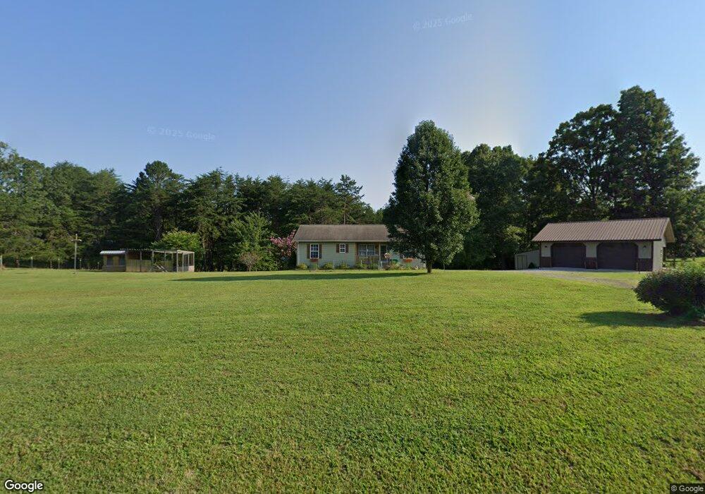
177 Cook Rd Clarkrange, TN 38553
Estimated Value: $108,000 - $252,000
2
Beds
2
Baths
1,172
Sq Ft
$148/Sq Ft
Est. Value
About This Home
This home is located at 177 Cook Rd, Clarkrange, TN 38553 and is currently estimated at $173,448, approximately $147 per square foot. 177 Cook Rd is a home located in Fentress County.
Ownership History
Date
Name
Owned For
Owner Type
Purchase Details
Closed on
Apr 11, 2025
Sold by
Race Marcia and Casada Janice V
Bought by
Huddleston Braden L and Huddleston Makenzee M
Current Estimated Value
Home Financials for this Owner
Home Financials are based on the most recent Mortgage that was taken out on this home.
Original Mortgage
$104,080
Outstanding Balance
$103,536
Interest Rate
6.76%
Mortgage Type
Credit Line Revolving
Estimated Equity
$69,912
Purchase Details
Closed on
Aug 16, 2016
Sold by
Race Marcia
Bought by
Phillips Carl Wayne
Purchase Details
Closed on
Sep 12, 2012
Sold by
Phillips Steve
Bought by
Schultz Otto
Purchase Details
Closed on
Apr 15, 2011
Sold by
Phillips Randell
Bought by
Phillips Steve
Purchase Details
Closed on
Oct 15, 2008
Sold by
Ganes Wendy A
Bought by
Agreement Wendy A Ganes
Purchase Details
Closed on
Mar 28, 2008
Bought by
Phillips Randell and Phillips Kathy
Purchase Details
Closed on
Nov 3, 2005
Sold by
Not Provided
Bought by
Phillips Steve
Purchase Details
Closed on
Mar 5, 1999
Bought by
Johnsen Greg and Johnsen Barbara
Create a Home Valuation Report for This Property
The Home Valuation Report is an in-depth analysis detailing your home's value as well as a comparison with similar homes in the area
Purchase History
| Date | Buyer | Sale Price | Title Company |
|---|---|---|---|
| Huddleston Braden L | $106,000 | Capstone Title & Escrow | |
| Phillips Carl Wayne | $9,510 | -- | |
| Schultz Otto | $105,000 | -- | |
| Phillips Steve | -- | -- | |
| Agreement Wendy A Ganes | -- | -- | |
| Phillips Randell | $15,000 | -- | |
| Phillips Steve | $38,912 | -- | |
| Johnsen Greg | $100,000 | -- |
Source: Public Records
Mortgage History
| Date | Status | Borrower | Loan Amount |
|---|---|---|---|
| Open | Huddleston Braden L | $104,080 |
Source: Public Records
Tax History
| Year | Tax Paid | Tax Assessment Tax Assessment Total Assessment is a certain percentage of the fair market value that is determined by local assessors to be the total taxable value of land and additions on the property. | Land | Improvement |
|---|---|---|---|---|
| 2025 | $560 | $41,450 | $4,050 | $37,400 |
| 2024 | $560 | $41,450 | $4,050 | $37,400 |
| 2023 | $560 | $41,450 | $4,050 | $37,400 |
| 2022 | $468 | $24,500 | $1,625 | $22,875 |
| 2021 | $468 | $24,500 | $1,625 | $22,875 |
| 2020 | $378 | $24,500 | $1,625 | $22,875 |
| 2019 | $378 | $19,800 | $1,625 | $18,175 |
| 2018 | $378 | $19,800 | $1,625 | $18,175 |
| 2017 | $442 | $22,275 | $4,650 | $17,625 |
| 2016 | $442 | $22,275 | $4,650 | $17,625 |
| 2015 | $442 | $22,272 | $0 | $0 |
| 2014 | $442 | $22,272 | $0 | $0 |
Source: Public Records
Map
Nearby Homes
- 1255 Franklin Loop
- 6105 S South York Hwy
- 164 Green Acres
- 6105 S York Hwy
- 6006 S York Hwy
- 5715 S York Highway 127 Hwy
- 145 Rhum Rd
- 5740 S York Hwy
- 5651 S York Hwy
- 106 MacA Ridge Cir
- 1070 N Shady Lane Loop
- 5550 S York Hwy
- 5534 S York Hwy
- 5521 S York Hwy
- 5521 S York Highway 5521 Hwy
- 1011 Fox Ridge Dr
- 2019 Martha Washington Rd
- 1079 South Ln
- 238 Thacker Rd
- 238 Thacker Rd Unit 30
Your Personal Tour Guide
Ask me questions while you tour the home.