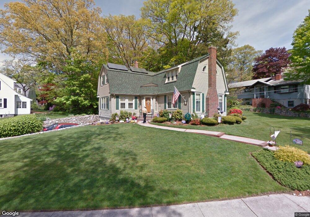
177 Hobart Ave Braintree, MA 02184
North Braintree NeighborhoodEstimated Value: $943,549 - $1,030,000
3
Beds
2
Baths
2,248
Sq Ft
$433/Sq Ft
Est. Value
About This Home
This home is located at 177 Hobart Ave, Braintree, MA 02184 and is currently estimated at $972,637, approximately $432 per square foot. 177 Hobart Ave is a home located in Norfolk County with nearby schools including Braintree High School, Meeting House Montessori School, and Thayer Academy.
Ownership History
Date
Name
Owned For
Owner Type
Purchase Details
Closed on
Aug 14, 2025
Sold by
Genevieve A Mccarthy T A and Genevieve Mccarthy
Bought by
Mccarthy Lawrence J and Mccarthy Joanne L
Current Estimated Value
Home Financials for this Owner
Home Financials are based on the most recent Mortgage that was taken out on this home.
Original Mortgage
$1,342,500
Interest Rate
6.74%
Mortgage Type
Purchase Money Mortgage
Purchase Details
Closed on
Oct 19, 2023
Sold by
Mccarthy Genevieve A
Bought by
Genevieve A Mccarthy T A and Genevieve Mccarthy
Purchase Details
Closed on
Jul 7, 2014
Sold by
Mccarthy Joseph P and Mccarthy Genevieve A
Bought by
Mccarthy Genevieve A
Purchase Details
Closed on
Aug 14, 1975
Bought by
Mccarthy Genevieve A
Create a Home Valuation Report for This Property
The Home Valuation Report is an in-depth analysis detailing your home's value as well as a comparison with similar homes in the area
Home Values in the Area
Average Home Value in this Area
Purchase History
| Date | Buyer | Sale Price | Title Company |
|---|---|---|---|
| Mccarthy Lawrence J | -- | -- | |
| Genevieve A Mccarthy T A | -- | None Available | |
| Genevieve A Mccarthy T A | -- | None Available | |
| Mccarthy Genevieve A | -- | -- | |
| Mccarthy Genevieve A | -- | -- | |
| Mccarthy Genevieve A | -- | -- | |
| Mccarthy Genevieve A | -- | -- |
Source: Public Records
Mortgage History
| Date | Status | Borrower | Loan Amount |
|---|---|---|---|
| Closed | Mccarthy Lawrence J | $1,342,500 | |
| Previous Owner | Mccarthy Genevieve A | $30,000 |
Source: Public Records
Tax History Compared to Growth
Tax History
| Year | Tax Paid | Tax Assessment Tax Assessment Total Assessment is a certain percentage of the fair market value that is determined by local assessors to be the total taxable value of land and additions on the property. | Land | Improvement |
|---|---|---|---|---|
| 2025 | $9,108 | $912,600 | $446,500 | $466,100 |
| 2024 | $8,170 | $861,800 | $398,600 | $463,200 |
| 2023 | $7,791 | $798,300 | $361,400 | $436,900 |
| 2022 | $7,520 | $755,800 | $318,900 | $436,900 |
| 2021 | $7,259 | $729,500 | $318,900 | $410,600 |
| 2020 | $6,633 | $672,700 | $280,600 | $392,100 |
| 2019 | $6,539 | $648,100 | $280,600 | $367,500 |
| 2018 | $6,396 | $606,800 | $255,100 | $351,700 |
| 2017 | $6,291 | $585,800 | $255,100 | $330,700 |
| 2016 | $5,992 | $545,700 | $229,600 | $316,100 |
| 2015 | $5,910 | $533,900 | $229,600 | $304,300 |
| 2014 | $5,378 | $470,900 | $190,300 | $280,600 |
Source: Public Records
Map
Nearby Homes
- 305 Franklin St
- 6 Oak St
- 37 Monatiquot Ave
- 491 Washington St Unit 1
- 78 Windemere Cir
- 6 Franklin St
- 7 Carter Rd
- 47 Addison St
- 29 Joseph Rd
- 414 John Mahar Hwy Unit 402
- 418 John Mahar Hwy Unit 408
- 80 Lake St
- 428 John Mahar Hwy Unit 301
- 605 Middle St Unit 38
- 72 Armstrong Cir
- 61 Grove St
- 298 Lisle St
- 9 Independence Ave Unit 307
- 124 Louise Rd
- 106 Home Park Rd
- 134 Hollingsworth Ave
- 167 Hobart Ave
- 163 Hobart Ave
- 126 Hollingsworth Ave
- 156 Academy St
- 174 Hobart Ave
- 150 Academy St
- 141 Hollingsworth Ave
- 159 Hobart Ave
- 166 Academy St
- 146 Academy St
- 149 Hollingsworth Ave
- 2 Norton St
- 160 Hobart Ave
- 155 Hobart Ave
- 162 Hollingsworth Ave
- 9 Talbot Rd
- 121 Hollingsworth Ave
- 10 Norton St
- 15 Talbot Rd