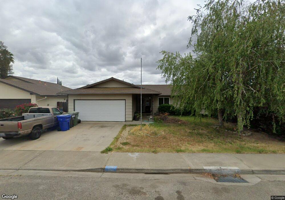
1780 Lial Ct Turlock, CA 95380
Estimated Value: $358,000 - $421,000
3
Beds
2
Baths
1,244
Sq Ft
$318/Sq Ft
Est. Value
About This Home
This home is located at 1780 Lial Ct, Turlock, CA 95380 and is currently estimated at $395,705, approximately $318 per square foot. 1780 Lial Ct is a home located in Stanislaus County with nearby schools including Crowell Elementary School, Marvin A. Dutcher Middle School, and Turlock Junior High School.
Ownership History
Date
Name
Owned For
Owner Type
Purchase Details
Closed on
Aug 3, 2017
Sold by
Betts David E and Betts Donna R
Bought by
Betts David E and Betts Donna R
Current Estimated Value
Purchase Details
Closed on
Dec 10, 2009
Sold by
California Housing Finance Agency
Bought by
Betts David E and Betts Donna R
Home Financials for this Owner
Home Financials are based on the most recent Mortgage that was taken out on this home.
Original Mortgage
$84,000
Outstanding Balance
$54,451
Interest Rate
4.78%
Mortgage Type
Purchase Money Mortgage
Estimated Equity
$341,254
Purchase Details
Closed on
Aug 26, 2009
Sold by
Bobst Dale Duane
Bought by
California Housing Finance Agency
Purchase Details
Closed on
Aug 20, 2007
Sold by
Bobst Jennifer
Bought by
Bobst Dale Duane
Home Financials for this Owner
Home Financials are based on the most recent Mortgage that was taken out on this home.
Original Mortgage
$190,000
Interest Rate
6.73%
Mortgage Type
New Conventional
Purchase Details
Closed on
Apr 28, 1997
Sold by
Heller Randall W and Heller Diana L
Bought by
Murphy Thomas E and Murphy Christina J
Create a Home Valuation Report for This Property
The Home Valuation Report is an in-depth analysis detailing your home's value as well as a comparison with similar homes in the area
Purchase History
| Date | Buyer | Sale Price | Title Company |
|---|---|---|---|
| Betts David E | -- | None Available | |
| Betts David E | $120,000 | Lawyers Title Company | |
| California Housing Finance Agency | $197,166 | North American Title Company | |
| Bobst Dale Duane | -- | Alliance Title Company | |
| Bobst Dale Duane | $270,000 | Alliance Title Company | |
| Murphy Thomas E | -- | -- |
Source: Public Records
Mortgage History
| Date | Status | Borrower | Loan Amount |
|---|---|---|---|
| Open | Betts David E | $84,000 | |
| Previous Owner | Bobst Dale Duane | $190,000 | |
| Previous Owner | Bobst Dale Duane | $80,000 |
Source: Public Records
Tax History
| Year | Tax Paid | Tax Assessment Tax Assessment Total Assessment is a certain percentage of the fair market value that is determined by local assessors to be the total taxable value of land and additions on the property. | Land | Improvement |
|---|---|---|---|---|
| 2025 | $1,664 | $154,882 | $64,533 | $90,349 |
| 2024 | $1,634 | $151,846 | $63,268 | $88,578 |
| 2023 | $1,631 | $148,870 | $62,028 | $86,842 |
| 2022 | $1,611 | $145,952 | $60,812 | $85,140 |
| 2021 | $1,587 | $143,091 | $59,620 | $83,471 |
| 2020 | $1,576 | $141,625 | $59,009 | $82,616 |
| 2019 | $1,550 | $138,849 | $57,852 | $80,997 |
| 2018 | $1,548 | $136,127 | $56,718 | $79,409 |
| 2017 | $1,512 | $133,458 | $55,606 | $77,852 |
| 2016 | $1,412 | $130,842 | $54,516 | $76,326 |
| 2015 | $1,400 | $128,878 | $53,698 | $75,180 |
| 2014 | $1,386 | $126,355 | $52,647 | $73,708 |
Source: Public Records
Map
Nearby Homes
- 1400 N Tully Rd Unit 120
- 1400 N Tully Rd Unit 168
- 1400 N Tully Rd Unit 187
- 1900 Joett Dr
- 1051 Hysell Ct
- 2098 Joett Dr
- 2230 Aspenwood Dr
- 2400 Fulkerth Rd
- 2450 Fulkerth Rd
- 2192 Royal Wood Ln
- 1114 Kay Cir
- 1186 Kay Cir
- 2147 Sorrel Dr
- 2031 Draft Ct
- 1253 Magic Sands Way
- 1465 W Tuolumne Rd
- 2631 Polous Dr
- 500 N Tully Rd
- 2091 State St
- 900 W Canal Dr Unit 100
Your Personal Tour Guide
Ask me questions while you tour the home.