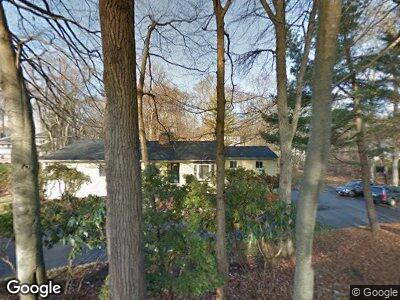
18 Joanne Cir Westport, CT 06880
Staples NeighborhoodEstimated Value: $1,383,462 - $1,652,000
4
Beds
3
Baths
2,440
Sq Ft
$616/Sq Ft
Est. Value
About This Home
This home is located at 18 Joanne Cir, Westport, CT 06880 and is currently estimated at $1,503,866, approximately $616 per square foot. 18 Joanne Cir is a home located in Fairfield County with nearby schools including Long Lots School, Bedford Middle School, and Staples High School.
Ownership History
Date
Name
Owned For
Owner Type
Purchase Details
Closed on
Apr 14, 2022
Sold by
Mail Jack R and Mail Anne T
Bought by
Moopen Anees
Current Estimated Value
Home Financials for this Owner
Home Financials are based on the most recent Mortgage that was taken out on this home.
Original Mortgage
$820,000
Outstanding Balance
$768,132
Interest Rate
3.13%
Mortgage Type
Purchase Money Mortgage
Estimated Equity
$733,805
Purchase Details
Closed on
Apr 16, 1992
Sold by
Schreiber Ronald and Schreiber Cynthia
Bought by
Mail Jack R and Mail Anne T
Home Financials for this Owner
Home Financials are based on the most recent Mortgage that was taken out on this home.
Original Mortgage
$150,000
Interest Rate
8.75%
Mortgage Type
Purchase Money Mortgage
Create a Home Valuation Report for This Property
The Home Valuation Report is an in-depth analysis detailing your home's value as well as a comparison with similar homes in the area
Home Values in the Area
Average Home Value in this Area
Purchase History
| Date | Buyer | Sale Price | Title Company |
|---|---|---|---|
| Moopen Anees | $1,025,000 | None Available | |
| Mail Jack R | $405,000 | -- |
Source: Public Records
Mortgage History
| Date | Status | Borrower | Loan Amount |
|---|---|---|---|
| Open | Moopen Aness | $356,700 | |
| Closed | Moopen Anees | $120,000 | |
| Open | Moopen Anees | $820,000 | |
| Previous Owner | Mail Jack R | $155,000 | |
| Previous Owner | Mail Jack R | $150,000 |
Source: Public Records
Tax History Compared to Growth
Tax History
| Year | Tax Paid | Tax Assessment Tax Assessment Total Assessment is a certain percentage of the fair market value that is determined by local assessors to be the total taxable value of land and additions on the property. | Land | Improvement |
|---|---|---|---|---|
| 2024 | $11,552 | $620,400 | $415,900 | $204,500 |
| 2023 | $11,384 | $620,400 | $415,900 | $204,500 |
| 2022 | $11,211 | $620,400 | $415,900 | $204,500 |
| 2021 | $11,274 | $623,900 | $415,900 | $208,000 |
| 2020 | $11,131 | $666,100 | $439,000 | $227,100 |
| 2019 | $11,230 | $666,100 | $439,000 | $227,100 |
| 2018 | $11,230 | $666,100 | $439,000 | $227,100 |
| 2017 | $11,230 | $666,100 | $439,000 | $227,100 |
| 2016 | $11,230 | $666,100 | $439,000 | $227,100 |
| 2015 | $11,100 | $613,600 | $352,000 | $261,600 |
| 2014 | $11,008 | $613,600 | $352,000 | $261,600 |
Source: Public Records
Map
Nearby Homes
- 19 Joann Cir
- 33 Pumpkin Hill Rd
- 35 Pumpkin Hill Rd
- 14 Reimer Rd
- 26 Hitchcock Rd
- 19 Twin Circle Dr
- 113 Roseville Rd
- 7 Brookside Dr
- 8 Twin Circle Dr
- 10 Dover Rd
- 4 Plumtree Ln
- 5 Brookside Dr
- 5 Elwil Dr
- 96 Compo Rd N
- 41 Burr Farms Rd
- 15 Lone Pine Ln
- 41 Whitney St
- 57 Evergreen Ave
- 158 Compo Rd N
- 157 North Ave