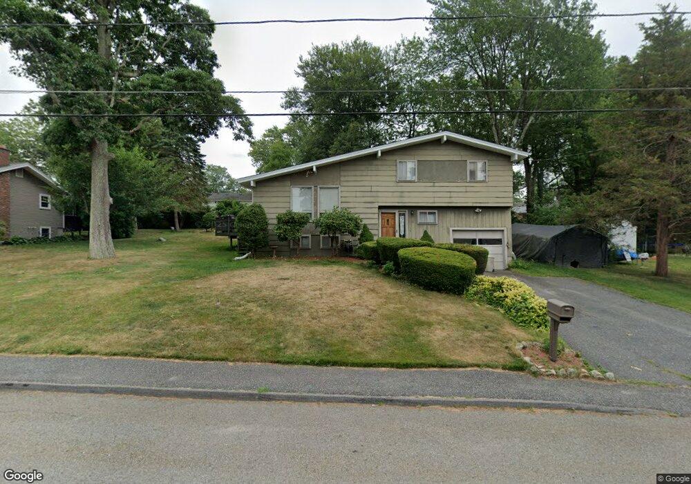
18 Simmons Dr Milford, MA 01757
Estimated Value: $464,084 - $570,000
3
Beds
2
Baths
1,560
Sq Ft
$338/Sq Ft
Est. Value
About This Home
This home is located at 18 Simmons Dr, Milford, MA 01757 and is currently estimated at $526,771, approximately $337 per square foot. 18 Simmons Dr is a home located in Worcester County with nearby schools including Milford High School.
Ownership History
Date
Name
Owned For
Owner Type
Purchase Details
Closed on
May 25, 1995
Sold by
Hildreth Norman and Hildreth Susan
Bought by
Roy Brian W and Roy Joanne
Current Estimated Value
Home Financials for this Owner
Home Financials are based on the most recent Mortgage that was taken out on this home.
Original Mortgage
$130,500
Interest Rate
8.33%
Mortgage Type
Purchase Money Mortgage
Purchase Details
Closed on
Jun 30, 1989
Sold by
Fantini Leo L
Bought by
Hildreth Norman
Create a Home Valuation Report for This Property
The Home Valuation Report is an in-depth analysis detailing your home's value as well as a comparison with similar homes in the area
Home Values in the Area
Average Home Value in this Area
Purchase History
| Date | Buyer | Sale Price | Title Company |
|---|---|---|---|
| Roy Brian W | $145,000 | -- | |
| Hildreth Norman | $150,000 | -- |
Source: Public Records
Mortgage History
| Date | Status | Borrower | Loan Amount |
|---|---|---|---|
| Open | Hildreth Norman | $100,000 | |
| Closed | Hildreth Norman | $124,000 | |
| Closed | Hildreth Norman | $130,000 | |
| Closed | Hildreth Norman | $130,500 |
Source: Public Records
Tax History Compared to Growth
Tax History
| Year | Tax Paid | Tax Assessment Tax Assessment Total Assessment is a certain percentage of the fair market value that is determined by local assessors to be the total taxable value of land and additions on the property. | Land | Improvement |
|---|---|---|---|---|
| 2025 | $4,419 | $345,200 | $182,300 | $162,900 |
| 2024 | $4,352 | $327,500 | $175,000 | $152,500 |
| 2023 | $4,101 | $283,800 | $145,800 | $138,000 |
| 2022 | $4,028 | $261,700 | $134,900 | $126,800 |
| 2021 | $4,072 | $254,800 | $134,900 | $119,900 |
| 2020 | $3,974 | $249,000 | $134,900 | $114,100 |
| 2019 | $4,357 | $263,400 | $134,900 | $128,500 |
| 2018 | $4,112 | $248,300 | $129,400 | $118,900 |
| 2017 | $3,991 | $237,700 | $129,400 | $108,300 |
| 2016 | $4,084 | $237,700 | $129,400 | $108,300 |
| 2015 | $3,849 | $219,300 | $123,900 | $95,400 |
Source: Public Records
Map
Nearby Homes
- 8 Vassar Dr
- 5 Stanford Cir
- 20 Senate Rd
- 44 Woodridge Rd
- 94 Highland St
- 250 Congress St
- 14 C Country Club Ln
- 62 Field Pond Rd
- 8 Colonial Rd
- 33 Country Club Ln Unit D
- 14 Country Club Ln Unit C
- 54 Village Cir Unit 54
- 8 Country Club Ln Unit B
- 13 Hemlock Ln
- 9 Robin Rd
- 9 Hancock St
- 1 Godfrey Ln Unit 1
- 44 Silver Hill Rd
- 56 Village Cir
- 0 West St