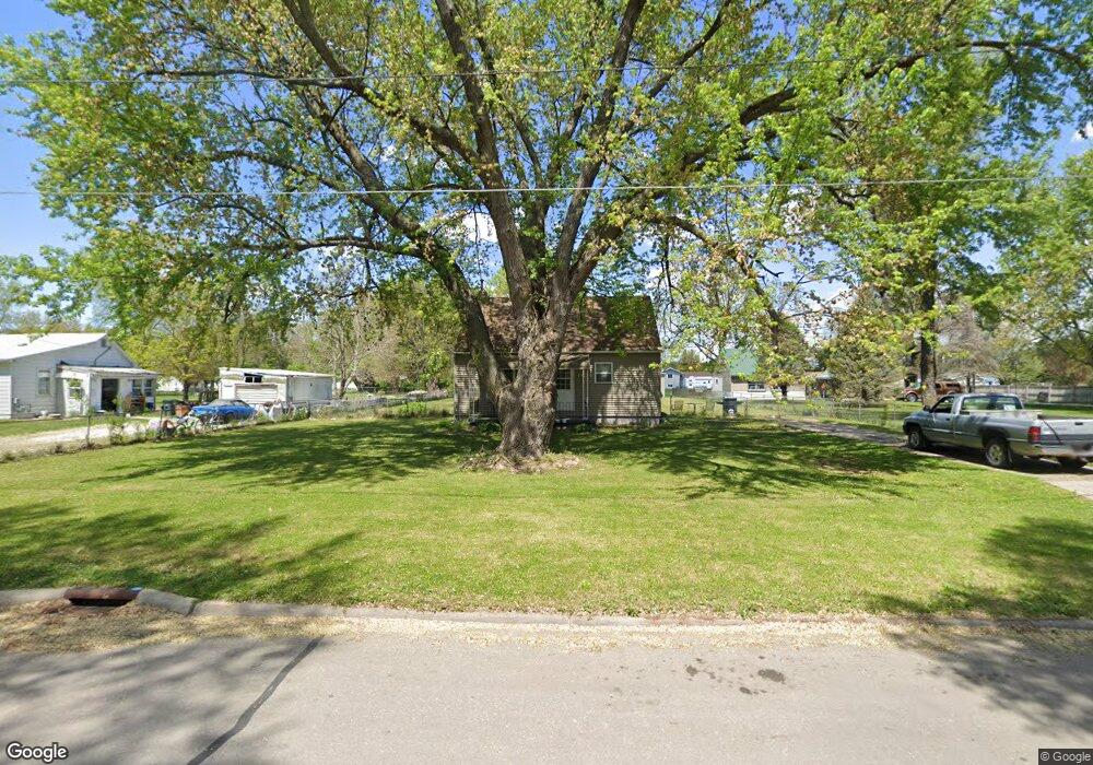
1804 Robin Rd Waterloo, IA 50701
Estimated Value: $139,000 - $166,000
3
Beds
1
Bath
1,340
Sq Ft
$114/Sq Ft
Est. Value
About This Home
This home is located at 1804 Robin Rd, Waterloo, IA 50701 and is currently estimated at $152,626, approximately $113 per square foot. 1804 Robin Rd is a home located in Black Hawk County with nearby schools including Becker Elementary School, Central Middle School, and West High School.
Ownership History
Date
Name
Owned For
Owner Type
Purchase Details
Closed on
Jul 8, 2014
Sold by
Hanson Leif E and Hanson Ashley M
Bought by
Fette Michael
Current Estimated Value
Home Financials for this Owner
Home Financials are based on the most recent Mortgage that was taken out on this home.
Original Mortgage
$77,175
Outstanding Balance
$58,502
Interest Rate
4.11%
Mortgage Type
Future Advance Clause Open End Mortgage
Estimated Equity
$94,124
Purchase Details
Closed on
May 10, 2007
Sold by
Fike Mary K
Bought by
Hanson Leif E and Tippett Ashley M
Home Financials for this Owner
Home Financials are based on the most recent Mortgage that was taken out on this home.
Original Mortgage
$91,918
Interest Rate
6.2%
Mortgage Type
FHA
Purchase Details
Closed on
Jun 28, 2006
Sold by
Dutler Douglas A
Bought by
Fike Mary K
Create a Home Valuation Report for This Property
The Home Valuation Report is an in-depth analysis detailing your home's value as well as a comparison with similar homes in the area
Purchase History
| Date | Buyer | Sale Price | Title Company |
|---|---|---|---|
| Fette Michael | $85,750 | None Available | |
| Hanson Leif E | $93,000 | Title Services Corporation | |
| Fike Mary K | -- | None Available |
Source: Public Records
Mortgage History
| Date | Status | Borrower | Loan Amount |
|---|---|---|---|
| Open | Fette Michael | $77,175 | |
| Previous Owner | Hanson Leif E | $91,918 |
Source: Public Records
Tax History
| Year | Tax Paid | Tax Assessment Tax Assessment Total Assessment is a certain percentage of the fair market value that is determined by local assessors to be the total taxable value of land and additions on the property. | Land | Improvement |
|---|---|---|---|---|
| 2025 | $2,622 | $145,350 | $37,700 | $107,650 |
| 2024 | $2,622 | $131,060 | $37,700 | $93,360 |
| 2023 | $2,282 | $131,060 | $37,700 | $93,360 |
| 2022 | $2,220 | $112,780 | $37,700 | $75,080 |
| 2021 | $2,228 | $112,780 | $37,700 | $75,080 |
| 2020 | $2,188 | $106,980 | $31,900 | $75,080 |
| 2019 | $2,188 | $106,980 | $31,900 | $75,080 |
| 2018 | $2,190 | $106,980 | $31,900 | $75,080 |
| 2017 | $2,190 | $106,980 | $31,900 | $75,080 |
| 2016 | $2,144 | $103,230 | $31,900 | $71,330 |
| 2015 | $2,144 | $103,230 | $31,900 | $71,330 |
| 2014 | $2,386 | $103,230 | $31,900 | $71,330 |
Source: Public Records
Map
Nearby Homes
- 1839 Rush St
- 1290 Scott Ave
- 1221 Julian Ave
- 1221 Downing Ave
- 1114 Eleanor Dr
- 1811 Sager Ave
- 3816 Monterey Dr
- 2320 University Ave
- 819 Hanna Blvd
- 627 Downing Ave
- 1044 Dundee Ave
- 4015 Mark Dr
- 608-610 Martin Rd
- Lot 19 Mark Dr
- Lot 22 Mark Dr
- Lot 20 Mark Dr
- Lot 15 Mark Dr
- Lot 21 Mark Dr
- Lot 16 Mark Dr
- Lot 23 Mark Dr
- 1814 Robin Rd
- 1752 Robin Rd
- 1744 Robin Rd
- 1826 Robin Rd
- 1803 Huntington Rd
- 1811 Huntington Rd
- 1753 Robin Rd
- 1815 Robin Rd
- 1755 Huntington Rd
- 1805 Robin Rd
- 1908 Robin Rd
- 1734 Robin Rd
- 1745 Huntington Rd
- 1829 Huntington Rd
- 1819 Huntington Rd
- 1743 Robin Rd
- 1827 Robin Rd
- 1724 Robin Rd
- 1835 Huntington Rd
- 1909 Robin Rd
Your Personal Tour Guide
Ask me questions while you tour the home.