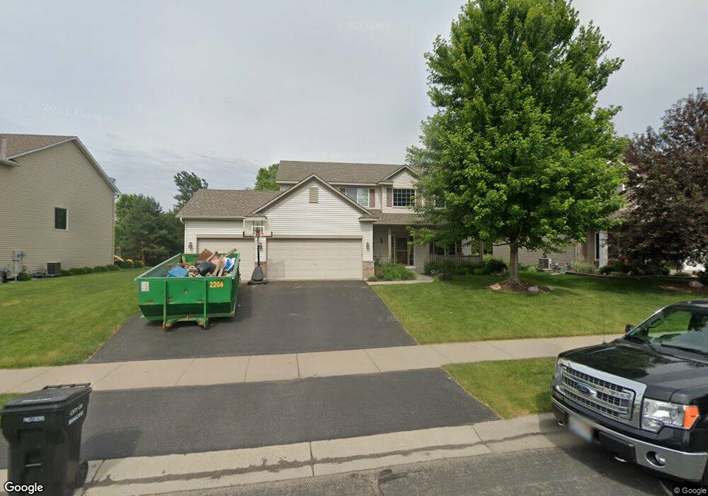
1805 Wyndam Dr Shakopee, MN 55379
Estimated Value: $529,907 - $588,000
5
Beds
4
Baths
2,220
Sq Ft
$251/Sq Ft
Est. Value
About This Home
This home is located at 1805 Wyndam Dr, Shakopee, MN 55379 and is currently estimated at $556,977, approximately $250 per square foot. 1805 Wyndam Dr is a home located in Scott County with nearby schools including Eagle Creek Elementary School, East Middle School, and Shakopee Senior High School.
Ownership History
Date
Name
Owned For
Owner Type
Purchase Details
Closed on
Jun 8, 2007
Sold by
Valentin David J and Valentin Kar
Bought by
Not Provided
Current Estimated Value
Purchase Details
Closed on
Sep 28, 2005
Sold by
Mattamy Minneapolis Partnership
Bought by
Valentin David J and Valentin Kari B
Purchase Details
Closed on
Mar 7, 2003
Sold by
Homes By Chase Inc
Bought by
Mattamy Minneapolis Partnership
Create a Home Valuation Report for This Property
The Home Valuation Report is an in-depth analysis detailing your home's value as well as a comparison with similar homes in the area
Home Values in the Area
Average Home Value in this Area
Purchase History
| Date | Buyer | Sale Price | Title Company |
|---|---|---|---|
| Not Provided | $385,500 | -- | |
| Valentin David J | $369,979 | -- | |
| Mattamy Minneapolis Partnership | $3,781,512 | -- |
Source: Public Records
Tax History Compared to Growth
Tax History
| Year | Tax Paid | Tax Assessment Tax Assessment Total Assessment is a certain percentage of the fair market value that is determined by local assessors to be the total taxable value of land and additions on the property. | Land | Improvement |
|---|---|---|---|---|
| 2025 | $4,962 | $472,600 | $141,400 | $331,200 |
| 2024 | $4,884 | $473,700 | $141,400 | $332,300 |
| 2023 | $5,132 | $456,000 | $136,000 | $320,000 |
| 2022 | $4,820 | $470,400 | $154,500 | $315,900 |
| 2021 | $4,124 | $380,500 | $122,000 | $258,500 |
| 2020 | $4,504 | $357,000 | $117,000 | $240,000 |
| 2019 | $4,586 | $343,100 | $104,000 | $239,100 |
| 2018 | $4,574 | $0 | $0 | $0 |
| 2016 | $4,452 | $0 | $0 | $0 |
| 2014 | -- | $0 | $0 | $0 |
Source: Public Records
Map
Nearby Homes
- 1895 Omega Dr
- 1624 Philipp Way
- 1545 Philipp Way
- 1515 Philipp Way
- 1491 Philipp Way
- 1580 Philipp Way
- 1520 Philipp Way
- 2886 Trinity Dr
- 2804 Trinity Dr
- 2868 Trinity Dr
- 2910 Trinity Dr
- 2942 Trinity Dr
- Lewis Plan at Summerland Place - Landmark Collection
- 2795 Downing Ave
- Vanderbilt Plan at Summerland Place - Landmark Collection
- Sinclair Plan at Summerland Place - Landmark Collection
- 2931 Trinity Dr
- 2777 Pampas Ct
- Nokomis Plan at Summerland Place - The Tradition Collection
- Gregorian Plan at Summerland Place - The Tradition Collection
- 1809 Wyndam Dr
- 1801 Wyndam Dr
- 1813 Wyndam Dr
- 1812 Wyndam Dr
- 2908 18th Ave E
- 2914 18th Ave E
- 1808 Wyndam Dr
- 1817 Wyndam Dr
- 2902 18th Ave E
- 2908 2908 18th-Avenue-e
- 2920 18th Ave E
- 1804 Wyndam Dr
- 1816 Wyndam Dr
- 2924 18th Ave E
- 2926 18th Ave E
- 1821 Wyndam Dr
- 2928 18th Ave E
- 1814 Omega Dr
- 1820 Wyndam Dr
- 2930 18th Ave E