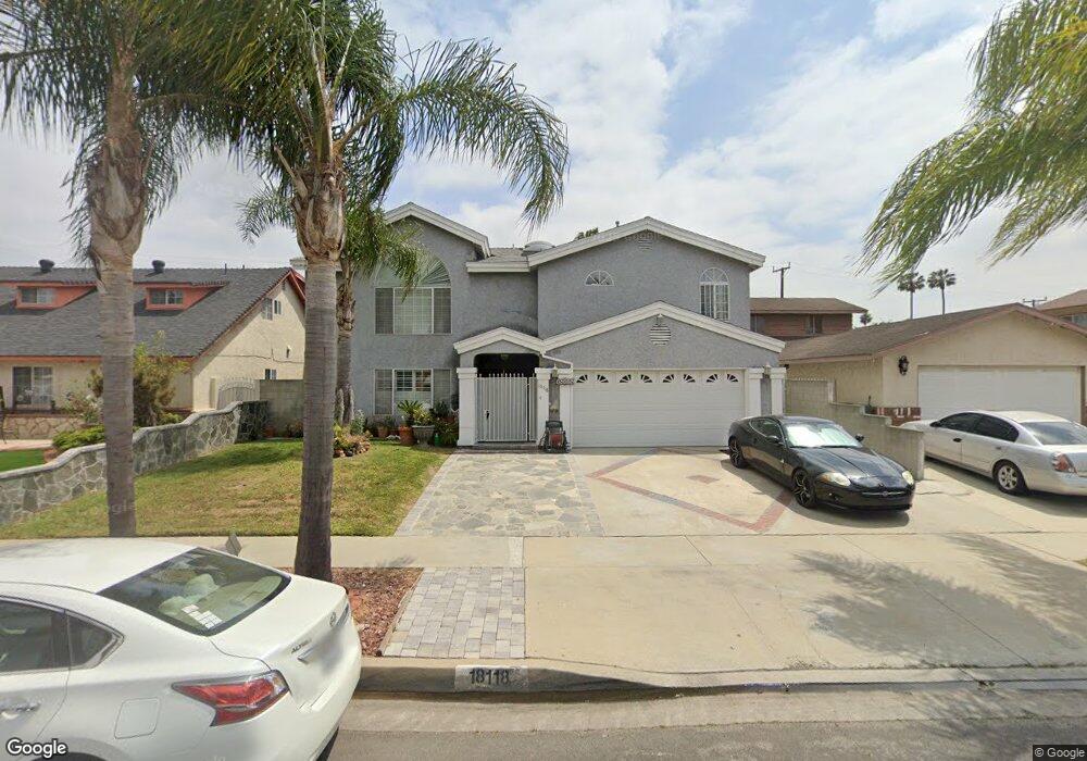
18118 Cairo Ave Carson, CA 90746
Estimated Value: $913,000 - $1,184,000
5
Beds
4
Baths
3,556
Sq Ft
$293/Sq Ft
Est. Value
About This Home
This home is located at 18118 Cairo Ave, Carson, CA 90746 and is currently estimated at $1,043,074, approximately $293 per square foot. 18118 Cairo Ave is a home located in Los Angeles County with nearby schools including Towne Avenue Elementary School, Glenn Hammond Curtiss Middle School, and Rancho Dominguez Preparatory School.
Ownership History
Date
Name
Owned For
Owner Type
Purchase Details
Closed on
Feb 25, 1997
Sold by
Chemical Bank
Bought by
Pelayo Leonel and Pelayo Roxana
Current Estimated Value
Home Financials for this Owner
Home Financials are based on the most recent Mortgage that was taken out on this home.
Original Mortgage
$164,571
Outstanding Balance
$19,957
Interest Rate
7.74%
Mortgage Type
FHA
Estimated Equity
$1,023,117
Purchase Details
Closed on
Nov 12, 1996
Sold by
Boatwright Eddie and Chemical Bank
Bought by
Chemical Bank and Cts Adjustable Rate Mtg Trust 1995-1
Create a Home Valuation Report for This Property
The Home Valuation Report is an in-depth analysis detailing your home's value as well as a comparison with similar homes in the area
Home Values in the Area
Average Home Value in this Area
Purchase History
| Date | Buyer | Sale Price | Title Company |
|---|---|---|---|
| Pelayo Leonel | $169,000 | First American Title Ins Co | |
| Chemical Bank | $259,211 | American Title Ins Co |
Source: Public Records
Mortgage History
| Date | Status | Borrower | Loan Amount |
|---|---|---|---|
| Open | Pelayo Leonel | $164,571 |
Source: Public Records
Tax History
| Year | Tax Paid | Tax Assessment Tax Assessment Total Assessment is a certain percentage of the fair market value that is determined by local assessors to be the total taxable value of land and additions on the property. | Land | Improvement |
|---|---|---|---|---|
| 2025 | $5,728 | $407,146 | $146,570 | $260,576 |
| 2024 | $5,728 | $399,164 | $143,697 | $255,467 |
| 2023 | $5,616 | $391,338 | $140,880 | $250,458 |
| 2022 | $5,345 | $383,666 | $138,118 | $245,548 |
| 2021 | $5,263 | $376,144 | $135,410 | $240,734 |
| 2019 | $5,072 | $364,990 | $131,395 | $233,595 |
| 2018 | $4,982 | $357,834 | $128,819 | $229,015 |
| 2016 | $4,742 | $343,941 | $123,818 | $220,123 |
| 2015 | $4,649 | $338,776 | $121,959 | $216,817 |
| 2014 | $4,639 | $332,140 | $119,570 | $212,570 |
Source: Public Records
Map
Nearby Homes
- 17701 Avalon Blvd
- 17701 Avalon Blvd Unit 291
- 17701 Avalon Blvd Unit 400
- 18325 Mettler Ave
- 17701 S Avalon Blvd Unit 81
- 17700 Avalon Blvd Unit 267
- 17700 Avalon Blvd Unit 387
- 17700 Avalon Blvd Unit 40
- 17700 S Avalon Blvd Unit 156
- 17202 Ambler Ave
- 910 E Meadbrook St
- 19327 Galway Ave
- 16952 Roa Dr
- 16928 S Broadway
- 514 E Moorehaven Dr
- 966 Apricot Way
- 664 E Elsmere Dr
- 19202 Campaign Dr
- 523 W 170th St
- 17536 Yellowwood Way
- 18124 Cairo Ave
- 18114 Cairo Ave
- 18115 Wall St
- 18202 Cairo Ave
- 18108 Cairo Ave
- 18109 Wall St
- 18121 Wall St
- 18103 Wall St
- 18208 Cairo Ave
- 18119 Cairo Ave
- 18102 Cairo Ave
- 18125 Cairo Ave
- 18115 Cairo Ave
- 18203 Cairo Ave
- 18203 Wall St
- 18025 Wall St
- 18109 Cairo Ave
- 18212 Cairo Ave
- 18020 Cairo Ave
- 18209 Cairo Ave
Your Personal Tour Guide
Ask me questions while you tour the home.