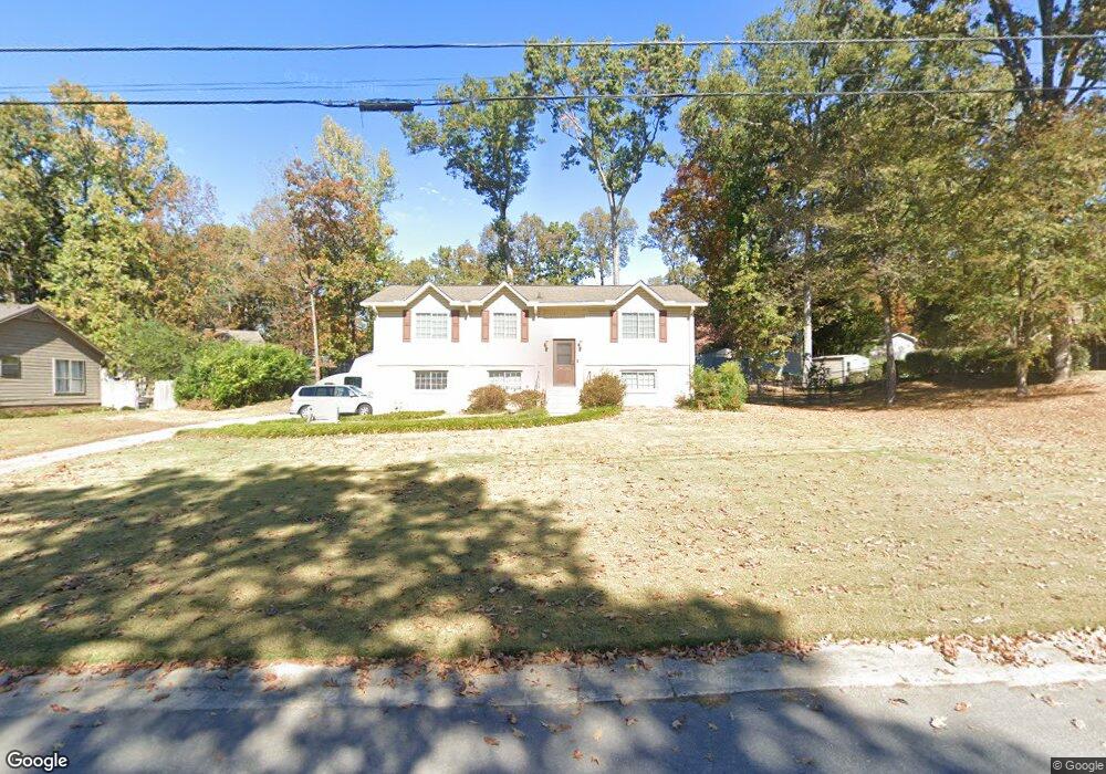
1812 Apache Way Alabaster, AL 35007
Estimated Value: $266,000 - $274,609
Studio
1
Bath
1,631
Sq Ft
$165/Sq Ft
Est. Value
About This Home
This home is located at 1812 Apache Way, Alabaster, AL 35007 and is currently estimated at $269,152, approximately $165 per square foot. 1812 Apache Way is a home located in Shelby County with nearby schools including Thompson Intermediate School, Thompson Middle School, and Thompson High School.
Ownership History
Date
Name
Owned For
Owner Type
Purchase Details
Closed on
Dec 14, 2015
Sold by
Domovic Kristiane Marie Tatum
Bought by
Domovic Kristiane T and Domovic Thomas D
Current Estimated Value
Purchase Details
Closed on
Apr 14, 2000
Sold by
Davey Stanley G and Davey Charlotte S
Bought by
Tatum John H and Tatum Kristiane D
Home Financials for this Owner
Home Financials are based on the most recent Mortgage that was taken out on this home.
Original Mortgage
$101,150
Outstanding Balance
$34,753
Interest Rate
8.27%
Estimated Equity
$234,399
Create a Home Valuation Report for This Property
The Home Valuation Report is an in-depth analysis detailing your home's value as well as a comparison with similar homes in the area
Home Values in the Area
Average Home Value in this Area
Purchase History
| Date | Buyer | Sale Price | Title Company |
|---|---|---|---|
| Domovic Kristiane T | $60,000 | None Available | |
| Tatum John H | $106,500 | -- |
Source: Public Records
Mortgage History
| Date | Status | Borrower | Loan Amount |
|---|---|---|---|
| Open | Tatum John H | $101,150 |
Source: Public Records
Tax History
| Year | Tax Paid | Tax Assessment Tax Assessment Total Assessment is a certain percentage of the fair market value that is determined by local assessors to be the total taxable value of land and additions on the property. | Land | Improvement |
|---|---|---|---|---|
| 2024 | $1,169 | $21,640 | $0 | $0 |
| 2023 | -- | $20,180 | $0 | $0 |
| 2022 | $0 | $18,800 | $0 | $0 |
| 2021 | $617 | $17,320 | $0 | $0 |
| 2020 | $617 | $14,820 | $0 | $0 |
| 2019 | $617 | $14,340 | $0 | $0 |
| 2017 | $617 | $13,300 | $0 | $0 |
| 2015 | -- | $12,760 | $0 | $0 |
| 2014 | $578 | $12,480 | $0 | $0 |
Source: Public Records
Map
Nearby Homes
- 1807 Apache Way
- 1805 Mohawk Dr
- 2001 1st Ave W
- 1349 Old Boston Rd
- 542 Navajo Trail
- 1317 Old Boston Rd
- 445 Ramsgate Dr
- 1317 W Navajo Dr
- 120 Mayfair Park
- 834 Burning Tree Trail
- 306 Mayfair Cir
- 1307 3rd Ave SW
- 109 Longfeather Cir
- 335 10th St NW
- 208 Queens Gate
- 501 Ramsgate Dr
- 537 Ramsgate Dr
- 236 Queens Gate
- 312 Cornwall Dr
- 955 3rd Ave NW
- 1813 Smoketree Ln
- 1816 Apache Way
- 1808 Apache Way
- 1813 Smoke Tree Ln
- 1809 Smoketree Ln
- 1813 Apache Way
- 1809 Smoke Tree Ln
- 1817 Apache Way
- 1817 Smoketree Ln
- 1804 Apache Way
- 1818 Apache Way
- 1805 Smoketree Ln
- 1821 Apache Way
- 1808 Smoketree Ln
- 1816 Mohawk Dr
- 1812 Mohawk Dr
- 1812 Smoketree Ln
- 1805 Apache Way
- 1808 Mohawk Dr
- 1804 Smoketree Ln
Your Personal Tour Guide
Ask me questions while you tour the home.