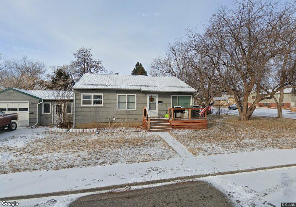
1820 6th St W Billings, MT 59102
Hilands NeighborhoodEstimated Value: $327,000 - $351,864
About This Home
This home is located at 1820 6th St W, Billings, MT 59102 and is currently estimated at $335,716, approximately $155 per square foot. 1820 6th St W is a home located in Yellowstone County with nearby schools including Highland Elementary School, Lewis & Clark Junior High School, and Billings Senior High School.
Ownership History
We collect this data history from publicly available records. To have your information removed, we recommend requesting removal directly through your county’s website.
Purchase Details
Purchase Details
Purchase Details
Home Financials for this Owner
Home Financials are based on the most recent Mortgage that was taken out on this home.Home Values in the Area
Average Home Value in this Area
Purchase History
We collect this data history from publicly available records. To have your information removed, we recommend requesting removal directly through your county’s website.
| Date | Buyer | Sale Price | Title Company |
|---|---|---|---|
| -- | -- | ||
| -- | American Title & Escrow | ||
| -- | None Available |
Mortgage History
We collect this data history from publicly available records. To have your information removed, we recommend requesting removal directly through your county’s website.
| Date | Status | Borrower | Loan Amount |
|---|---|---|---|
| Previous Owner | $126,000 |
Tax History
We collect this data history from publicly available records. To have your information removed, we recommend requesting removal directly through your county’s website.
| Year | Tax Paid | Tax Assessment Tax Assessment Total Assessment is a certain percentage of the fair market value that is determined by local assessors to be the total taxable value of land and additions on the property. | Land | Improvement |
|---|---|---|---|---|
| 2025 | $2,761 | $305,900 | $47,135 | $258,765 |
| 2024 | $2,761 | $277,200 | $43,756 | $233,444 |
| 2023 | $2,754 | $277,200 | $43,756 | $233,444 |
| 2022 | $1,858 | $196,800 | $0 | $0 |
| 2021 | $2,156 | $196,800 | $0 | $0 |
| 2020 | $2,303 | $198,200 | $0 | $0 |
| 2019 | $2,193 | $198,200 | $0 | $0 |
| 2018 | $2,046 | $180,200 | $0 | $0 |
| 2017 | $1,987 | $180,200 | $0 | $0 |
| 2016 | $1,937 | $177,100 | $0 | $0 |
| 2015 | $1,887 | $177,100 | $0 | $0 |
| 2014 | $1,603 | $78,492 | $0 | $0 |
Map
- 611 Avenue E
- 623 Avenue F
- 524 Avenue E
- 547 Parkhill Dr
- 545 Beverly Hill Blvd
- 641 Avenue C
- 415 Avenue D Unit 204
- 725 Beverly Hill Blvd
- 731 Avenue C
- 1617 8th St W Unit C
- 420 Lordwith Dr Unit Building A
- 420 Lordwith Dr Unit Building B
- 420 Lordwith Dr Unit Building C
- 824 Avenue D
- 534 Grand Ave
- 2309 Virginia Ln
- 2332 Pine St
- 2403 Elm St
- 204 Avenue F
- 144 Avenue E
Ask me questions while you tour the home.