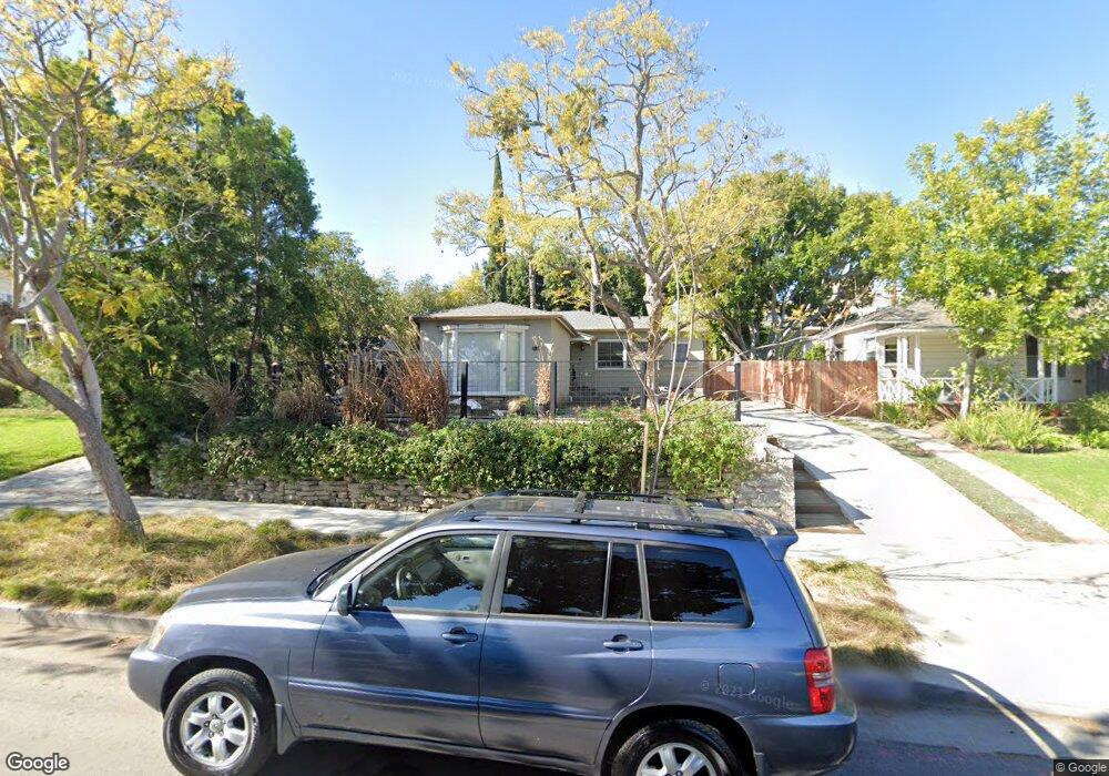
1821 Preuss Rd Los Angeles, CA 90035
Mid-City NeighborhoodEstimated Value: $1,521,653 - $2,374,000
2
Beds
1
Bath
1,409
Sq Ft
$1,294/Sq Ft
Est. Value
About This Home
This home is located at 1821 Preuss Rd, Los Angeles, CA 90035 and is currently estimated at $1,822,913, approximately $1,293 per square foot. 1821 Preuss Rd is a home located in Los Angeles County with nearby schools including Mark Twain Middle School, Alexander Hamilton Senior High School, and Cheder Menachem School.
Ownership History
Date
Name
Owned For
Owner Type
Purchase Details
Closed on
Nov 29, 2005
Sold by
Newton Reginald B and Newton Janis K
Bought by
Newton Reginald B
Current Estimated Value
Home Financials for this Owner
Home Financials are based on the most recent Mortgage that was taken out on this home.
Original Mortgage
$335,000
Interest Rate
6.5%
Mortgage Type
Purchase Money Mortgage
Purchase Details
Closed on
Jun 5, 2002
Sold by
Newton Reginald E and Newton Janis K
Bought by
Newton Reginald B
Create a Home Valuation Report for This Property
The Home Valuation Report is an in-depth analysis detailing your home's value as well as a comparison with similar homes in the area
Home Values in the Area
Average Home Value in this Area
Purchase History
| Date | Buyer | Sale Price | Title Company |
|---|---|---|---|
| Newton Reginald B | -- | Chicago Title Company | |
| Newton Reginald B | -- | -- |
Source: Public Records
Mortgage History
| Date | Status | Borrower | Loan Amount |
|---|---|---|---|
| Closed | Newton Reginald B | $335,000 |
Source: Public Records
Tax History Compared to Growth
Tax History
| Year | Tax Paid | Tax Assessment Tax Assessment Total Assessment is a certain percentage of the fair market value that is determined by local assessors to be the total taxable value of land and additions on the property. | Land | Improvement |
|---|---|---|---|---|
| 2025 | $3,998 | $316,248 | $189,753 | $126,495 |
| 2024 | $3,998 | $310,048 | $186,033 | $124,015 |
| 2023 | $3,928 | $303,970 | $182,386 | $121,584 |
| 2022 | $3,754 | $298,010 | $178,810 | $119,200 |
| 2021 | $3,701 | $292,167 | $175,304 | $116,863 |
| 2019 | $3,594 | $283,503 | $170,105 | $113,398 |
| 2018 | $3,543 | $277,945 | $166,770 | $111,175 |
| 2016 | $3,382 | $267,154 | $160,295 | $106,859 |
| 2015 | $3,335 | $263,142 | $157,888 | $105,254 |
| 2014 | $3,356 | $257,989 | $154,796 | $103,193 |
Source: Public Records
Map
Nearby Homes
- 1904 Preuss Rd
- 8767 Airdrome St
- 9142 Monte Mar Dr
- 1810 S Sherbourne Dr
- 1630 S Crest Dr
- 1726 S Sherbourne Dr
- 2011 S Shenandoah St
- 1942 S Sherbourne Dr
- 8860 Horner St
- 1543 S Crest Dr
- 1952 S Holt Ave
- 9313 Bolton Rd
- 1527 S Bedford St
- 9125 David Ave
- 8953 W 24th St
- 2006 S Corning St
- 8809 David Ave
- 2055 S Corning St
- 2502 S Robertson Blvd
- 1471 S Crest Dr
- 1819 Preuss Rd
- 1829 Preuss Rd
- 1835 Preuss Rd
- 1815 Preuss Rd
- 1826 S Robertson Blvd
- 1809 Preuss Rd
- 1839 Preuss Rd
- 1828 Preuss Rd
- 1822 Preuss Rd
- 1818 Preuss Rd
- 1826 Preuss Rd
- 1826 Preuss Rd
- 1814 Preuss Rd
- 1843 Preuss Rd
- 1801 Preuss Rd
- 1832 Preuss Rd
- 1808 Preuss Rd
- 1834 Preuss Rd
- 1846 S Robertson Blvd
- 1800 Preuss Rd