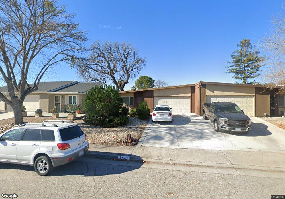
1821 Westfield Rd Paso Robles, CA 93446
Estimated Value: $346,000 - $408,000
2
Beds
1
Bath
883
Sq Ft
$418/Sq Ft
Est. Value
About This Home
This home is located at 1821 Westfield Rd, Paso Robles, CA 93446 and is currently estimated at $368,705, approximately $417 per square foot. 1821 Westfield Rd is a home located in San Luis Obispo County with nearby schools including Virginia Peterson Elementary School, Daniel Lewis Middle School, and Paso Robles High School.
Ownership History
Date
Name
Owned For
Owner Type
Purchase Details
Closed on
Oct 15, 2019
Sold by
Armstrong Gene
Bought by
Armstrong Gene and Armstrong Gene Revocable Livin
Current Estimated Value
Purchase Details
Closed on
Apr 22, 2019
Sold by
Armstrong Gene
Bought by
Livin Armstrong Gene and Livin Gene Armstrong Revocable
Purchase Details
Closed on
Jun 9, 1995
Sold by
Dempsey James Patrick and Dempsey Joan Clare
Bought by
Armstrong Gene and Armstrong Beverly A
Home Financials for this Owner
Home Financials are based on the most recent Mortgage that was taken out on this home.
Original Mortgage
$67,500
Interest Rate
7.59%
Create a Home Valuation Report for This Property
The Home Valuation Report is an in-depth analysis detailing your home's value as well as a comparison with similar homes in the area
Home Values in the Area
Average Home Value in this Area
Purchase History
| Date | Buyer | Sale Price | Title Company |
|---|---|---|---|
| Armstrong Gene | -- | None Available | |
| Livin Armstrong Gene | -- | None Available | |
| Armstrong Gene | $75,000 | Cuesta Title Guarant Co |
Source: Public Records
Mortgage History
| Date | Status | Borrower | Loan Amount |
|---|---|---|---|
| Previous Owner | Armstrong Gene | $67,500 |
Source: Public Records
Tax History Compared to Growth
Tax History
| Year | Tax Paid | Tax Assessment Tax Assessment Total Assessment is a certain percentage of the fair market value that is determined by local assessors to be the total taxable value of land and additions on the property. | Land | Improvement |
|---|---|---|---|---|
| 2025 | $1,280 | $124,556 | $58,127 | $66,429 |
| 2024 | $1,257 | $122,115 | $56,988 | $65,127 |
| 2023 | $1,257 | $119,721 | $55,871 | $63,850 |
| 2022 | $1,237 | $117,375 | $54,776 | $62,599 |
| 2021 | $1,215 | $115,074 | $53,702 | $61,372 |
| 2020 | $1,197 | $113,895 | $53,152 | $60,743 |
| 2019 | $1,179 | $111,662 | $52,110 | $59,552 |
| 2018 | $1,161 | $109,474 | $51,089 | $58,385 |
| 2017 | $1,090 | $107,329 | $50,088 | $57,241 |
| 2016 | $1,067 | $105,225 | $49,106 | $56,119 |
| 2015 | $1,062 | $103,646 | $48,369 | $55,277 |
| 2014 | $1,024 | $101,617 | $47,422 | $54,195 |
Source: Public Records
Map
Nearby Homes
- 1927 Fieldstone Cir
- 505 Creekside Ct
- 1719 Lark Ellen Dr
- 1823 Kimberly Dr
- 902 Sycamore Canyon Rd
- 1835 Ponderosa Ln
- 1951 Tulipwood Dr
- 611 Larkfield Place
- 1824 Marigold Ln
- 5185 Airport Rd
- 1337 Stoney Creek Rd
- 1615 Poppy Ln
- 204 Nighthawk Dr
- 1121 Turtle Creek Rd
- 830 Sycamore Canyon Rd
- 17 Green Ct
- Excite II Plan at Nevina - Freedom 50
- Reunion II Plan at Nevina - Freedom 40
- Vertex Plan at Nevina - Freedom 60
- Liberty II Plan at Nevina - Freedom 50
- 1819 Westfield Rd
- 1815 Westfield Rd
- 1827 Westfield Rd
- 1814 Redwood Dr
- 1816 Redwood Dr
- 1831 Westfield Rd
- 1813 Westfield Rd
- 1812 Redwood Dr
- 1818 Redwood Dr
- 1822 Westfield Rd
- 1833 Westfield Rd
- 1809 Westfield Rd
- 1818 Westfield Rd
- 1824 Westfield Rd
- 1816 Westfield Rd
- 1811 Redwood Dr
- 1826 Westfield Rd
- 1812 Westfield Rd
- 1828 Westfield Rd
- 1807 Westfield Rd