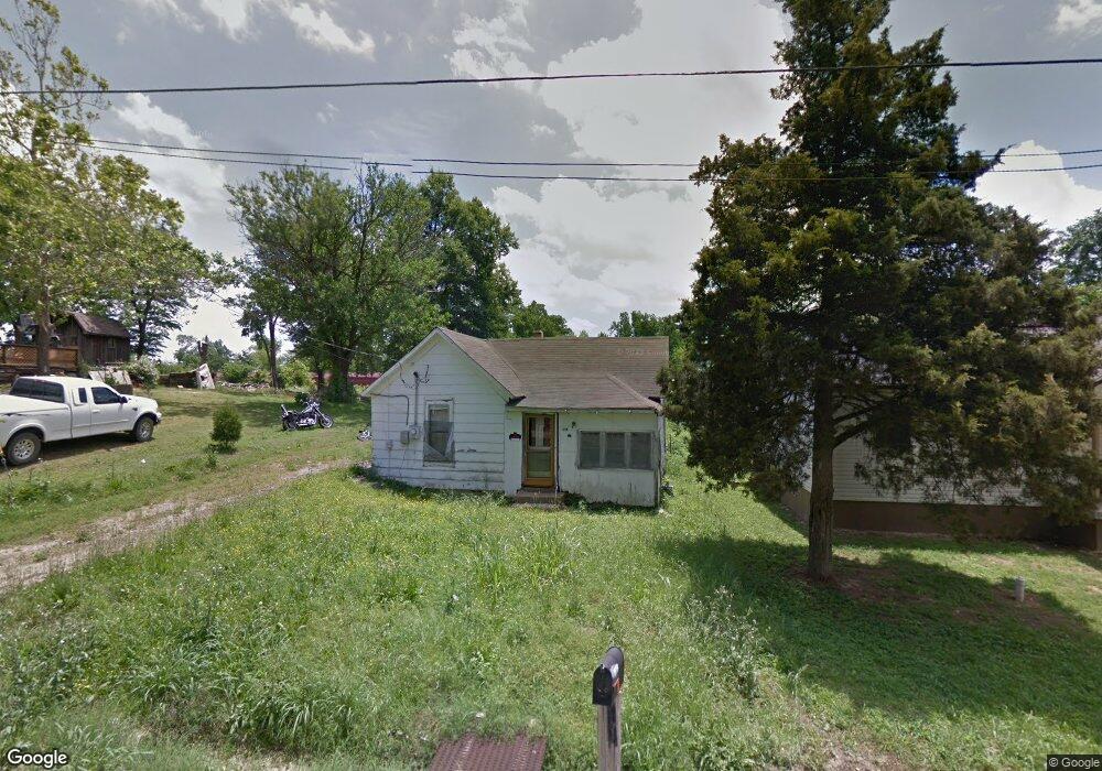
1826 S 11th St Poplar Bluff, MO 63901
Estimated Value: $72,000 - $132,000
--
Bed
--
Bath
804
Sq Ft
$119/Sq Ft
Est. Value
About This Home
This home is located at 1826 S 11th St, Poplar Bluff, MO 63901 and is currently estimated at $95,667, approximately $118 per square foot. 1826 S 11th St is a home with nearby schools including Eugene Field Elementary School, Poplar Bluff Fifth & Sixth Grade Center, and Poplar Bluff Junior High School.
Ownership History
Date
Name
Owned For
Owner Type
Purchase Details
Closed on
Mar 5, 2024
Sold by
Mondy Jesse
Bought by
Thorton Timothy G and Thorton Edward F
Current Estimated Value
Purchase Details
Closed on
Dec 19, 2023
Sold by
Mondy Jesse
Bought by
Mutch Amanda
Purchase Details
Closed on
Oct 4, 2023
Sold by
Buckley Freddie E and Tucker Gerald R
Bought by
Buckley Freddie E and Tucker Gerald R
Purchase Details
Closed on
Aug 6, 2012
Sold by
Buckley Freddie E and Tucker Phyllis
Bought by
Buckley Freddie E and Tucker Gerald R
Create a Home Valuation Report for This Property
The Home Valuation Report is an in-depth analysis detailing your home's value as well as a comparison with similar homes in the area
Home Values in the Area
Average Home Value in this Area
Purchase History
| Date | Buyer | Sale Price | Title Company |
|---|---|---|---|
| Thorton Timothy G | -- | None Listed On Document | |
| Mutch Amanda | -- | None Listed On Document | |
| Buckley Freddie E | -- | None Listed On Document | |
| Buckley Freddie E | -- | None Available |
Source: Public Records
Tax History Compared to Growth
Tax History
| Year | Tax Paid | Tax Assessment Tax Assessment Total Assessment is a certain percentage of the fair market value that is determined by local assessors to be the total taxable value of land and additions on the property. | Land | Improvement |
|---|---|---|---|---|
| 2024 | $21 | $440 | $0 | $0 |
| 2023 | $21 | $440 | $0 | $0 |
| 2022 | $142 | $2,950 | $0 | $0 |
| 2021 | $142 | $2,950 | $0 | $0 |
| 2020 | $132 | $2,700 | $0 | $0 |
| 2019 | $131 | $2,700 | $0 | $0 |
| 2018 | $131 | $2,700 | $0 | $0 |
| 2017 | -- | $2,700 | $0 | $0 |
| 2016 | -- | $2,700 | $0 | $0 |
| 2015 | -- | $2,700 | $0 | $0 |
| 2014 | -- | $2,520 | $0 | $0 |
| 2012 | $107 | $2,520 | $0 | $0 |
Source: Public Records
Map
Nearby Homes
- 2121 Pike St
- 1025 Delano St
- 1315 S 11th St
- 1000 W Victor St
- 712 Nickey St
- 2335 Cheshire Blvd
- 622 Nickey St
- 912 Adam St
- 1905 Kentucky Ave
- 1708 Kentucky Ave
- 1947 Glendale Rd
- 2011 Arkansas Ave
- 2015 Arkansas Ave
- 2347 Arkansas Ave
- 2318 Arkansas Ave
- 1910 Arkansas Ave
- 813 Kendall Dr
- 326 Apple Park Way
- 803 Kendall Dr
- 2801 Bedoll Ave