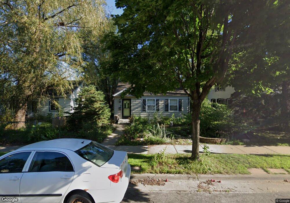
1827 Taylor Ave W Saint Paul, MN 55104
Hamline-Midway NeighborhoodEstimated Value: $259,000 - $286,000
3
Beds
1
Bath
672
Sq Ft
$406/Sq Ft
Est. Value
About This Home
This home is located at 1827 Taylor Ave W, Saint Paul, MN 55104 and is currently estimated at $272,582, approximately $405 per square foot. 1827 Taylor Ave W is a home located in Ramsey County with nearby schools including Hancock/Hamline Magnet Elementary School, Murray Middle School, and Como Park Senior High School.
Ownership History
Date
Name
Owned For
Owner Type
Purchase Details
Closed on
Mar 24, 2016
Sold by
Brassard M G
Bought by
Denton Charles and Sendrijas Ivymar
Current Estimated Value
Home Financials for this Owner
Home Financials are based on the most recent Mortgage that was taken out on this home.
Original Mortgage
$141,500
Outstanding Balance
$111,959
Interest Rate
3.64%
Estimated Equity
$160,623
Purchase Details
Closed on
Sep 5, 2003
Sold by
Dalton Ross R
Bought by
M G Brassard Living Trust
Purchase Details
Closed on
Nov 21, 2001
Sold by
Aurinnivae Mesha S
Bought by
Dalton Ross R
Purchase Details
Closed on
Jul 26, 2000
Sold by
Wortman Adam R and Wortman Tiffany M
Bought by
Aurianivar Mesha S
Purchase Details
Closed on
Oct 30, 1998
Sold by
Estate Of John A Carlson
Bought by
Wortman Adam and Wortman Tiffany
Create a Home Valuation Report for This Property
The Home Valuation Report is an in-depth analysis detailing your home's value as well as a comparison with similar homes in the area
Home Values in the Area
Average Home Value in this Area
Purchase History
| Date | Buyer | Sale Price | Title Company |
|---|---|---|---|
| Denton Charles | $145,924 | Gibraltar Title | |
| M G Brassard Living Trust | $155,000 | -- | |
| Dalton Ross R | $127,000 | -- | |
| Aurianivar Mesha S | $110,000 | -- | |
| Wortman Adam | $50,000 | -- |
Source: Public Records
Mortgage History
| Date | Status | Borrower | Loan Amount |
|---|---|---|---|
| Open | Denton Charles | $141,500 |
Source: Public Records
Tax History Compared to Growth
Tax History
| Year | Tax Paid | Tax Assessment Tax Assessment Total Assessment is a certain percentage of the fair market value that is determined by local assessors to be the total taxable value of land and additions on the property. | Land | Improvement |
|---|---|---|---|---|
| 2025 | $3,524 | $264,100 | $40,000 | $224,100 |
| 2023 | $3,524 | $237,100 | $40,000 | $197,100 |
| 2022 | $3,056 | $242,800 | $40,000 | $202,800 |
| 2021 | $2,984 | $202,600 | $40,000 | $162,600 |
| 2020 | $3,030 | $204,800 | $40,000 | $164,800 |
| 2019 | $2,552 | $195,200 | $35,000 | $160,200 |
| 2018 | $2,066 | $166,500 | $35,000 | $131,500 |
| 2017 | $1,670 | $143,700 | $27,000 | $116,700 |
| 2016 | $2,150 | $0 | $0 | $0 |
| 2015 | $2,044 | $127,400 | $27,000 | $100,400 |
| 2014 | $2,082 | $0 | $0 | $0 |
Source: Public Records
Map
Nearby Homes
- 1831 Englewood Ave
- 774 Aldine St
- 914 Charlotte St
- 1756 Minnehaha Ave W
- 682 Fairview Ave N
- 1702 Minnehaha Ave W
- 1636 Minnehaha Ave W
- 1784 Lafond Ave
- 610 Fairview Ave N
- 1767 Thomas Ave
- 1698 Lafond Ave
- 1595 Blair Ave
- 1527 Minnehaha Ave W
- 2119 University Ave W
- 1557 Blair Ave
- 641 Asbury St
- 1515 Blair Ave
- 1506 Blair Ave
- 1665 Sherburne Ave
- 1437 Englewood Ave
- 1833 Taylor Ave W
- 1823 Taylor Ave W
- 1837 Taylor Ave W
- 1843 Taylor Ave W
- 895 Fairview Ave N
- 1847 Taylor Ave W
- 891 Fairview Ave N
- 1840 Taylor Ave W
- 1846 Taylor Ave W
- 887 Fairview Ave N
- 1853 Taylor Ave W
- 884 Clayland St
- 883 Fairview Ave N
- 1857 Taylor Ave W
- 880 Clayland St
- 1861 Taylor Ave W
- 895 Clayland St
- 891 Clayland St
- 1865 Taylor Ave W
- 1827 Hewitt Ave