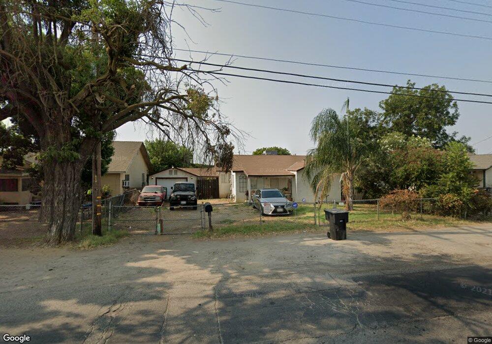
1828 Robertson Rd Modesto, CA 95351
West Modesto NeighborhoodEstimated Value: $221,000 - $281,000
2
Beds
1
Bath
768
Sq Ft
$324/Sq Ft
Est. Value
About This Home
This home is located at 1828 Robertson Rd, Modesto, CA 95351 and is currently estimated at $248,628, approximately $323 per square foot. 1828 Robertson Rd is a home located in Stanislaus County with nearby schools including Robertson Road Elementary School, Evelyn Hanshaw Middle School, and Modesto High School.
Ownership History
Date
Name
Owned For
Owner Type
Purchase Details
Closed on
Feb 13, 2025
Sold by
Cerna Jaime
Bought by
Jaime Miguel Cerna Lopez Trust and Cerna
Current Estimated Value
Purchase Details
Closed on
Mar 3, 2011
Sold by
Wells Fargo Bank Na
Bought by
Cerna Jaime
Purchase Details
Closed on
Jan 4, 2011
Sold by
Lombera Mateo and Lombera Gloria
Bought by
Wells Fargo Bank Na and Wachovia Mortgage
Purchase Details
Closed on
Dec 19, 2003
Sold by
Feichter George E and Feichter Wanda J
Bought by
Gloria Lombera Mateo and Gloria Lombrea
Home Financials for this Owner
Home Financials are based on the most recent Mortgage that was taken out on this home.
Original Mortgage
$75,000
Interest Rate
6.03%
Mortgage Type
Purchase Money Mortgage
Create a Home Valuation Report for This Property
The Home Valuation Report is an in-depth analysis detailing your home's value as well as a comparison with similar homes in the area
Home Values in the Area
Average Home Value in this Area
Purchase History
| Date | Buyer | Sale Price | Title Company |
|---|---|---|---|
| Jaime Miguel Cerna Lopez Trust | -- | None Listed On Document | |
| Cerna Jaime | $38,500 | Fidelity National Title Co | |
| Wells Fargo Bank Na | $28,780 | None Available | |
| Gloria Lombera Mateo | $118,500 | Fidelity National Title |
Source: Public Records
Mortgage History
| Date | Status | Borrower | Loan Amount |
|---|---|---|---|
| Previous Owner | Gloria Lombera Mateo | $75,000 |
Source: Public Records
Tax History
| Year | Tax Paid | Tax Assessment Tax Assessment Total Assessment is a certain percentage of the fair market value that is determined by local assessors to be the total taxable value of land and additions on the property. | Land | Improvement |
|---|---|---|---|---|
| 2025 | $729 | $49,312 | $19,212 | $30,100 |
| 2024 | $702 | $48,346 | $18,836 | $29,510 |
| 2023 | $693 | $47,399 | $18,467 | $28,932 |
| 2022 | $679 | $46,470 | $18,105 | $28,365 |
| 2021 | $646 | $45,559 | $17,750 | $27,809 |
| 2020 | $654 | $45,092 | $17,568 | $27,524 |
| 2019 | $641 | $44,209 | $17,224 | $26,985 |
| 2018 | $617 | $43,343 | $16,887 | $26,456 |
| 2017 | $605 | $42,494 | $16,556 | $25,938 |
| 2016 | $597 | $41,662 | $16,232 | $25,430 |
| 2015 | $591 | $41,038 | $15,989 | $25,049 |
| 2014 | $532 | $40,235 | $15,676 | $24,559 |
Source: Public Records
Map
Nearby Homes
- 1820 Kenneth St
- 1805 Kenneth St
- 2012 Ridgecrest Dr
- 1908 Vernon Ave
- 2104 Olive Branch Dr
- 1801 W Hatch Rd
- 1805 Vernon Ave
- 1633 Kazmir Ct
- 1501 Pelton Ave
- 1708 Rouse Ave
- 812 Clementa Way
- 1546 Bedford Ave
- 1809 Taos Ct
- 821 Sutter Ave
- 1521 Dezzani Ln
- 1808 Rancho Encantado Ct
- 1102 Garden Ave
- 1121 Crater Ave
- 1629 Tonilane
- 2508 Paradise Rd
- 1824 Robertson Rd
- 1832 Robertson Rd
- 1829 Kenneth St
- 1820 Robertson Rd
- 1825 Kenneth St
- 1833 Kenneth St
- 1821 Kenneth St
- 1816 Robertson Rd
- 1316 Hancock St
- 1817 Kenneth St
- 1303 Hancock St
- 1812 Robertson Rd
- 1813 Kenneth St
- 1901 Kenneth St
- 0 Kenneth St
- 1828 Kenneth St
- 1824 Kenneth St
- 1904 Robertson Rd
- 1836 Robertson Rd
- 1808 Robertson Rd
Your Personal Tour Guide
Ask me questions while you tour the home.