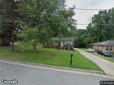
1850 Blain St High Point, NC 27262
Greater High Point NeighborhoodEstimated Value: $121,537 - $153,000
2
Beds
1
Bath
1,040
Sq Ft
$130/Sq Ft
Est. Value
About This Home
This home is located at 1850 Blain St, High Point, NC 27262 and is currently estimated at $135,384, approximately $130 per square foot. 1850 Blain St is a home located in Guilford County with nearby schools including Oak View Elementary School, Welborn Academy of Science & Technology, and High Point Central High School.
Ownership History
Date
Name
Owned For
Owner Type
Purchase Details
Closed on
Apr 9, 2019
Sold by
Roberts Barthell Sheila R and Roberts Barthell Shela
Bought by
Polecat Partners Inc
Current Estimated Value
Home Financials for this Owner
Home Financials are based on the most recent Mortgage that was taken out on this home.
Original Mortgage
$43,500
Interest Rate
4.3%
Mortgage Type
Future Advance Clause Open End Mortgage
Purchase Details
Closed on
Feb 5, 1997
Bought by
Barthell Shelia R
Create a Home Valuation Report for This Property
The Home Valuation Report is an in-depth analysis detailing your home's value as well as a comparison with similar homes in the area
Home Values in the Area
Average Home Value in this Area
Purchase History
| Date | Buyer | Sale Price | Title Company |
|---|---|---|---|
| Polecat Partners Inc | $43,500 | None Available | |
| Barthell Shelia R | -- | -- |
Source: Public Records
Mortgage History
| Date | Status | Borrower | Loan Amount |
|---|---|---|---|
| Open | Polecat Partners Inc | $285,000 | |
| Closed | Polecat Partners Inc | $43,500 | |
| Previous Owner | Barthell Shelia R | $35,000 |
Source: Public Records
Tax History Compared to Growth
Tax History
| Year | Tax Paid | Tax Assessment Tax Assessment Total Assessment is a certain percentage of the fair market value that is determined by local assessors to be the total taxable value of land and additions on the property. | Land | Improvement |
|---|---|---|---|---|
| 2023 | $1,069 | $77,600 | $15,000 | $62,600 |
| 2022 | $1,046 | $77,600 | $15,000 | $62,600 |
| 2021 | $868 | $63,000 | $15,000 | $48,000 |
| 2020 | $868 | $63,000 | $15,000 | $48,000 |
| 2019 | $868 | $63,000 | $0 | $0 |
| 2018 | $864 | $63,000 | $0 | $0 |
| 2017 | $868 | $63,000 | $0 | $0 |
| 2016 | $947 | $67,500 | $0 | $0 |
| 2015 | $952 | $67,500 | $0 | $0 |
| 2014 | $968 | $67,500 | $0 | $0 |
Source: Public Records
Map
Nearby Homes
- 1406 Cook St
- 1700 N Hamilton St Unit F
- 606 E State Ave
- 1602 Larkin St
- 1821 Johnson St
- 1433 Larkin St
- 1607 Bridges Dr
- 442 Chester Woods Ct
- 410 Clover Dr
- 1123 Denny St
- 105 Idol St
- 230 Northpoint Ave Unit E
- 1112 N Hamilton St
- 325 Louise Ave
- 317 Louise Ave
- 1603 Laurel Ln
- 201 Northpoint Ave Unit G
- 1306 Prescott Place
- 1013 Johnson St
- 304 Louise Ave
- 1850 Blain St
- 1848 Blain St
- 1511 Futrelle Dr
- 1846 Blain St
- 507 Marion Ct
- 505 Marion Ct
- 1507 Futrelle Dr
- 1853 Blain St
- 1840 Blain St
- 508 Marion Ct
- 1847 Blain St
- 503 Marion Ct
- 1855 Blain St
- 501 Marion Ct
- 1508 Futrelle Dr
- 1506 Futrelle Dr
- 1510 Futrelle Dr
- 1504 Futrelle Dr
- 506 Marion Ct
- 1502 Futrelle Dr