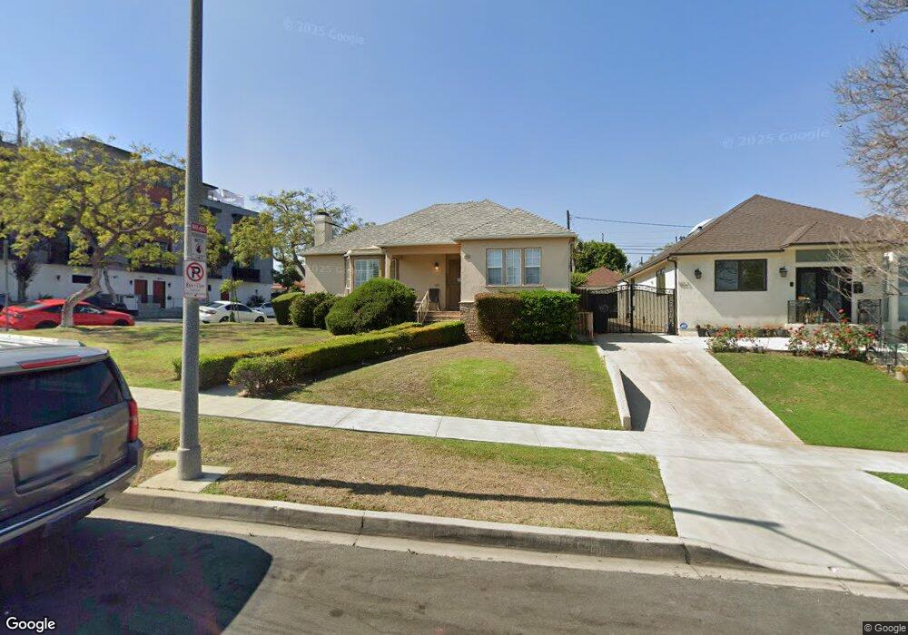
1857 Preuss Rd Los Angeles, CA 90035
Mid-City NeighborhoodEstimated Value: $1,844,000 - $2,428,956
3
Beds
2
Baths
2,038
Sq Ft
$1,044/Sq Ft
Est. Value
About This Home
This home is located at 1857 Preuss Rd, Los Angeles, CA 90035 and is currently estimated at $2,126,739, approximately $1,043 per square foot. 1857 Preuss Rd is a home located in Los Angeles County with nearby schools including Mark Twain Middle School, Alexander Hamilton Senior High School, and Cheder Menachem School.
Ownership History
Date
Name
Owned For
Owner Type
Purchase Details
Closed on
Jan 28, 2013
Sold by
Ross Victor and Ross Susan S
Bought by
Ross Victor A and Ross Susan S
Current Estimated Value
Home Financials for this Owner
Home Financials are based on the most recent Mortgage that was taken out on this home.
Original Mortgage
$411,000
Outstanding Balance
$286,113
Interest Rate
3.32%
Mortgage Type
New Conventional
Estimated Equity
$1,840,626
Purchase Details
Closed on
Apr 20, 2011
Sold by
Goldberg Harold and Goldberg Golde
Bought by
Ross Victor A and Ross Susan S
Create a Home Valuation Report for This Property
The Home Valuation Report is an in-depth analysis detailing your home's value as well as a comparison with similar homes in the area
Home Values in the Area
Average Home Value in this Area
Purchase History
| Date | Buyer | Sale Price | Title Company |
|---|---|---|---|
| Ross Victor A | -- | Accommodation | |
| Ross Victor | -- | Lawyers Title Company | |
| Ross Victor A | $820,000 | Equity Title Los Angeles |
Source: Public Records
Mortgage History
| Date | Status | Borrower | Loan Amount |
|---|---|---|---|
| Open | Ross Victor | $411,000 |
Source: Public Records
Tax History Compared to Growth
Tax History
| Year | Tax Paid | Tax Assessment Tax Assessment Total Assessment is a certain percentage of the fair market value that is determined by local assessors to be the total taxable value of land and additions on the property. | Land | Improvement |
|---|---|---|---|---|
| 2025 | $1,998 | $150,230 | $85,046 | $65,184 |
| 2024 | $1,998 | $147,285 | $83,379 | $63,906 |
| 2023 | $1,966 | $144,398 | $81,745 | $62,653 |
| 2022 | $1,885 | $141,568 | $80,143 | $61,425 |
| 2021 | $1,847 | $138,793 | $78,572 | $60,221 |
| 2019 | $1,795 | $134,679 | $76,243 | $58,436 |
| 2018 | $1,698 | $132,040 | $74,749 | $57,291 |
| 2016 | $1,601 | $126,915 | $71,848 | $55,067 |
| 2015 | $1,579 | $125,009 | $70,769 | $54,240 |
| 2014 | $1,594 | $122,561 | $69,383 | $53,178 |
Source: Public Records
Map
Nearby Homes
- 1904 Preuss Rd
- 2011 S Shenandoah St
- 1942 S Sherbourne Dr
- 9142 Monte Mar Dr
- 1810 S Sherbourne Dr
- 8767 Airdrome St
- 1726 S Sherbourne Dr
- 1630 S Crest Dr
- 8953 W 24th St
- 9125 David Ave
- 9313 Bolton Rd
- 8809 David Ave
- 2502 S Robertson Blvd
- 2006 S Corning St
- 2055 S Corning St
- 8860 Horner St
- 1543 S Crest Dr
- 1527 S Bedford St
- 2411 S Canfield Ave
- 1944 Chariton St
- 1853 Preuss Rd
- 1847 Preuss Rd Unit ID1042932P
- 1847 Preuss Rd
- 8915 Sawyer St
- 1901 Preuss Rd Unit Preuss
- 1901 Preuss Rd
- 8900 Sawyer St
- 8908 Sawyer St
- 8906 Sawyer St
- 8904 Sawyer St
- 8902 Sawyer St
- 8921 Sawyer St
- 1843 Preuss Rd
- 1903 Preuss Rd
- 8916 Sawyer St
- 1850 Preuss Rd
- 1856 Preuss Rd
- 1846 Preuss Rd
- 8922 Sawyer St
- 8927 Sawyer St