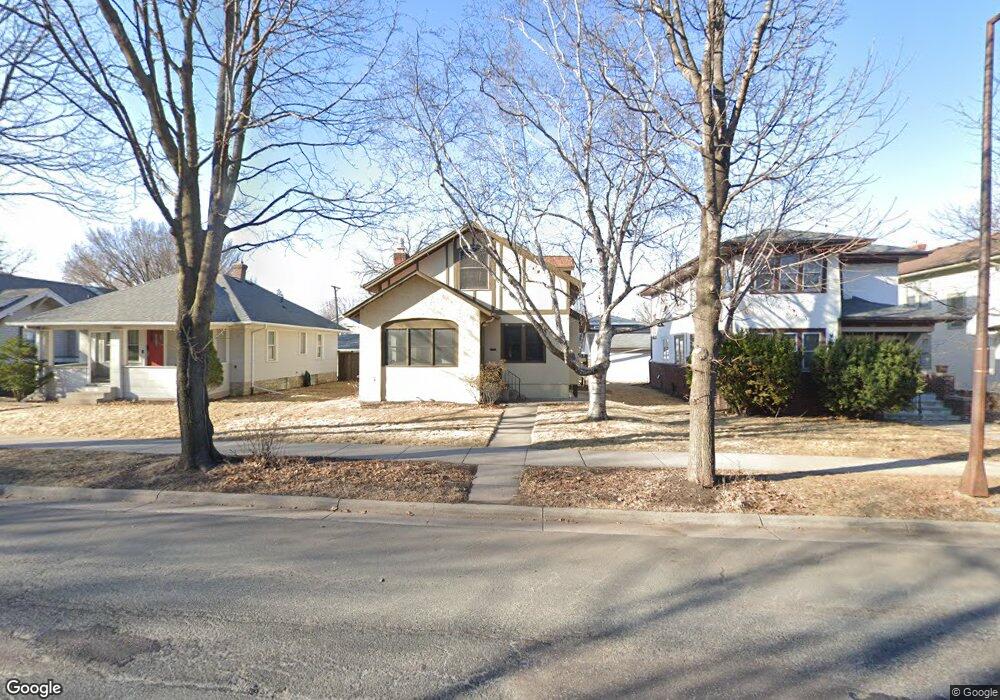
1867 Saint Clair Ave Saint Paul, MN 55105
Macalester-Groveland NeighborhoodEstimated Value: $471,938 - $486,000
4
Beds
2
Baths
1,638
Sq Ft
$292/Sq Ft
Est. Value
About This Home
This home is located at 1867 Saint Clair Ave, Saint Paul, MN 55105 and is currently estimated at $478,235, approximately $291 per square foot. 1867 Saint Clair Ave is a home located in Ramsey County with nearby schools including Groveland Park Elementary School, Hidden River Middle School, and Central Senior High School.
Ownership History
Date
Name
Owned For
Owner Type
Purchase Details
Closed on
Apr 27, 2020
Sold by
Samilo Kathleen Ann and Samilo Myros
Bought by
Larson Justin
Current Estimated Value
Home Financials for this Owner
Home Financials are based on the most recent Mortgage that was taken out on this home.
Original Mortgage
$148,000
Outstanding Balance
$103,523
Interest Rate
3.3%
Mortgage Type
New Conventional
Estimated Equity
$374,713
Create a Home Valuation Report for This Property
The Home Valuation Report is an in-depth analysis detailing your home's value as well as a comparison with similar homes in the area
Home Values in the Area
Average Home Value in this Area
Purchase History
| Date | Buyer | Sale Price | Title Company |
|---|---|---|---|
| Larson Justin | $370,000 | Burnet Title |
Source: Public Records
Mortgage History
| Date | Status | Borrower | Loan Amount |
|---|---|---|---|
| Open | Larson Justin | $148,000 |
Source: Public Records
Tax History Compared to Growth
Tax History
| Year | Tax Paid | Tax Assessment Tax Assessment Total Assessment is a certain percentage of the fair market value that is determined by local assessors to be the total taxable value of land and additions on the property. | Land | Improvement |
|---|---|---|---|---|
| 2025 | $6,376 | $447,500 | $110,700 | $336,800 |
| 2023 | $6,376 | $412,500 | $110,700 | $301,800 |
| 2022 | $5,666 | $395,800 | $110,700 | $285,100 |
| 2021 | $6,386 | $353,900 | $110,700 | $243,200 |
| 2020 | $6,730 | $409,500 | $110,700 | $298,800 |
| 2019 | $6,478 | $391,200 | $110,700 | $280,500 |
| 2018 | $6,022 | $373,500 | $110,700 | $262,800 |
| 2017 | $5,558 | $359,600 | $110,700 | $248,900 |
| 2016 | $5,542 | $0 | $0 | $0 |
| 2015 | $2,786 | $322,500 | $92,200 | $230,300 |
| 2014 | $5,502 | $0 | $0 | $0 |
Source: Public Records
Map
Nearby Homes
- 1926 Lincoln Ave
- 1818 Juliet Ave
- 191 Vernon St
- 188 Cleveland Ave S
- 281 Cleveland Ave S
- 1797 James Ave
- 2009 Grand Ave
- 1615 Stanford Ave
- 1917 Summit Ave Unit 2
- 2047 Grand Ave
- 2133 Berkeley Ave
- 2129 Stanford Ave
- 2056 Summit Ave
- 1688 James Ave
- 1676 Randolph Ave
- 1873 Ashland Ave
- 388 Snelling Ave S
- 1920 Laurel Ave
- 2034 Ashland Ave
- 265 Mount Curve Blvd
- 1865 Saint Clair Ave
- 1869 Saint Clair Ave
- 1873 Saint Clair Ave
- 1861 Saint Clair Ave
- 1855 Saint Clair Ave
- 1877 Saint Clair Ave
- 1864 Sargent Ave
- 1858 Sargent Ave
- 1868 Sargent Ave
- 1849 Saint Clair Ave
- 1849 Saint Clair Ave Unit St Thomas MacGrove D
- 1854 Sargent Ave
- 1872 Sargent Ave
- 1862 Saint Clair Ave
- 1862 1862 St Clair Ave
- 1862 1862 St Clair-Avenue-
- 1850 Sargent Ave
- 1876 Sargent Ave
- 1866 Saint Clair Ave
- 1845 Saint Clair Ave