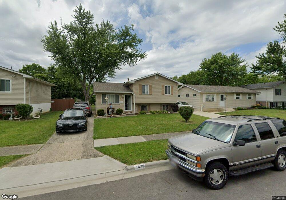
1875 Bar Harbor Rd Columbus, OH 43219
Brittany Hills NeighborhoodEstimated Value: $179,471 - $212,000
3
Beds
2
Baths
1,324
Sq Ft
$150/Sq Ft
Est. Value
About This Home
This home is located at 1875 Bar Harbor Rd, Columbus, OH 43219 and is currently estimated at $198,368, approximately $149 per square foot. 1875 Bar Harbor Rd is a home located in Franklin County with nearby schools including South Mifflin Stem Academy (K-6), Linden-Mckinley Stem School On Arcadia, and Cesar Chavez College Preparatory School.
Ownership History
Date
Name
Owned For
Owner Type
Purchase Details
Closed on
Sep 1, 1997
Sold by
Swanson Lynette and Swanson Lynette
Bought by
Johnson Treva L
Current Estimated Value
Home Financials for this Owner
Home Financials are based on the most recent Mortgage that was taken out on this home.
Original Mortgage
$52,503
Outstanding Balance
$8,187
Interest Rate
7.54%
Mortgage Type
FHA
Estimated Equity
$190,181
Purchase Details
Closed on
Jan 1, 1987
Create a Home Valuation Report for This Property
The Home Valuation Report is an in-depth analysis detailing your home's value as well as a comparison with similar homes in the area
Home Values in the Area
Average Home Value in this Area
Purchase History
| Date | Buyer | Sale Price | Title Company |
|---|---|---|---|
| Johnson Treva L | $53,000 | -- | |
| -- | $19,100 | -- |
Source: Public Records
Mortgage History
| Date | Status | Borrower | Loan Amount |
|---|---|---|---|
| Open | Johnson Treva L | $52,503 | |
| Closed | Johnson Treva L | $2,290 |
Source: Public Records
Tax History Compared to Growth
Tax History
| Year | Tax Paid | Tax Assessment Tax Assessment Total Assessment is a certain percentage of the fair market value that is determined by local assessors to be the total taxable value of land and additions on the property. | Land | Improvement |
|---|---|---|---|---|
| 2024 | $2,184 | $48,660 | $10,680 | $37,980 |
| 2023 | $2,156 | $48,660 | $10,680 | $37,980 |
| 2022 | $1,055 | $20,340 | $2,210 | $18,130 |
| 2021 | $1,057 | $20,340 | $2,210 | $18,130 |
| 2020 | $1,058 | $20,340 | $2,210 | $18,130 |
| 2019 | $994 | $16,380 | $1,750 | $14,630 |
| 2018 | $949 | $16,380 | $1,750 | $14,630 |
| 2017 | $993 | $16,380 | $1,750 | $14,630 |
| 2016 | $1,027 | $15,510 | $2,770 | $12,740 |
| 2015 | $906 | $15,060 | $2,770 | $12,290 |
| 2014 | $908 | $15,060 | $2,770 | $12,290 |
| 2013 | $596 | $20,020 | $2,765 | $17,255 |
Source: Public Records
Map
Nearby Homes
- 2336 Edenburgh Dr S
- 1882 Dunning Rd
- 2471 Mock Rd
- 1794 Devonshire Rd
- 0 Mock Rd
- 1808 Brentnell Ave
- 2736 Bellero Way Unit 94
- 1860 Meadowlawn Dr Unit 75
- 0 Danby Dr
- 2483 Vendome Dr
- 2054 Jermain Dr
- 1657 Brentnell Ave
- 1991 Woodland Ave
- 2424 Holt Ave
- 2228 Holt Ave
- 0 Rankin Ave Unit (Rear)
- 2363 Holt Ave
- 2193 Rustic Ledge Dr
- 1978 Argyle Dr
- 2040 Loretta Ave
- 1863 Bar Harbor Rd
- 1883 Bar Harbor Rd
- 1889 Bar Harbor Rd
- 1892 Edenburgh Dr E
- 1872 Bar Harbor Rd
- 2414 Dunkirk Dr
- 1898 Edenburgh Dr E
- 1895 Bar Harbor Rd
- 2399 Edenburgh Dr S
- 2408 Dunkirk Dr
- 1903 Bar Harbor Rd
- 1904 Edenburgh Dr E
- 2457 Peekskill Dr
- 2454 Peekskill Dr
- 1852 Bar Harbor Rd
- 2398 Dunkirk Dr
- 2393 Edenburgh Dr S
- 1910 Edenburgh Dr E
- 2429 Dunkirk Dr
- 1898 Bar Harbor Rd