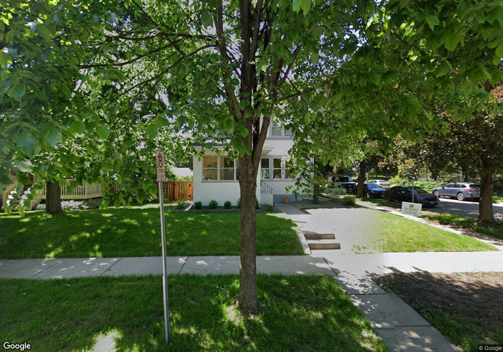
1876 Sargent Ave Saint Paul, MN 55105
Macalester-Groveland NeighborhoodEstimated Value: $502,000 - $577,000
3
Beds
2
Baths
1,424
Sq Ft
$368/Sq Ft
Est. Value
About This Home
This home is located at 1876 Sargent Ave, Saint Paul, MN 55105 and is currently estimated at $524,473, approximately $368 per square foot. 1876 Sargent Ave is a home located in Ramsey County with nearby schools including Groveland Park Elementary School, Hidden River Middle School, and Central Senior High School.
Ownership History
Date
Name
Owned For
Owner Type
Purchase Details
Closed on
Jul 3, 2015
Sold by
Coumoyer David A
Bought by
Coumoyer Andrea M
Current Estimated Value
Home Financials for this Owner
Home Financials are based on the most recent Mortgage that was taken out on this home.
Original Mortgage
$253,425
Outstanding Balance
$198,704
Interest Rate
4.02%
Mortgage Type
New Conventional
Estimated Equity
$325,769
Purchase Details
Closed on
Feb 22, 2002
Sold by
Webb James R
Bought by
Knuth Nathan D and Huffman Rachel C
Purchase Details
Closed on
Jan 9, 1998
Sold by
Nelson James C and Nelson Marie P
Bought by
Webb James R
Create a Home Valuation Report for This Property
The Home Valuation Report is an in-depth analysis detailing your home's value as well as a comparison with similar homes in the area
Home Values in the Area
Average Home Value in this Area
Purchase History
| Date | Buyer | Sale Price | Title Company |
|---|---|---|---|
| Coumoyer Andrea M | -- | Gcs Title | |
| Knuth Nathan D | $280,000 | -- | |
| Webb James R | $165,000 | -- |
Source: Public Records
Mortgage History
| Date | Status | Borrower | Loan Amount |
|---|---|---|---|
| Open | Coumoyer Andrea M | $253,425 |
Source: Public Records
Tax History Compared to Growth
Tax History
| Year | Tax Paid | Tax Assessment Tax Assessment Total Assessment is a certain percentage of the fair market value that is determined by local assessors to be the total taxable value of land and additions on the property. | Land | Improvement |
|---|---|---|---|---|
| 2025 | $7,144 | $509,600 | $130,200 | $379,400 |
| 2023 | $7,144 | $455,600 | $130,200 | $325,400 |
| 2022 | $6,678 | $448,800 | $130,200 | $318,600 |
| 2021 | $6,316 | $412,600 | $130,200 | $282,400 |
| 2020 | $6,758 | $405,300 | $130,200 | $275,100 |
| 2019 | $6,086 | $403,100 | $130,200 | $272,900 |
| 2018 | $5,956 | $361,300 | $130,200 | $231,100 |
| 2017 | $5,142 | $358,400 | $130,200 | $228,200 |
| 2016 | $5,308 | $0 | $0 | $0 |
| 2015 | $5,548 | $326,500 | $108,500 | $218,000 |
| 2014 | $5,180 | $0 | $0 | $0 |
Source: Public Records
Map
Nearby Homes
- 1926 Lincoln Ave
- 188 Cleveland Ave S
- 1818 Juliet Ave
- 191 Vernon St
- 281 Cleveland Ave S
- 2009 Grand Ave
- 1797 James Ave
- 1917 Summit Ave Unit 2
- 2047 Grand Ave
- 2133 Berkeley Ave
- 2129 Stanford Ave
- 2056 Summit Ave
- 1615 Stanford Ave
- 1688 James Ave
- 1873 Ashland Ave
- 1920 Laurel Ave
- 2034 Ashland Ave
- 1676 Randolph Ave
- 265 Mount Curve Blvd
- 388 Snelling Ave S
- 1872 Sargent Ave
- 1868 Sargent Ave
- 1882 Sargent Ave
- 1864 Sargent Ave
- 1877 Saint Clair Ave
- 1873 Saint Clair Ave
- 1888 Sargent Ave
- 1869 Saint Clair Ave
- 1858 Sargent Ave
- 1873 Sargent Ave
- 1877 Sargent Ave
- 1883 Saint Clair Ave
- 1867 Saint Clair Ave
- 1890 Sargent Ave
- 1869 Sargent Ave
- 1887 Saint Clair Ave
- 1854 Sargent Ave
- 1881 Sargent Ave
- 1865 Saint Clair Ave
- 1865 Sargent Ave