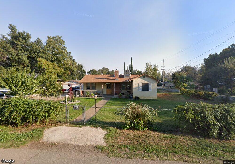
18791 Thomas Rd Anderson, CA 96007
Estimated Value: $216,000 - $267,000
2
Beds
1
Bath
2,073
Sq Ft
$116/Sq Ft
Est. Value
About This Home
This home is located at 18791 Thomas Rd, Anderson, CA 96007 and is currently estimated at $240,976, approximately $116 per square foot. 18791 Thomas Rd is a home located in Shasta County with nearby schools including Meadow Lane Elementary School, Anderson Heights Elementary School, and Anderson Middle School.
Ownership History
Date
Name
Owned For
Owner Type
Purchase Details
Closed on
Jun 26, 2017
Sold by
Lambert Judy Caton and Caton Judy G
Bought by
Lambert Judy Caton and The Judy Caton Lambert Separate Property
Current Estimated Value
Purchase Details
Closed on
Oct 29, 2008
Sold by
Caton Marvin L
Bought by
Caton Marvin L and Caton Judy G
Home Financials for this Owner
Home Financials are based on the most recent Mortgage that was taken out on this home.
Original Mortgage
$20,000
Interest Rate
5.77%
Mortgage Type
Credit Line Revolving
Create a Home Valuation Report for This Property
The Home Valuation Report is an in-depth analysis detailing your home's value as well as a comparison with similar homes in the area
Purchase History
| Date | Buyer | Sale Price | Title Company |
|---|---|---|---|
| Lambert Judy Caton | -- | None Available | |
| Caton Marvin L | -- | First American Title Co |
Source: Public Records
Mortgage History
| Date | Status | Borrower | Loan Amount |
|---|---|---|---|
| Closed | Caton Marvin L | $20,000 |
Source: Public Records
Tax History
| Year | Tax Paid | Tax Assessment Tax Assessment Total Assessment is a certain percentage of the fair market value that is determined by local assessors to be the total taxable value of land and additions on the property. | Land | Improvement |
|---|---|---|---|---|
| 2025 | $403 | $40,993 | $6,764 | $34,229 |
| 2024 | $393 | $40,190 | $6,632 | $33,558 |
| 2023 | $393 | $39,402 | $6,502 | $32,900 |
| 2022 | $380 | $38,630 | $6,375 | $32,255 |
| 2021 | $374 | $37,873 | $6,250 | $31,623 |
| 2020 | $376 | $37,485 | $6,186 | $31,299 |
| 2019 | $359 | $36,751 | $6,065 | $30,686 |
| 2018 | $352 | $36,032 | $5,947 | $30,085 |
| 2017 | $351 | $35,327 | $5,831 | $29,496 |
| 2016 | $3,494 | $34,635 | $5,717 | $28,918 |
| 2015 | $324 | $34,116 | $5,632 | $28,484 |
| 2014 | $315 | $33,449 | $5,522 | $27,927 |
Source: Public Records
Map
Nearby Homes
- 6820 California 273
- 7155 The Terrace St
- 7252 Whitehouse Dr
- 18411 Majestic View Dr
- 18376 Utility Ave
- 7728 Pit Rd
- 19301 Clover Rd
- 6950 Riverland Dr Unit 23
- 6950 Riverland Dr Unit 27
- 7420 Platinum Way
- 6973 Happy Valley Rd
- 7100 Milky Way
- 19233 W Niles Ln
- 6210 Dolores Ave
- 8641 Redbank Rd
- 7035 Riverside Dr
- 3182 Island Dr
- 7022 Marvin Trail
- 7605 Churn Creek Rd
- 8818 Valley View Rd
- 6945 Ladysmith Ave
- 18799 Thomas Rd
- 6950 Lady Smith Ave
- 6937 Lady Smith Ave
- 6937 Ladysmith Ave
- 6940 Ladysmith Ave
- 6978 Ladysmith Ave
- 18775 Thomas Rd
- 7186 Highway 273
- 18767 Thomas Rd
- 6924 Ladysmith Ave
- 6913 Ladysmith Ave
- 6913 Lady Smith Ave
- 7042 California 273
- 7006 Banigan Rd
- 7042 State Highway 273
- 7006 State Highway 273
- 6978 Lady Smith Ave
- 6910 Ladysmith Ave
- 6903 Ladysmith Ave
Your Personal Tour Guide
Ask me questions while you tour the home.