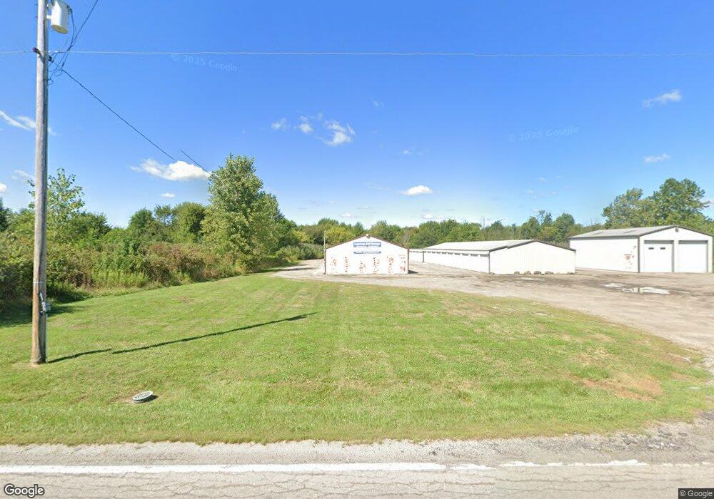
18816 Diagonal Rd La Grange, OH 44050
Estimated Value: $498,698
--
Bed
--
Bath
87,120
Sq Ft
$6/Sq Ft
Est. Value
About This Home
This home is located at 18816 Diagonal Rd, La Grange, OH 44050 and is currently estimated at $498,698, approximately $5 per square foot. 18816 Diagonal Rd is a home located in Lorain County with nearby schools including Keystone Elementary School, Keystone Middle School, and Keystone High School.
Ownership History
Date
Name
Owned For
Owner Type
Purchase Details
Closed on
May 8, 2021
Sold by
Tillery Holdings Llc
Bought by
18816 Npd Llc
Current Estimated Value
Home Financials for this Owner
Home Financials are based on the most recent Mortgage that was taken out on this home.
Original Mortgage
$303,720
Outstanding Balance
$183,551
Interest Rate
3.1%
Mortgage Type
Commercial
Estimated Equity
$315,147
Purchase Details
Closed on
Nov 17, 2009
Sold by
Baron Ronald and Baron Lillian L
Bought by
Tillery Holdings Llc
Home Financials for this Owner
Home Financials are based on the most recent Mortgage that was taken out on this home.
Original Mortgage
$196,000
Interest Rate
6.25%
Mortgage Type
Seller Take Back
Purchase Details
Closed on
Jul 6, 2000
Sold by
Sauter Michael F
Bought by
Barron Ronald
Create a Home Valuation Report for This Property
The Home Valuation Report is an in-depth analysis detailing your home's value as well as a comparison with similar homes in the area
Home Values in the Area
Average Home Value in this Area
Purchase History
| Date | Buyer | Sale Price | Title Company |
|---|---|---|---|
| 18816 Npd Llc | $355,000 | Examco Title Services | |
| Tillery Holdings Llc | $245,000 | Chicago Title Insurance Co | |
| Barron Ronald | $40,000 | -- |
Source: Public Records
Mortgage History
| Date | Status | Borrower | Loan Amount |
|---|---|---|---|
| Open | 18816 Npd Llc | $303,720 | |
| Previous Owner | Tillery Holdings Llc | $196,000 |
Source: Public Records
Tax History Compared to Growth
Tax History
| Year | Tax Paid | Tax Assessment Tax Assessment Total Assessment is a certain percentage of the fair market value that is determined by local assessors to be the total taxable value of land and additions on the property. | Land | Improvement |
|---|---|---|---|---|
| 2024 | $7,687 | $150,920 | $22,596 | $128,324 |
| 2023 | $7,536 | $124,250 | $16,765 | $107,485 |
| 2022 | $7,521 | $124,250 | $16,765 | $107,485 |
| 2021 | $6,011 | $97,860 | $16,765 | $81,095 |
| 2020 | $6,081 | $97,870 | $16,770 | $81,100 |
| 2019 | $6,304 | $97,870 | $16,770 | $81,100 |
| 2018 | $5,950 | $97,870 | $16,770 | $81,100 |
| 2017 | $5,822 | $84,810 | $13,630 | $71,180 |
| 2016 | $5,774 | $84,810 | $13,630 | $71,180 |
| 2015 | $5,707 | $84,810 | $13,630 | $71,180 |
| 2014 | $4,748 | $84,810 | $13,630 | $71,180 |
| 2013 | $4,598 | $84,810 | $13,630 | $71,180 |
Source: Public Records
Map
Nearby Homes
- 131 Walleye Ct
- 364 Hickory Run
- 403 Palomino Ct
- 441 Morgan Ct
- 468 Stallion Ct
- 511 Arabian Ct
- 510 Arabian Ct
- 19045 Whitehead Rd
- 0 West Rd Unit 5125531
- 43311 Peck Wadsworth Rd
- 16974 Hawley Rd
- 224 W Main St
- 110 - 122 Railroad St
- 110 Railroad St
- 302 N Center St
- 194 Railroad St
- 43983 State Route 18
- 171 Keywood Blvd
- 433 N Center St
- 21690 State Route 301
- 18838 Diagonal Rd
- VL Pheasant Run Dr
- 555 Mountain Lion Dr
- 554 Mountain Lion Dr
- 556 Mountain Lion Dr
- 553 Mountain Lion Dr
- 557 Mountain Lion Dr
- 18874 Diagonal Rd
- V/L Mountain Lion Dr
- 558 Mountain Lion Dr
- 559 Mountain Lion Dr
- 564 S/L Mountain Lion Dr
- 565 S/L Mountain Lion Dr
- 566 S/L Mountain Lion Dr
- VL Bobcat Dr
- V/L Bobcat Dr
- 4 Sunset Dr
- 560 Mountain Lion Dr
- 31 Sunset Dr
- 724 Grey Wolfe Dr