Estimated Value: $1,175,731 - $1,229,000
4
Beds
3
Baths
2,043
Sq Ft
$592/Sq Ft
Est. Value
About This Home
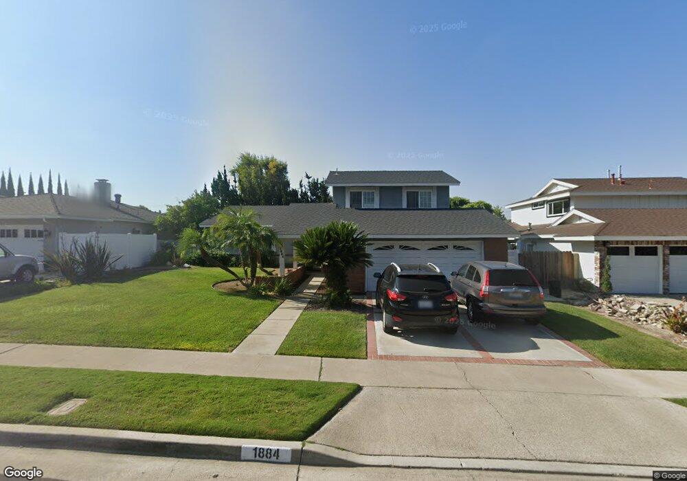
This home is located at 1884 Ravencrest Dr, Brea, CA 92821 and is currently estimated at $1,210,183, approximately $592 per square foot. 1884 Ravencrest Dr is a home located in Orange County with nearby schools including Brea Country Hills Elementary School, Brea Junior High School, and Brea-Olinda High School.
Ownership History
Date
Name
Owned For
Owner Type
Purchase Details
Closed on
Dec 1, 2010
Sold by
Kling Harold L and Kling Carole L
Bought by
Kling Harold L and Kling Carole L
Current Estimated Value
Home Financials for this Owner
Home Financials are based on the most recent Mortgage that was taken out on this home.
Original Mortgage
$250,000
Interest Rate
4.18%
Mortgage Type
New Conventional
Create a Home Valuation Report for This Property
The Home Valuation Report is an in-depth analysis detailing your home's value as well as a comparison with similar homes in the area
Home Values in the Area
Average Home Value in this Area
Purchase History
| Date | Buyer | Sale Price | Title Company |
|---|---|---|---|
| Kling Harold L | -- | First American Title |
Source: Public Records
Mortgage History
| Date | Status | Borrower | Loan Amount |
|---|---|---|---|
| Closed | Kling Harold L | $250,000 |
Source: Public Records
Tax History
| Year | Tax Paid | Tax Assessment Tax Assessment Total Assessment is a certain percentage of the fair market value that is determined by local assessors to be the total taxable value of land and additions on the property. | Land | Improvement |
|---|---|---|---|---|
| 2025 | $3,009 | $250,728 | $110,520 | $140,208 |
| 2024 | $3,009 | $245,812 | $108,353 | $137,459 |
| 2023 | $2,924 | $240,993 | $106,229 | $134,764 |
| 2022 | $2,890 | $236,268 | $104,146 | $132,122 |
| 2021 | $2,836 | $231,636 | $102,104 | $129,532 |
| 2020 | $2,816 | $229,261 | $101,057 | $128,204 |
| 2019 | $2,744 | $224,766 | $99,075 | $125,691 |
| 2018 | $2,702 | $220,359 | $97,132 | $123,227 |
| 2017 | $2,651 | $216,039 | $95,228 | $120,811 |
| 2016 | $2,599 | $211,803 | $93,360 | $118,443 |
| 2015 | $2,562 | $208,622 | $91,958 | $116,664 |
| 2014 | $2,488 | $204,536 | $90,157 | $114,379 |
Source: Public Records
Map
Nearby Homes
- 1941 Hillhaven Dr
- 2851 Rolling Hills Dr Unit 257
- 2851 Rolling Hills Dr Unit 248
- 2851 Rolling Hills Dr
- 3054 Associated Rd Unit 20
- 3062 Associated Rd Unit 1
- 3010 Associated Rd Unit 122
- 2304 Carrotwood Dr
- 3000 Associated Rd Unit 60
- 2050 Fallingleaf Cir
- 2313 Lark Ellen Dr
- 2756 Pine Creek Cir
- 2733 Quail Ridge Cir Unit 32
- 2541 Thorn Place
- 2531 Hartford Ave
- 2760 Quail Ridge Cir Unit 57
- 3019 Sheffield Place
- 213 Appalachian Cir
- 2756 Craig Cir
- 2454 Beacon St
- 1874 Ravencrest Dr
- 1894 Ravencrest Dr
- 1883 Moorpark Dr
- 1873 Moorpark Dr
- 1895 Moorpark Dr
- 1864 Ravencrest Dr
- 1885 Ravencrest Dr
- 1865 Moorpark Dr
- 1895 Ravencrest Dr
- 1875 Ravencrest Dr
- 1854 Ravencrest Dr
- 1905 Ravencrest Dr
- 444 Greenbriar Ln
- 1851 Moorpark Dr
- 458 Larkstone Ln
- 450 Larkstone Ln
- 464 Larkstone Ln
- 1910 Westmoreland Dr
- 1844 Ravencrest Dr
- 1921 Ravencrest Dr
Your Personal Tour Guide
Ask me questions while you tour the home.